NWP Hall of Fame

In 2019 I was inducted into the Vancouver Maritime Museum’s Northwest Passage Hall of Fame. I was very honoured, but due to a mishmash of communications and scheduling, was unable to attend the ceremony. They promised to send me the physical award. Then Covid-19 hit, and packages were lost in purgatory.

But eventually the trophy did arrive, and it looks great in Hong Kong! Sincere thanks to those who nominated me, and to the VMM for this recognition. I share this honour with the crew of the Open Passage Expedition (Hanns, Tobias, Drew, Anna), and with S/Y Silent Sound.

Launched in 2017, the Northwest Passage Hall of Fame Awards were established by the VMM to celebrate important achievements in navigation and exploration of the waterways through the high Arctic. Each year, the awards honour one individual, one vessel, and one expedition to celebrate their achievements and historical significance.

I was inducted as an individual. The other 2019 inductees were the Hudsons’s Bay Company Schooner the Fort McPherson (vessel) and the Northabout Expedition (Expedition).

Story Untold Podcast

Martin Bauman hosted me on his podcast Story Untold to talk about the journey that led me to research and write a travel memoir about my Mennonite culture. Have a listen!

“Mennonite has a lot of definitions.”

Menno Moto Virtual Launch

Join Cameron Dueck on Thursday, May 14 for a virtual launch of his new book, Menno Moto: A Journey Across the Americas in Search of My Mennonite Identity. There will be a reading, a Q&A, and the opportunity to win a copy of Menno Moto! Cameron will be joined by his brother, Rod, and writer Dora Dueck (no relation).

Join the event on Facebook Live
https://bit.ly/2SU8XNv
Thursday, May 14, 7pm EDT/6pm CDT

Across Latin America, from the plains of Mexico to the jungles of Paraguay, live a cloistered Germanic people. For nearly a century, they have kept their doors and their minds closed, separating their communities from a secular world they view as sinful.

The story of their search for religious and social independence began generations ago in Europe and led them, in the late 1800s, to Canada, where they enjoyed the freedoms they sought under the protection of a nascent government. Yet in the 1920s, when the country many still consider their motherland began to take shape as a nation and their separatism came under scrutiny, groups of Mennonites left for the promises of Latin America: unbroken land and new guarantees of freedom to create autonomous, ethnically pure colonies. There they live as if time stands still—an isolation with dark consequences.

In this memoir of an eight-month, 45,000 kilometre motorcycle journey across the Americas, Mennonite writer Cameron Dueck searches for common ground within his cultural diaspora. From skirmishes with secular neighbours over water rights in Mexico, to a mass-rape scandal in Bolivia, to the Green Hell of Paraguay and the wheat fields of Argentina, Dueck follows his ancestors south, finding reasons to both love and loathe his culture—and, in the process, finding himself.

To get your copy of Menno Moto, call or visit the McNally Robinson Grant Park bookstore. 10 AM to 6 PM, Monday through Saturday. 204-475-0483.

You may also order online here: mcnallyrobinson.com/9781771963473/cameron-dueck/menno-moto though note that it will take at least a week to process new orders, so for faster service we strongly encourage you to phone or visit the bookstore.

145 Years Ago

145 years ago today (Aug 1) my nine-year old great grandfather stepped off a paddle wheel ship onto the banks of the Red River in Southern Manitoba. He was among the first of 7,000 Mennonites to come to Manitoba from German-speaking colonies in South Russia, now Ukraine. His landing site was where I chose to begin my motorcycle adventure through the Americas. I crossed 19 countries and rode my bike 45,000 km to find the diaspora that has its roots in that same riverbank, and to discover the Mennonite in me. My book about that search for identity will be released by Biblioasis on March 21, 2020.

Image may contain: 1 person, smiling, tree and outdoor


Biblioasis to publish Menno Moto

I’ve received many messages from people who want to know when they can read the story of my motorcycle trip across the Americas to research the Mennonite diaspora. Those messages encouraged me to keep editing, rewriting and reimagining what has become a very personal project. I’m pleased to finally have some good news to share. I’ve sold the manuscript to Biblioasis, and Menno Moto is slated for publication in Spring 2020.

Biblioasis is an independent bookstore and publishing company based in Windsor, Ontario. It was founded by Dan Wells as a bookstore in 1998, and in the early years it focused on poetry and short story collections. Biblioasis went on to become one of Canada’s most prestigious small press publishing houses and in 2015 they had three books nominated for the Giller Prize. You can read articles about them here and here.

Dan is known for taking a risk on new writers and books that other publishers won’t touch. In that case, I’m proud to have written something the publishing industry considers risky.

Menno Moto documents a culture of fair-haired, blue-eyed people who have created isolated colonies across Latin America. There, they have kept their doors and minds closed for nearly a century, viewing the rest of the world as sinful. These are my people, and they are my story.

In Menno Moto, farmers, teachers, missionaries, drug-mules and rapists force me to reconsider my assumptions about my Mennonite culture, which I find to be more varied than I had dared to hope. I find some of my people in prison for the infamous Bolivian “ghost rapes”, while others are educating the poor in Belize or growing rich in Patagonia. In each of these communities I encounter hospitality and suspicion, backward and progressive attitudes, corruption and idealism. I find the freedom of the road, the hell of loneliness, and am almost killed by accidents and exhaustion as I ride my motorcycle across two continents. I learn that there is more Mennonite in me than I expected, and in some cases wanted, to find. I find reasons to both love and loathe the identity I am searching for.

I hope you’ll buy Menno Moto when it’s published in Spring 2020.

Betwixt and Between

One year ago I spent a month as a resident at the Vermont Studio Center, where focused on essay writing. This essay about open ocean sailing was written while at the center, in response to fellow resident’s question.

Read this essay as it appeared in the October 2018 issue of Cruising World Magazine. (pdf download)

It was also performed live at Liars’ League Hong Kong, watch the video here.

Leaving without a fixed destination to arrive to an uncertain welcome. That is why I sail.

It’s the first thing I tell landlubbers who ask, “What is it like, to sail across an ocean in a small boat?”

I could describe the long, loping swell of the deep ocean. The black, moonless nights when the darkness chokes my mind. The curl of blue bioluminescence on a breaking wave. The way a new dawn paints the deck candy floss pink. I could describe the welling of joy when dolphins appear and the secrets we share. But I always begin with the thrill of leaving port.

My port clearance is a precious document, the paper clearing boat and crew of debts and warrants and unpaid bar tabs, free to leave without obligation to say where we will come to rest. A zarpe, outbound clearance, a chit that sets you free. The thrill of limbo when I travel without destination sets my imagination afloat.

I aim my boat into blue waters, seeking wind and way. A month of waves may kiss my keel, then, just miles from port, I gybe away. To another coast, a friendlier nation, somewhere downwind from here. Perhaps I’ll never return, never arrive, betwixt and between, alone at sea. I’ll sail in circles, north to the pole, south to the ice, east and then west until land stands in the way. I could if I wanted to.

When the wind blows hard from the north, we aim for Yemen rather than Oman. When our water runs low we stop in Alaska on our way to Japan. If the sailing is good I’ll pass New Zealand and aim straight for Tahiti.

It isn’t always so, this ticket to eternal noncommittal freedom. If you are port hopping in an island nation, or skipping down a nation’s coast, authorities may ask your destination. But when you raise your sail to cross the Atlantic Ocean, The Arabian Sea, crossing a great expanse to a land far away, you wave farewell and slip away into a world between nations, free of borders, free of customs, duties and right of abode.

Tell me, where else can you wander like this? Which train carries you across a border without two nations, one to exit, one to enter? No airliner takes off without a destination on your boarding pass. Roads that lead to the fronterra cross to the other side.

But not when I go to sea.

“Don’t you get bored, day after day with nothing new to do or see?” the landlubbers ask.

Bored? No. Never. I’m too engrossed in the blue soul of the Indian Ocean, light shot through it like a drift of silver filings. The fear that punches through the bottom of my belly when I look aft and see a grey wave, two, three stories high, with anger in its face. The brilliant flash of metal and blue, streaks of yellow, as a tuna hits the lure. Hand over hand, in it comes, the first fresh food of the voyage.

There’s too much work, helming hour after hour, trimming, changing sails. An inch of ease for a tenth of speed. Or making repairs, jury-rigging when you don’t have spares. Baking bread, cooking dinner, cleaning the head.

My father, an old farmer, came aboard my boat. Never sailed, never cruised, a life spent working hard. He knew nothing of the sea. I was proud, showing him my world. And I waited, wanting a hand on the shoulder saying, son, you’ve done well. Nothing. A silent, critical eye.

“So Dad, what do you think of sailing?”

“Seems like an awful lot of work to go real slow.”

I couldn’t argue. The whole point is to go real slow, to appreciate the subtle shifts of scene. Sometimes I just sit and stare at the sea. Every cloud that passes creates a new blue, new grey, new frothy white cap on the wave. Sometimes there are thrills, a squall that makes us long for home. A whale, a school of dolphins showing us the way. But even without, even if it’s calm, we’re still sailing in a kaleidoscope of shifting shape and light. The setting sun on a clean horizon, the masthead light joining Orion. Darkness so deep it’s hard to stay on your feet. Watching the stars revolve, picking a new one to point the way. Then the dawn. Oh, the dawn. First a tinge of grey, then blues and pinks and tangerine light. The white decks glow, waves and wind that frightened in the night pushed back by the light. If I show you the dawn of open sea you will love me. You’ll know what’s for real.

And then, a few weeks in, someone gets lucky on their watch.

“Land! I think I see land!”

A dark smudge on the horizon turns into mountains, beaches and trees and sand. An excitement takes hold. We clean, we shower, we put the ship in order, we work even harder.

Port of Aden, Dutch Harbour, Port of Jamestown, Pond Inlet, Galle, Salalah. Ports and not marinas, not moored next to superyachts and motor cruisers, but ships of war and coastal barges, the grit and grim of a working harbour. The docks are painted with tar, the water streaked with oil. This is not the country’s best face. But it’s where we arrive, alongside working men and foreign cargos, by the kitchen door. Others, less fortunate I’d say, are disgorged into shiny halls, then a taxi and a hotel in a predictable order. We hoist our yellow flag, a declaration of quarantine, inviting corrupt officials to board.

“Perhaps you have a gift for me? Ah thank you, but my brother, he likes Marlboros too.”

Our first requests are fuel and water and is there a sailmaker in this port? And once she’s secure, the papers signed and bilge inspected, we step ashore.

A cold beer, that day’s newspaper, a meal that’s fresh and green. A walk about town, perhaps a souvenir. And then I begin to wonder, what does the forecast say, when will the wind blow and get us out of here?

Cruising through the Cold War

Finland is opening some of its secluded military islands to the public, creating a string of new cruising destinations and adding to the many gems of unpolished history spread across this remote archipelago.

This story was first published in the February 2018 issue of Cruising Helmsman.

The waters approaching Örö are treacherous. Submerged rocks abound, and if you don’t pay attention to your charts you’ll end up swimming in the cold Baltic Sea. It only makes sense, as the inhabitants of this Finnish island have spent the last century with guns in hand, trying to keep visitors at bay.

We handed our sails and motor into the marina under the gun-slit gaze of a weathered concrete bunker, knowing the gun barrels were plugged with concrete while the bunkers are now a tourist attraction.

Örö served as a grazing pasture for local farmers until the early 1900s. Then, as the First World War loomed, Tsarist Russia built a fortress on the island to keep ships away from it’s nearby capital, St Petersburg. Civilians were prohibited from visiting the island and the Russians embarked on a base-building frenzy, from artillery batteries, observation towers, barracks, jetties and cobble-stone roads to warrens of trenches.

When Finland declared independent in 1917 Örö was handed to the Finnish Defence Forces — and remained closed to the public. It was an important defence base during World War Two, and it remained an active base until 2004. Only in 2015 were Örö and all of its buildings transferred to the park system and opened to the public. Örö is only about a 25 mile sail southwest of the region’s major yachting base of Hankow.

The second ö in Örö means island in Swedish, the language of choice for many locals — which points to wars that took place even before this island was militarised. Many of the decommissioned islands have been occupied by Swedish, Russian and Finnish soldiers over the centuries, so each layer of peeling camouflage paint has a story to tell.

On Örö,, the rusting weaponry still gives off a Cold War chill. The historical preservation has been careful and unobtrusive, allowing each new visitor to feel as if they’ve stumbled upon a secret.

If your charts are a year or two out of date, like mine were, the secret can suddenly become pressingly more realistic.

“There’s a north cardinal up ahead,” my girlfriend told me as she helmed our borrowed H323 through the skerries south of Örö. We were on a three-week cruise, with this being her first ever sailing trip. I was navigating, my nose in a book of charts.

“What? You must be seeing something else. There’s nothing on the charts,” I replied, scanning paper and screen simultaneously.


The lack of marks on my charts explained why we were sticking to a wider channel, tacking well clear of the shore and watching the depth meter with a nervous eye. Finland’s waters are notoriously rocky, but the main cruising areas are well marked, with excellently maintained and positioned cardinals, transit marks, lighthouses and cairns. It’s like sailing in a navigational classroom.

“And there’s an east cardinal…I think I can see another north over there.”

These marks for small craft had been laid, or maybe only revealed, in the past year or two, if the date on my charts were correct. I had no doubt the Finnish Defence Forces had these waters well-charted, but still, it felt like we were in remote waters.

Once we were safely moored on Örö we wandered the many hiking trails that wind through forests and over windswept rocky shores. Sprinkled across the island are barracks and mess halls painted the rusty red colour favoured by Scandinavian cottage owners. Örö felt like a summer camp, until we stumbled upon guns with barrels big enough to support a bridge. A radar whirred and spun atop a communications tower, reminding us of Örö’s less peaceful past. Each headland and windswept hill is honeycombed with bunkers and gun positions.

That night we sat, naked and sweating, in the marina’s new sauna, a Scandinavian chic and minimalistic building nestled among the birch trees. An expansive veranda led to a pier, from which steaming pink bodies were being launched into the frigid sea. A full moon bathed the rocky shore in light and turned the leaves of the forest silver. War seemed far away.

Some of the decommissioned islands are just outside Helsinki’s main harbour. Vallisaari was known for centuries as a place where sailors could take fresh water. When Sweden and Russia were at war in 1808 the Russians used Vallisaari as a base, and the island was only opened as tourism destination in 2016. The nearby islands of Isosaari and Lonna, all part of the Helsinki Archipelago, have similar stories to tell. Limited access has allowed threatened wildlife species and habitats to thrive on these islands, making them popular with scientists and eco-tourists alike.

While the bucolic natural settings have made it easy to turn the islands into parks, some decommissioned islands can’t shake their rough character quite so easily. On Utö, 25 miles to the southwest of Örö, the cruising boats are outnumbered by beefy coast guard ships and working boats that have to earn their keep. Utö has had a weather station since 1881 and is the southernmost year-round inhabited island in Finland, but the island feels like a place you are sent to and where you remain out of a sense of duty. Here the bunkers carved into granite feel colder, harder, more dangerous. In reality, Utö has also been a place of refuge. The island and its sailors formed the backbone of the rescue effort when the MS Estonia ferry sank nearby in 1994.

There was a cold, stiff breeze hitting Utö from the northeast when we were there, and it made me wonder about the island’s welcome. But then it came time for one of the handful of sailing boats to leave the dock, and the warm heart of these waters showed. Helping hands began to emerge from cockpits as the departing sail boat started her engine. Warps were run ashore, instructions shouted into the wind, and the boat began to back out while the sailors ashore controlled her head and made sure she got away cleanly. Here, boats moor bow to the dock, with a hook on a stern line to catch the mooring buoy. Boats run their anchor from the stern in smaller marinas without buoys. Most local boats have a strap line on a spool at the stern to make mooring easier.

A spool of strong line on the stern also makes it easier to adapt to local customs in natural harbours. In the Finnish archipelago the land falls into the sea so steeply that in many places you can moor your boat directly to the rocks — a frightening exercise for uninitiated sailors. The anchor is dropped off the stern, and bow lines are tied to trees or pitons pounded into cracks in the rock. Then you jump ashore off the bow and explore your island.

Even in the high season of June and July you can have a cozy bay all to yourself. The forests are wild and pristine, filled with wild berries — within a one-week span we picked blueberries, strawberries, raspberries and cranberries — as well as wild mushrooms, if you dare. While there are summer houses sprinkled across the archipelago, the land use customs dictate that as long as you’re not moored right in front of the property and give everyone a bit of space and privacy, you’re allowed to go ashore anywhere you want.

When you run out of beer and locally smoked fish, there are scores of small, affordable with basic services and friendly advice. The islands have three main mooring options: Natural harbours, whether anchored or moored to the shore; basic marinas, with a toilet and picnic table near the dock and not much more, are free; service marinas, which range from small family-run affairs that offer basic amenities to professionally-run marinas with fuel and repair support. Service marinas charges anywhere from 15 to 40 euros for a 40-foot boat, depending on their location and services.

Foreign boats are rare, and locals are surprised to encounter sailors from Hong Kong in their homely little ports. We borrowed Valaska from a friend, and she flies the Finnish flag, so in every port there was an awkward explanation — we’re not Finnish, we don’t speak Finnish or Swedish, we’re not from around here, but hello all the same. We saw a handful of Germans, the odd British, Estonian or Russian flag, but the vast majority of the boats were from Sweden or Finland. It only added to the feeling that we were discovering something special.

But the discoveries are not limited to old guns and underground bunkers. A dusty patina of history also covers many of the civilian islands that have transitioned from industry and other functions to nature tourism. Most of them are within an easy day’s sail of each other.

Själö was once home to a mental hospital and leper colony — today it’s a marine research center and quiet marina. Nearby is Jussarö’s abandoned iron ore mine, which became a military training ground before even the soldiers went home. The island, now a nature reserve, advertises itself as Finland’s only ghost town.

Helsingholmen is also on that list. When I told a fellow sailor that I preferred rustic, quiet marinas to the full-service ones, he showed me the island on a map.

“There’s just one family living there, running the place, selling some fish and keeping the island alive,” he said.

We arrived in Helsingholmen after a long day of dodging squalls and running in front of a 25-knot breeze. It was nearly dead calm in the bay. Children were playing on the lawn and the smell of smoke and fish drifted through the air.

Helsingholmen has been inhabited by farmers and fishermen since the 1770s, but now it’s just the Andersson family left. I went ashore to pay our marina fee and instead of a cash register found a wooden box nailed to the wall of an old barn, on the honour system. Smoked fish and bread rolls that were still warm from the Andersson family oven were on offer.

A hike across the island took me past abandoned log cabins with leaky roofs, 18th century farm machinery that was slowly becoming part of nature, and overgrown pastures carved out of the forest. The whole island felt like a museum piece.

The sun was beginning to set — which happens late, if at all, during the Finnish summer. I found a rocky outcrop that faced mainland Finland. The sea chopped at the rocky shore, trying to tear out the reeds that grew in the shallows. My sailing voyage through Finland’s archipelago was coming to an end, and I looked out across the water we would cross the next day. We would sail east, towards the bustling port of Hankow and beyond that the capital, Helsinki, and back into the present.

Double Haven

Read this story as it originally appeared on SCMP.com.

The map showed an idyllic patch of water hemmed in by parkland islands. I could see small coves and passages, the perfect place to explore in a kayak. Its name, Double Haven, completed the tranquil image.

But we weren’t there yet. First we had to cross the lumpy, grey seas of Tolo Channel, our kayaks bobbing in the waves as we waited for a ship to pass. Then we rounded Wong Chuk Kok Tsui, where hikers scrambling along the rocky shore to get to the Devil’s Fist shouted and waved at us as we paddled by.

We landed on Tung Wan for lunch, where my paddling partner, on her first big kayaking trip, slumped down onto a rock, exhausted.

“Is the whole trip going to be like this? With wind and waves? This cold?”

I made reassuring sounds and promised better conditions ahead, but I wasn’t sure myself what to expect. After an hour of shivering on the beach and gulping hot tea from a thermos I cajoled her back into her kayak. We pointed the boats through the narrow gap between Crescent and Double Islands and entered a whole different world.

Double Haven lay spread out before us, unfurled like an old Chinese scroll painting, complete with overlapping hills that disappeared into the blue haze. The water was calm, like an inland lake. The sun came out, turning greys into greens and blues, the light catching the silver flash of a jumping fish.

Double Haven, named Yan Chau Tong in Chinese, is on the northeastern shores of Plover Cove Country Park. Eroded volcanic rock, which is sharp and brittle and often blood red with iron oxide, shelters Double Haven at all points of the compass, saving it from the storms that batter other parts of Hong Kong. At its north end Double Haven becomes Crooked Harbour, but the two protected bodies of water can be explored as one.

Very few Hong Kongers even know of Double Haven, much less visited it. There no roads into the area and ferry connections are infrequent and inconvenient, so most visitors hike in. The area is perhaps best known for Lai Chi Wo, the 300-year old walled Hakka village that is being revitalised and sits inside the Yan Chau Tong Marine Park that was created in 1996.

The historic village was our destination for the day, and it was late afternoon by the time our kayaks bumped ashore next to its pier. There was no space for a tent on the beach, and the village square was covered in concrete, so we settled on a tiny patch of grass next to the village gate. We pulled our kayaks up above the high-tide line, hung our dripping clothes from a line and pitched the tent. It was dark by the time we had our cook stove hissing. Soon a villager arrived on his bicycle and we braced ourselves, expecting him to chase us away.

“I’m just checking my nets,” the man said. “It’s okay, you can camp here.”

He waded out into the receding tide, and moments later reappeared with a small fish he had pulled from his net.

“It’s not much, but I’m just fishing to feed myself, so it’s enough,” he said.

Before leaving he warned us to secure our food bags against wild pigs. Sure enough, we saw one trotting along the darkened shore and were jolted awake during the night when a squealing pig ran by our tent, chased by baying village dogs.

The next morning we paddled north to the island of Ap Chau. In the 1960s this island became home to the Taiwan-based True Jesus Church and its followers. Today, the church remains in use but there are only a handful of the island’s 1,000 Tanka residents left.

It was on the peak of Ap Chau where the preciousness of Double Haven’s seclusion hit home. Just two kilometres to the north was Yantian, which in the past two decades has evolved from a small fishing village into one of the world’s busiest container terminals. The roar of engines and clang of metal floated across the water, the acrid smell of diesel exhaust hung in the air. To the northwest was a wall of office and residential towers, where Sha Tau Kok blends seamlessly into the far reaches of the Shenzhen metropolis. To the east, beyond the hills of Crooked Island, was the open waters of Mirs Bay, dotted with cargo ships from around the world. But to south lay a scene largely unchanged for thousands of years; the intricate maze of isolated islands and quiet bays that we’d just paddled through. A tiny refuge in a sea of people and progress.

We paddled two kilometres east to the village of Kat O on Crooked Island, one of the only villages in the area with a permanent population and signs of activity. The village itself is well maintained and interesting to explore, but its main beach, where we landed, faces the industrial eyesore of Yantien, so we ate a quick lunch and continued on our way.

We pointed our kayaks south, back into the protection and quiet of Double Haven. It was hot and still for a winter day, and we took breaks from paddling to trail our hands in the cool water. The marine park teems with life, and the jumping fish were the only thing breaking the smooth surface of the sea. Our course took us along the southern shores of Double Haven and through the narrow Hung Shek Mun gap between Double Island and the mainland. We were on our way home, but it was still a long way to go.

Because Double Haven has so few waves the vegetation grows right down to the high tide line and there are few beaches, resulting in a dearth of camping spots. The weather forecast called for a drastic change of weather, so we needed protection. I scanned the shores, looking for a flat, dry spot to pitch our tent.

As we rounded the southern tip of Double Island and exited Double Haven I spotted the Outward Bound base in Wong Wan. The camp was empty except for a grizzled caretaker, who welcomed us to pitch our tent on the lawn. By the time all our gear was hung to dry, the tent was pitched and our dinner was on the stove the wind had begun to pick up. It was hard to tell at first, as we were still in a protected cove, but across the water we could see white-caps and spumes of spray where the waves were crashing into the shore.

“There’s going to be a storm,” the caretaker warned. “Tomorrow will be worse.”

He was right. We fell asleep to the sound of our tent fly flapping in the wind, and awoke to a full gale that brought with it a 10-degree drop in temperatures. The final 10 kilometres of our 45 kilometre trip would take us through exposed, open seas, so we waited, hoping the wind would ease. In the afternoon we went as far as to load the kayaks and paddle out to sea, but we were quickly turned back by steep, breaking waves. The camp caretaker gave us a “I told you so” look as we returned to his base and set up our tent for another night.

By the next morning the wind had subsided, but the cold remained. We hurried through breakfast iin case the wind would return and then pushed off from the shore, headed for home. The waves were smaller than they’d been the day before, but they still broke over the decks of our kayaks, reminding us of the haven we’d left behind.

Åland

Read this story as it was first published in the April issue of Cruising World.

Finnish sailors are proud of their submerged rocks. They grinned as they told me about the many skerries that barely break the surface of the Baltic Sea.

“Surely most of them are well marked,” I begged.

They shrugged their shoulders in a worrying, non-committal way and gave a rueful chuckle, like someone who has learned their lesson the hard way.

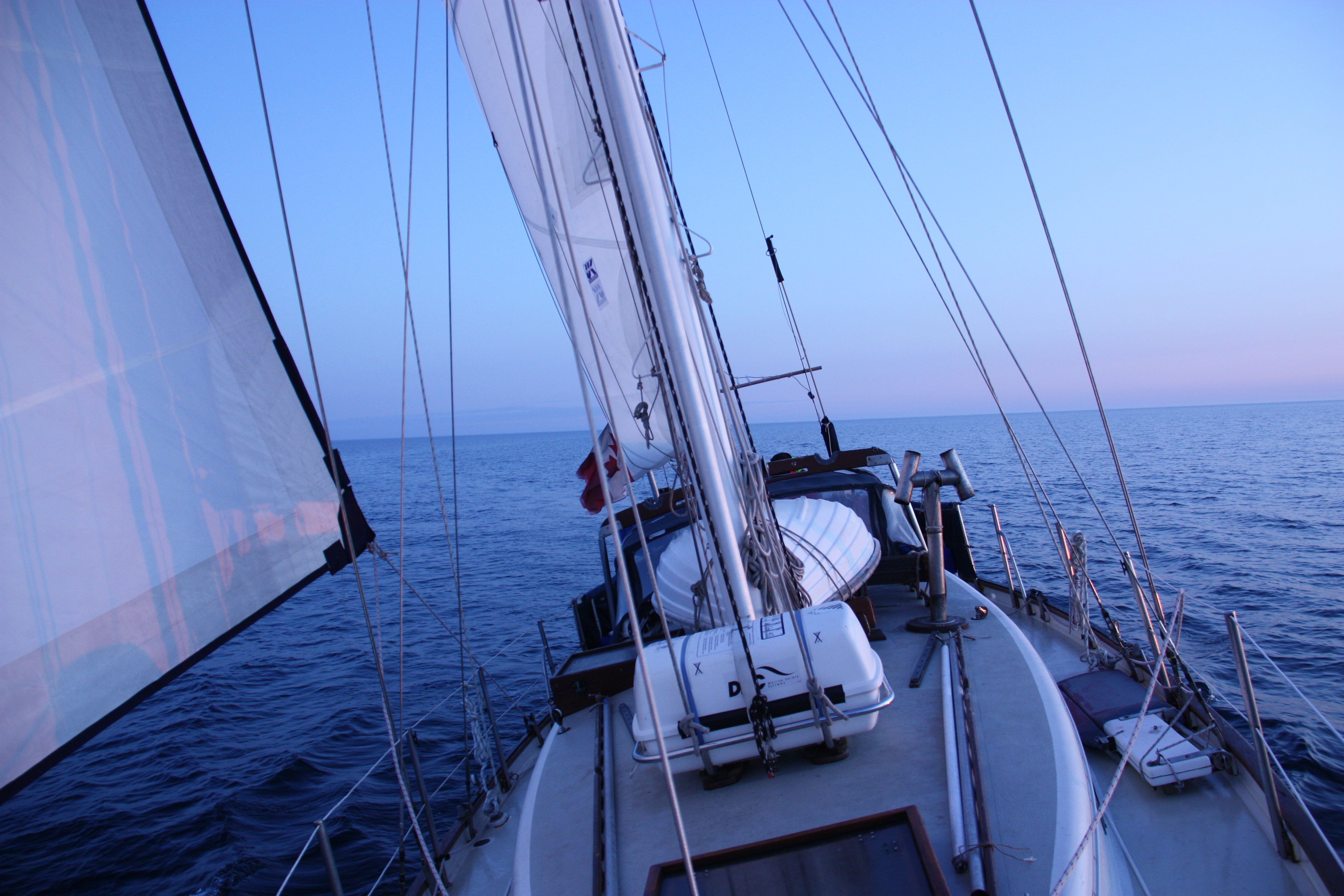
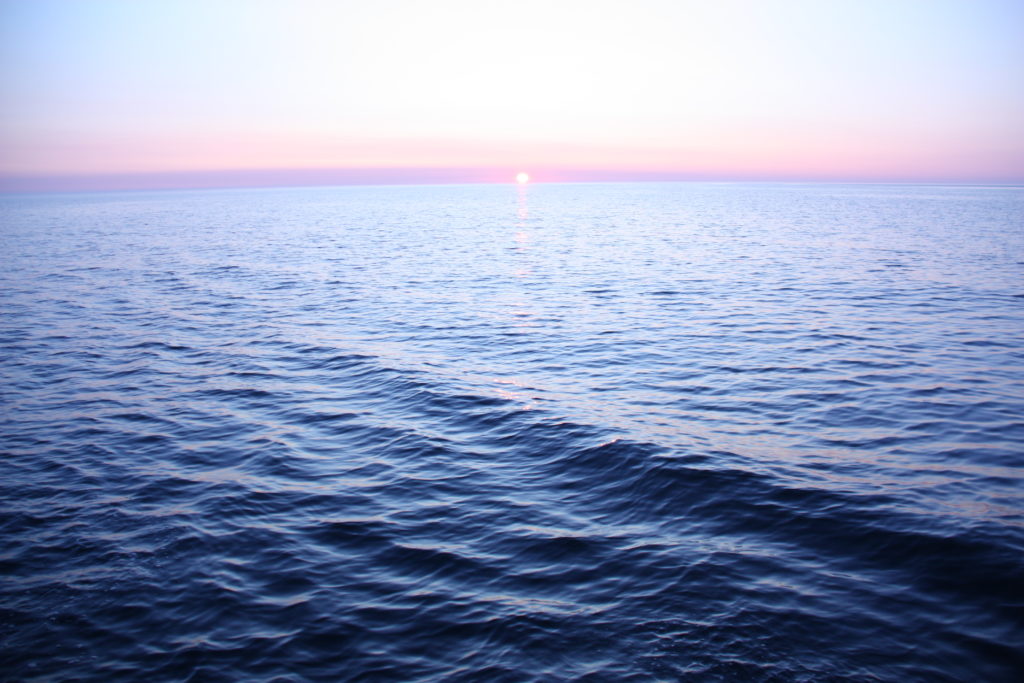
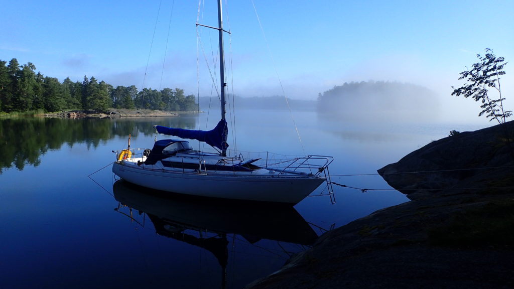
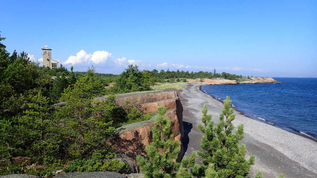
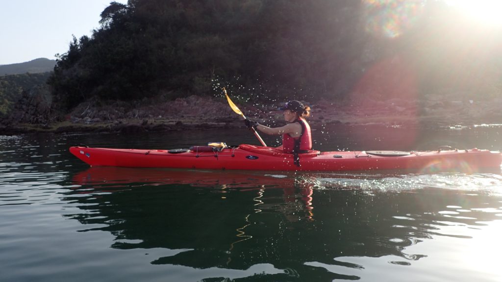
Those rocks were on my mind as I helmed west through the Finnish Archipelago.
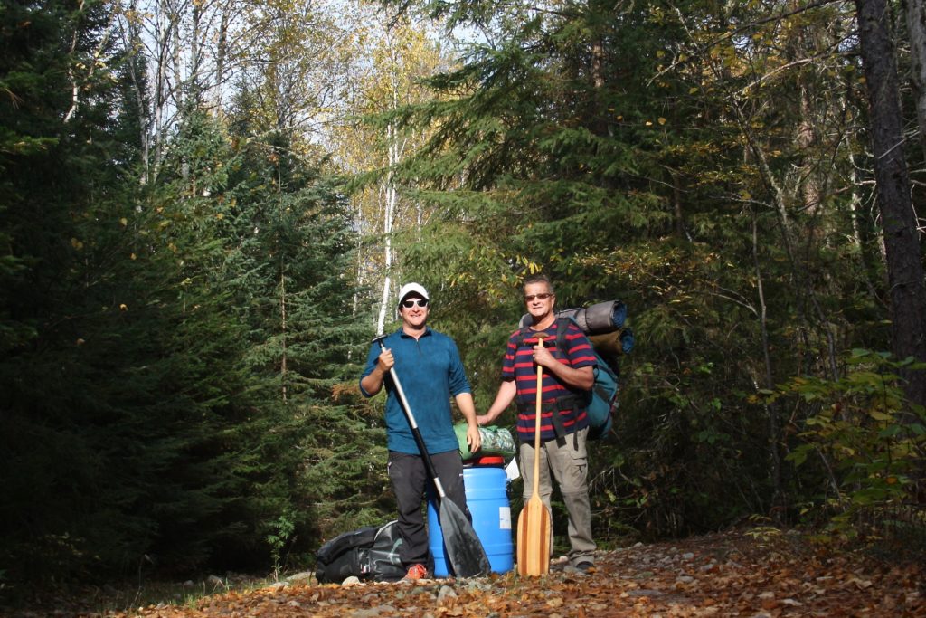
I couldn’t afford to mess this up. My Finnish friends had generously lent me their sailing boat, Valaska, for three weeks, no strings attached, and I didn’t want to betray their trust.

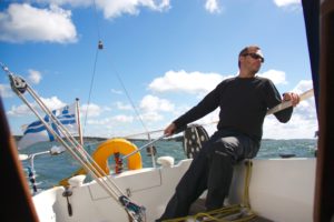
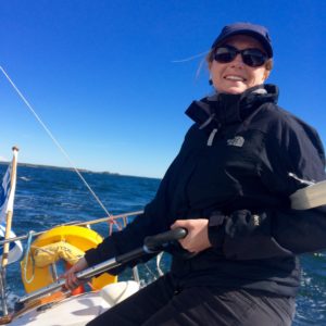
The island of Korpo was to starboard. I’d just dropped off the owner’s son after a two-day shakedown cruise out of Turku, during which I tried to memorise where all the switches, sea cocks and latches were, which bits to jimmy and which ones were jammed. Now the yacht was my responsibility, and nothing but the hull stood between the rocks and I.

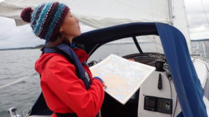
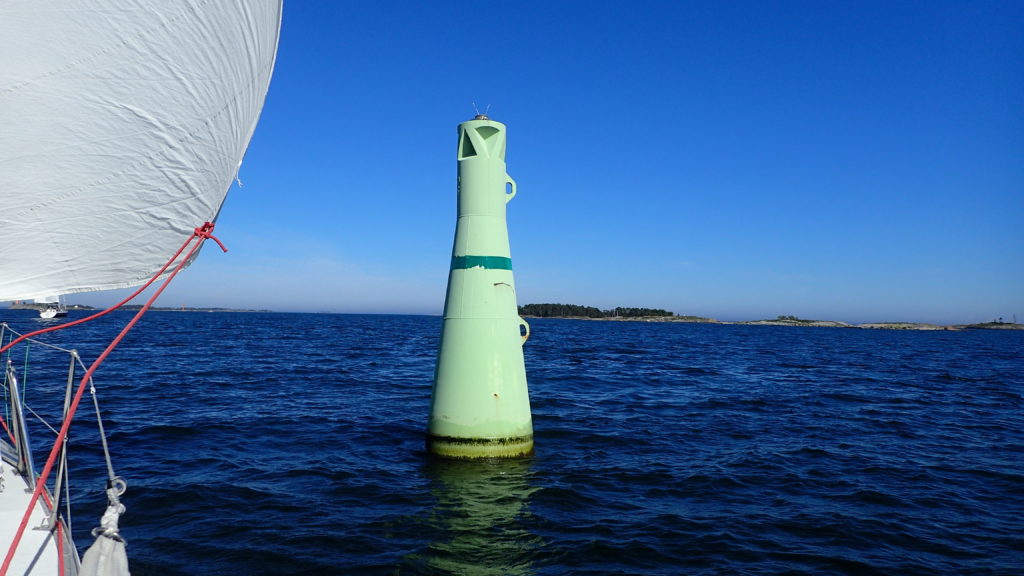
“After this west cardinal there are three north cardinals in a row, and then a south cardinal,” my crew told me, sitting in the cockpit, paper charts on his lap, checking the veracity of the chart plotter. He looked worried.

“I see an east cardinal there…is that ours?” I stood up, straddling the rudder of the trim little H323, ready to turn either way at moment’s notice, my eyes scanning the water for the waves in the middle of nowhere that characterise skerries.

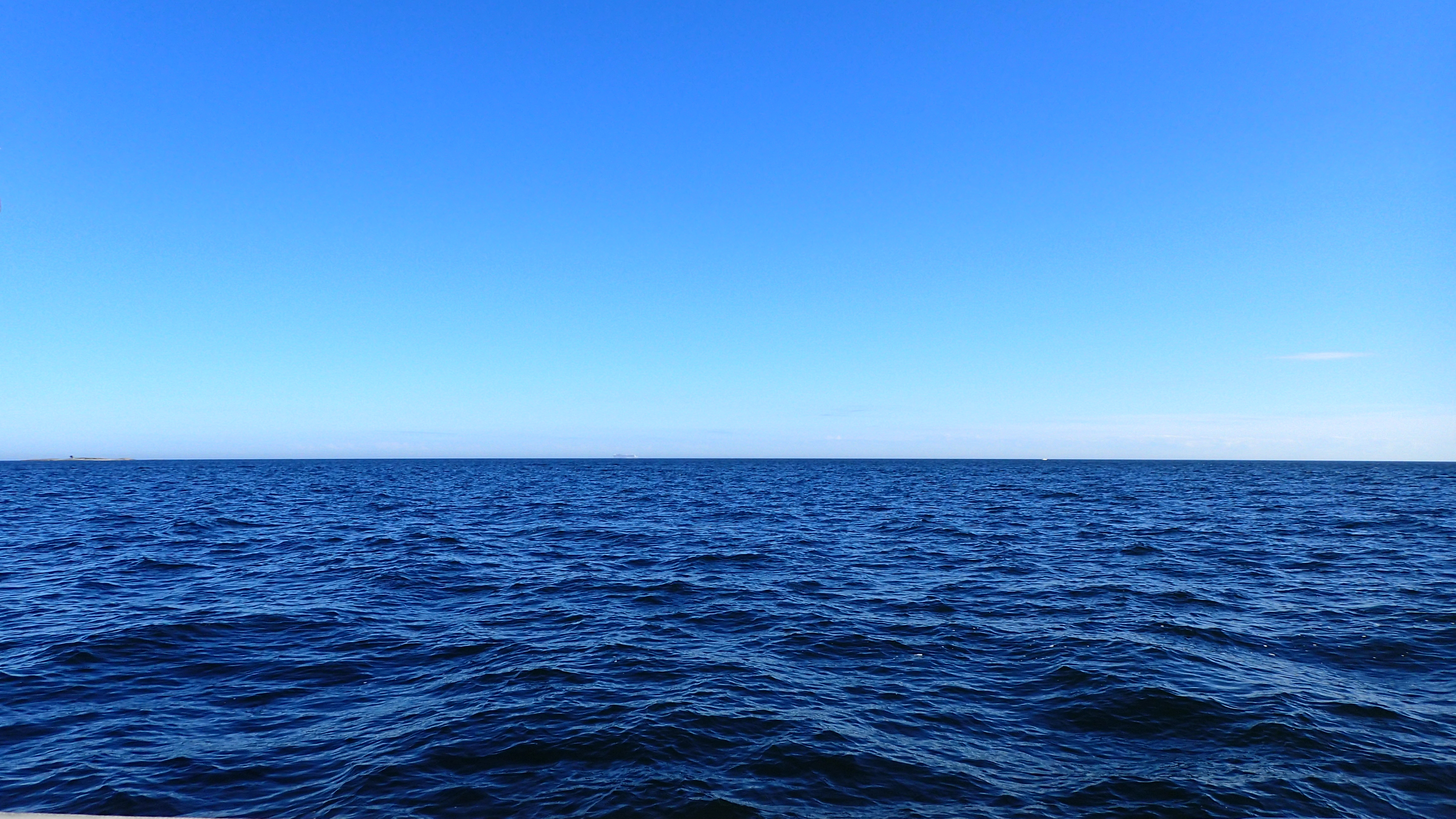
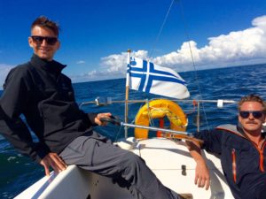
And so it would go for the next few hundred miles as we wove our way through the thousands of islands sprinkled across the Gulf of Bothnia. Our destination was Åland, a place I’d never even heard of until I’d begun planning this cruise.

When the owner first made his offer I proposed that I sail to Sweden and explore its famous archipelago. And as soon as the words were out of my mouth I sensed that this was not what he had in mind.

“Yes, you could sail to Sweden, but Finland has thousands of islands as well. You would have to pass right by Åland. Look it up, you might want to spend your time there instead.” There was raw nerve of competition between the Scandinavian neighbours, I realised.

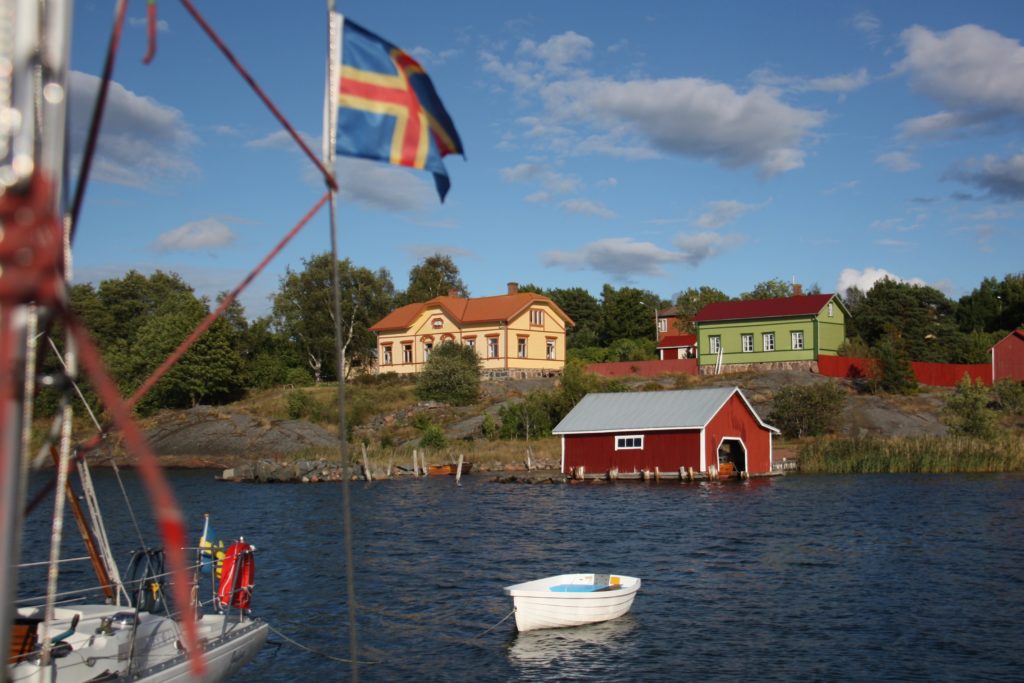
They were right about this little-known corner of Europe, where berries grow wild, the sun stays high in the sky during summer nights and the fluttering Åland flag reminds visitors that Finland may own the land, but the hearts and spirit of the people remain free.

Åland is an archipelago of 6,500 islands and skerries. It was under Swedish rule for 700 years until the Treaty of Fredrikshamn forced Sweden to hand it, along with Finland, to Imperial Russia. In 1917 Finland declared independence from Russia and took Åland with it. Ålanders argued for their own self-determination, with a request for annexation by Sweden, but there were concerns that independence could make them vulnerable to Nazi Germany or Soviet influence.

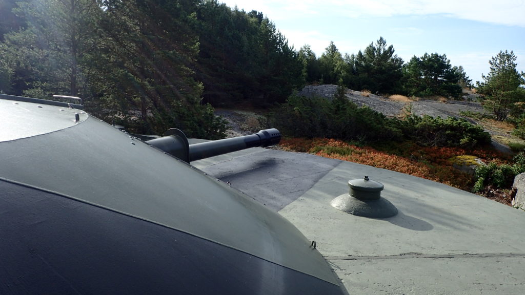
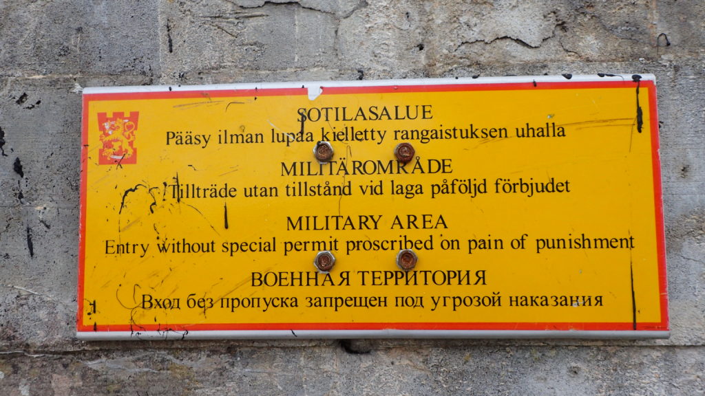
In 1920 Finland granted wide-reaching cultural and political autonomy to Åland, including its own flag, postage stamps, police force and a seat in the Nordic Council. This demilitarised region is part of Finland’s Archipelago Sea, the largest archipelago system in the world and the spiritual home of Tove Jansson, the Finnish novelist and comic strip author of the Moomin books for children.

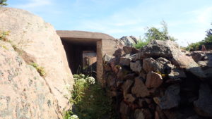
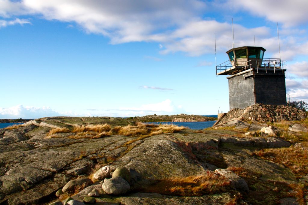
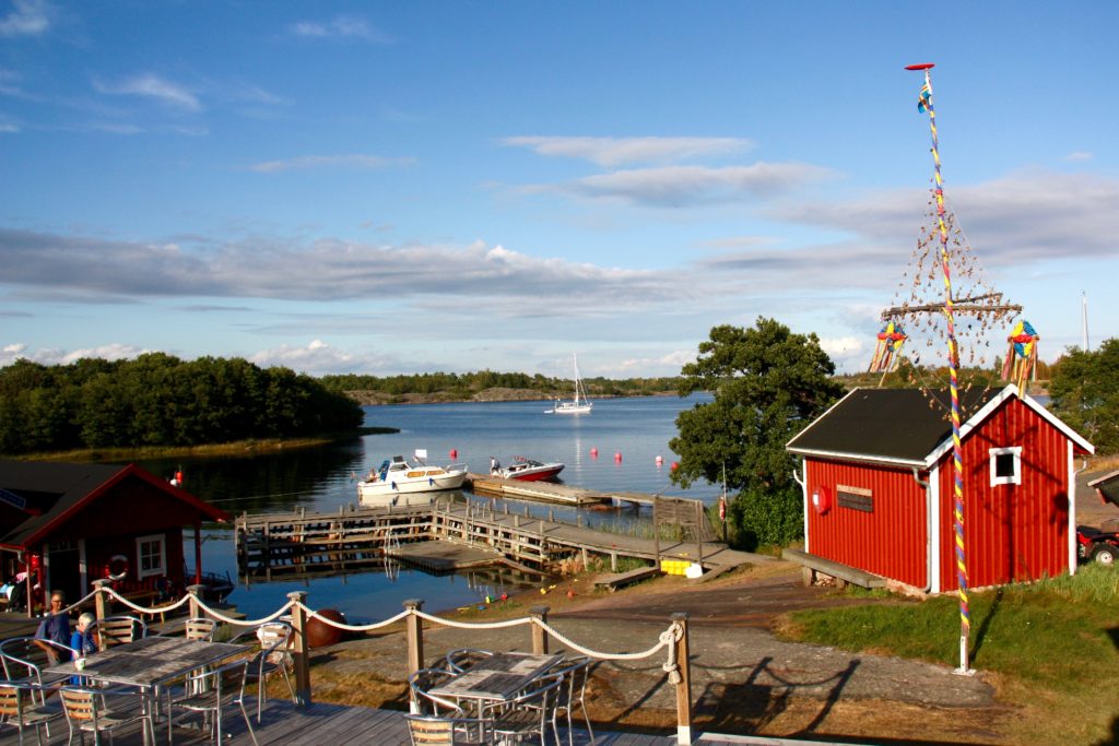
Dotted with natural harbours, remote islands and weatherbeaten pilot houses, Åland’s history is visible at every turn. In small ports I saw iron mooring rings pounded into granite shores by Russian sailors more than a century ago, which today are used to moor yachts. Lonely pilot houses top windswept islands and remind sailors that this was once one of the great shipbuilding sites of Europe.

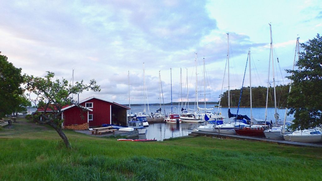
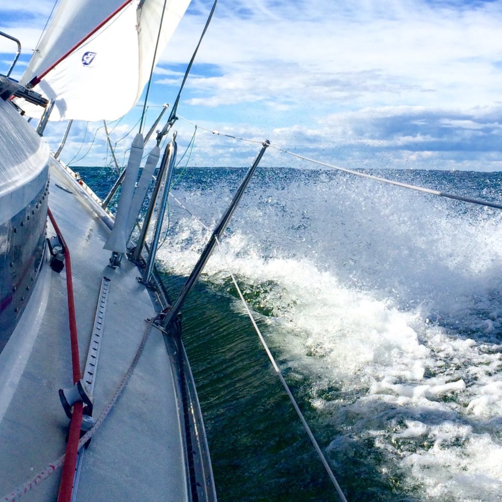
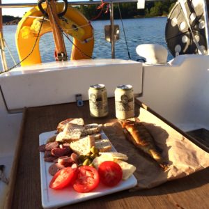
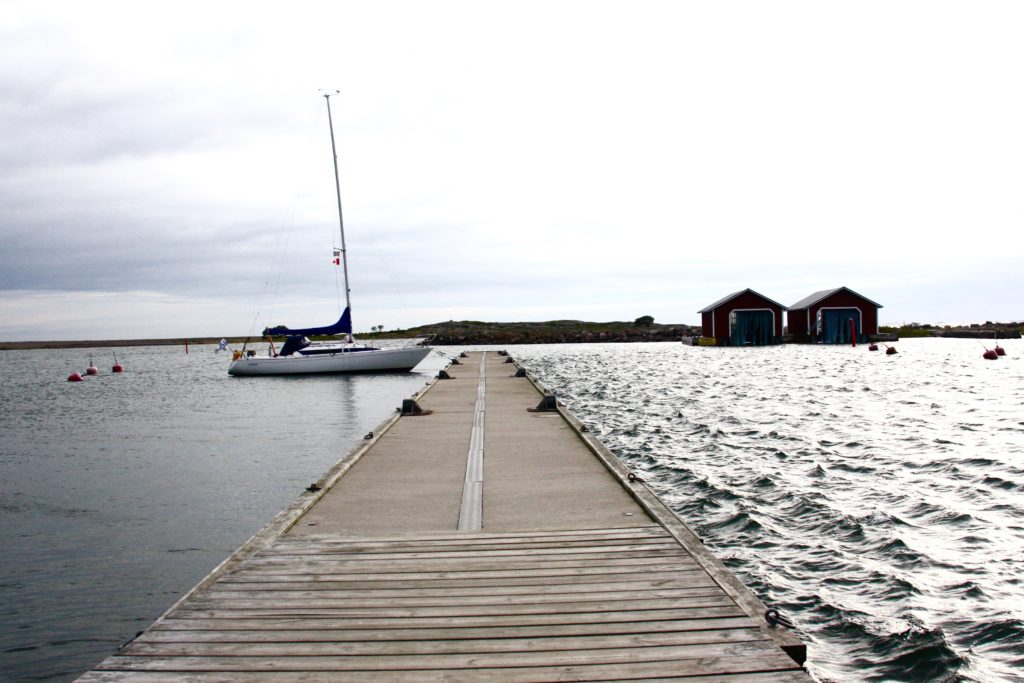
It is rare to see sailors from outside Scandinavia in these waters, and most of those you do meet are German. So, when we arrived in the marina at the top of Bärö, next to the island of Kumlinge, we were surprise to find a dozen cruisers filling the tiny harbour. But there was still one spot left — arriving in a 32 foot boat with a 1.4m draft is a distinct advantage in these waters. These brackish waters have no significant tides, allowing for an extra degree of bravery when edging a yacht into shallow anchorages.

After the customary anchor drinks I changed into swimming shorts and headed for the sauna built on a floating dock, eager for the full experience of Finnish sailing. I threw open the door with a cheery “Hello!” — sometimes it’s an advantage to have everyone know you’re not local. The three women inside pulled their towels a little bit tighter around them and looked at me suspiciously.

“This is a private sauna,” one of them cooly informed me.

I stammered my apologies, backing out the way I’d come, and returned to the boat for additional anchor drinks. Soon one of them swam over with a smile on her face to explain that we had to book the sauna — but unfortunately it was already booked solid for the evening. Our first sauna experience would have to wait.

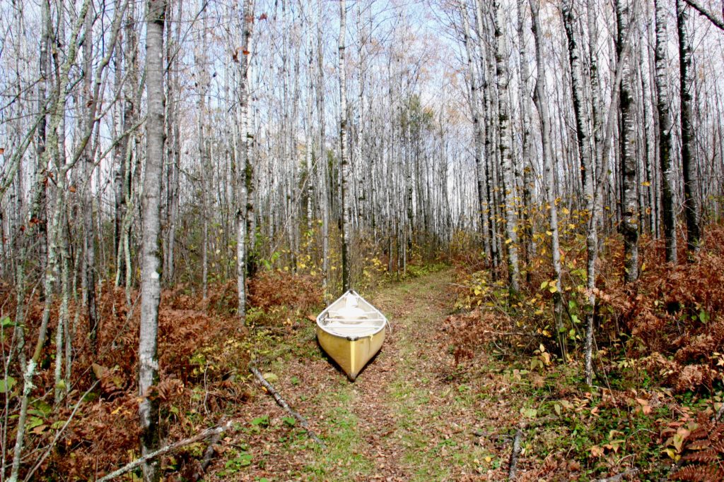
The next morning we returned to the steady southwesterly 15-18 knot breeze that had brought us here. It carried us to the remote northern shores of Fasta Åland, the main island, where the region’s most untamed forests and islands are. Saggö, nestled against its sister island Saggö ön, forms a narrow strait that provided us protection from the wind and showed promise ashore.

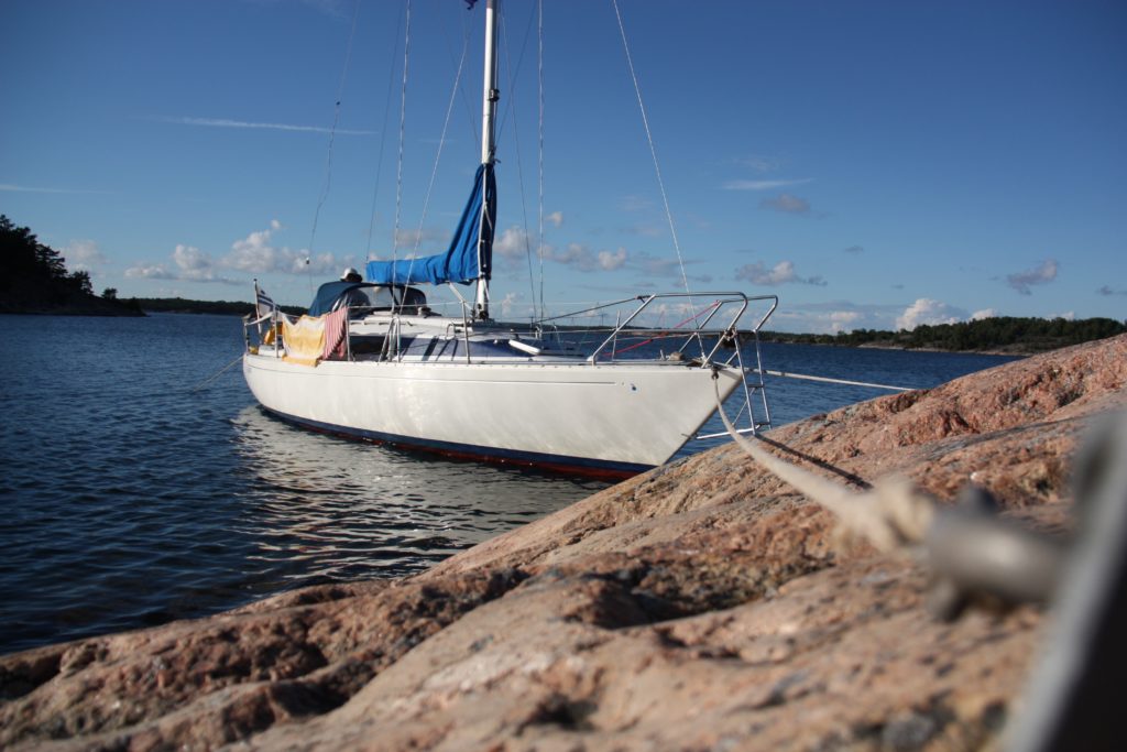
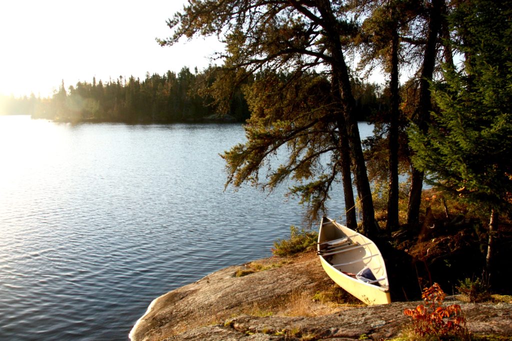
It was my first attempt at Finland’s unique mooring system. I motored along the shore to check depths, then picked my spot. The crew stood on the bow, mooring lines in hand, and I dropped the anchor from the stern as we approached the rocky cliffs. I edged the boat close enough for the crew to jump ashore, where they banged iron pitons into cracks in the granite. Mooring lines were looped through the pitons, while I tightened the anchor line. When we were done the bow of the boat was only two feet from the rocks, but the steep shore and taut anchor line kept the keel in deep water.

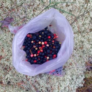
I jumped onto a boulder covered in orange lichen and scrambled up the rocks, using the scrawny fir trees to pull myself into the forest. The forest was deep and quiet, with only the sigh of wind against the tops of the fir trees to break the silence. The thick, springy silenced my steps. I reached down and pulled out a damp handful, releasing a woodsy, earthy smell — a scent I don’t normally associate with cruising holidays.

Then I spotted them…a cluster of red ones here, some deep purple ones there. Bilberries and lingonberries — in North America commonly known as blueberries and cranberries — growing wild in thick clumps.

I dropped to my knees and gorged on them. They were tart and sweet, making my tongue tingle. I picked until my fingers were blue with juice and had filled a small bag with those that somehow escaped my mouth.

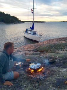
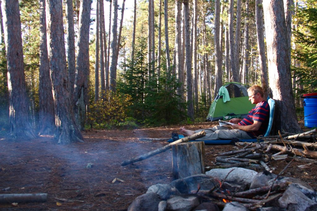
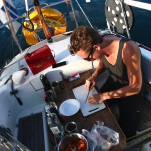
That evening we sat around a campfire on the rocks, sipping coffee and eating fresh berries with scones baked in Valaska’s oven. The firelight flickered on her white hull, confusing me for a moment — was I on a camping or a sailing holiday?

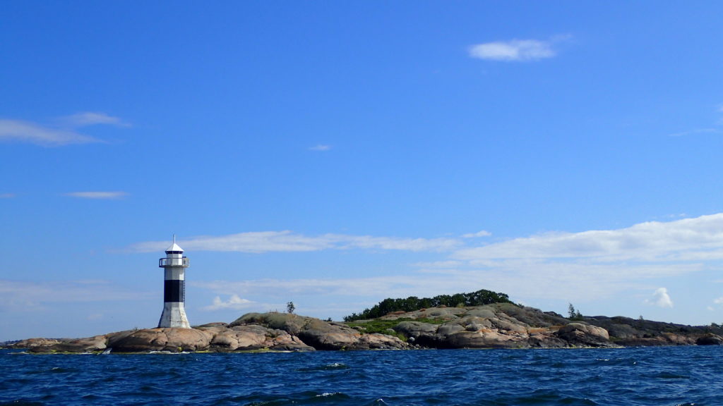
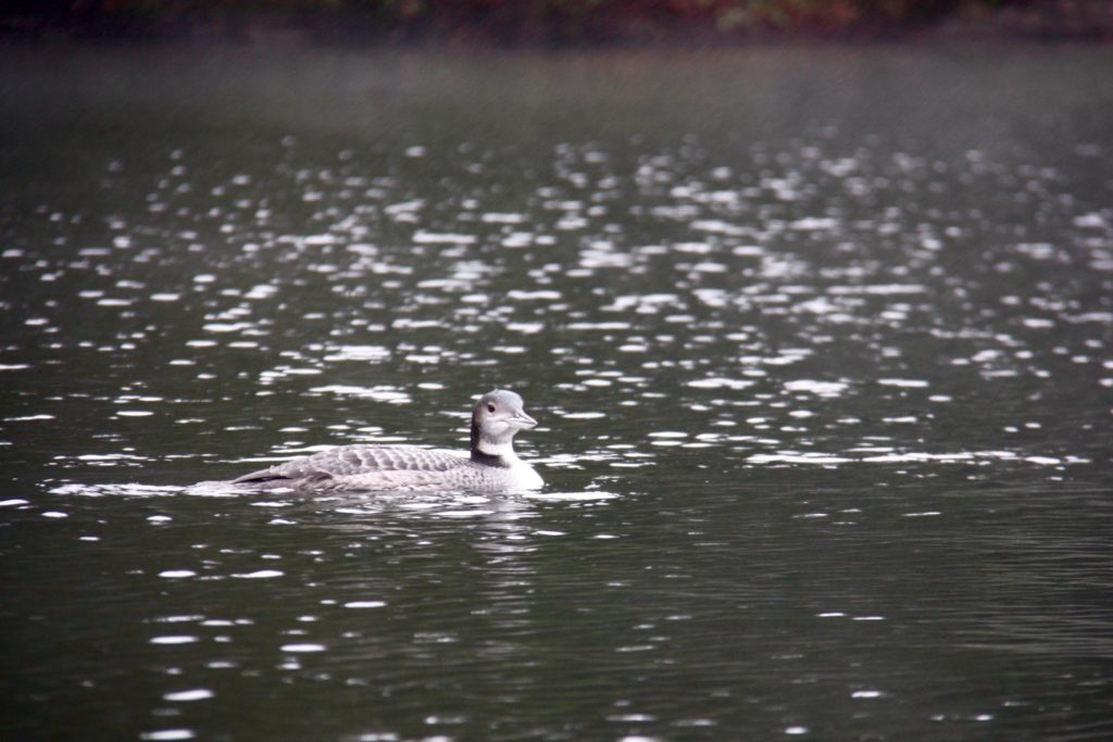
We continued across the north of Fasta Åland, alone but for the Whooper swans — Finland’s national bird featured on the 1 euro coin — and even an occasional seal, but we saw few other boats. Eventually we turned south, down the western side of the island, past the Ådskär lighthouse to Mariehamn.

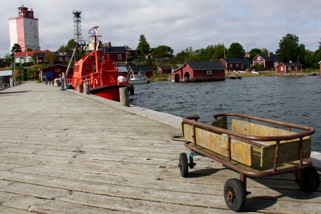
The southern coast is the part of Åland that most visitors see. Mariehamn, the region’s capital, was named for a Russian empress. Here huge ferries disgorge tourists from Sweden, Estonia and mainland Finland, and the streets are lined with cafes and restaurants in ornate, historic buildings. It’s home to summer music festivals and nearly half of Åland’s population.

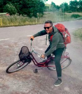
That night the wind rose until waves broke over the marina docks and the air was filled with the screech of rigging, so in the morning we switched to bicycles, Åland’s other great mode of transport. Fasta Åland and the outlying islands have hundreds of kilometres of well maintained and signposted bicycle paths, and we followed one of them north. It took us through rolling fields of ripe barley and wheat growing between forests of fir and silver birch, past small farms with bright red outbuildings and summer cottages with stacks of firewood outside their doors. Every few kilometres the path cut back towards the coast, and I caught glimpses of the sparkling Baltic Sea.

Twenty-five kilometres later we arrived at Kastelholm, a Swedish-built medieval castle occupied by Finns, Swedes and Russians over the centuries. It was used as a prison and execution grounds in the late 1600’s when Åland was in the grip of a hysterical witch hunt. Åland’s independent postal office has just issued a stamp to commemorate the execution of seven suspected witches.

From the castle walls I looked down on the Kastelholm Yacht Harbour, nestled in the narrow inlet of Ladängsviken, making a mental note to sail rather then pedal next time.

By the next morning the winds were more manageable, and we set off through the complicated fairway leading from Mariehamn to open sea. We shared the channel with several massive international ferries, which added to the navigational challenge. Despite the apparent remoteness of the region, there are also small ferries criss-crossing the archipelago, requiring sailors to keep a constant watch.

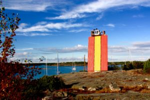
Rödhamn, an island port I’ve heard about from numerous other sailors, is just 10 nm south of Mariehamn. Its name refers to the red (röd) colour of its rocky shores, which have provided safe haven to centuries of seafarers. The shores of the southern, sea-lashed side of the island are dotted with stone cairns left behind by passing sailors. There is no electricity or running water in the marina, making it a quiet, peaceful place. A small bakery delivers hot rolls to your boat in the morning.

But the real reason I came to Rödhamn was its famed sauna. Late that night we hiked across the island with our towels around our necks. The air had turned chilly and the sky was filled with the kind of clear light only found in a high-latitude summer night. On the far side of Rödhamn, perched at the tip of a peninsula, was a small hut facing the sea. Smoke puffed from its chimney.

We stripped and ducked into the warm darkness. It was nearly dark inside, with just a glimmer of evening light coming through a small window. The wood-burning stove hissed as I threw a scoop of water at it, producing a searing hot steam that rose to ceiling. Soon I was dripping with sweat and conversation ebbed to the occasional sigh.

When the heat became unbearable I burst out of the sauna and ran, stark naked, across the smooth granite rocks that sloped towards the sea. The indigo sky was streaked with yellow light, the sun still high above the horizon despite the late hour.

“Whoo hooo!” I shouted as I launched myself, my yell becoming a yelp as I hit the frigid Baltic Sea. Within seconds the cold became too much, and I swam for the shore to dash back into the sauna.

The summer was coming to an end, and the wind turned from westerlies to easterlies as we began our 150nm voyage to Valaska’s home port of Helsinki. The easterlies brought a cold rain that slashed at our faces as we tacked our way home, as if cajoling us to return to Åland and its sunny skies.

Canadian Shield

Read this story online as it was published in the South China Morning Post.

camerondueckrriverimg_3582

“This sure doesn’t feel like October,” my brother says, standing knee deep in lake water, squinting up at the warm afternoon sun.

Our yellow canoe is pulled up on a narrow beach, perpendicular to the deep hoof prints left by a passing moose. The birch and spruce forest leans over the beach, as if reaching for the sunlight that glitters off the water. Most of the leaves have already fallen and the trees are naked and white.

“The water’s a bit chilly, but the sun makes up for it,” I say as I wade ashore after a quick plunge in Lake Kilvert, in Ontario’s Eagle-Dogtooth Provincial Park.

camerondueckrriverimg_3500

It’s one of thousands of lakes carved out of the 4 billion year old rock. This is the Canadian Shield, the largest mass of exposed Precambrian rock on earth, the exposed continental crust of North America, where ancient mountains were flattened and lakes carved from rock during the Ice Age. Eight million square kilometers of it, igneous rock born from volcanoes that grew into tall mountains which were then worn down to rolling hills and a thin sifting of soil by monstrous slabs of ice.

camerondueckrriverimg_3473

Right now, that much ice, or even snow, is hard to imagine. We’re enjoying some late season warmth on the first day of our canoe trip. This park, only a 2.5 hour drive east of Winnipeg, has five meandering canoe routes through moraines, boggy beaver ponds and pine forest ecosystems. We gambled with a late-season trip and it paid off as we have the lakes to ourselves. Everyone else has already packed up their boats for the winter.

We hoist our canoe and trudge one and a half kilometers through the forest to Gale Lake, where we drop it with a sigh. I stretch my neck and shoulders as we walk back to retrieve our bags and a food barrel. This is just one of seven portages we’ll make on our 51.5 kilometer route, the price we pay to paddle across these remote lakes.

camerondueckrriverimg_3593

Once we’ve portaged all of our gear we set up camp in a stand of tall red pine on the western shore of Gale Lake, a small tear-drop shaped body of water that pinches off into a narrow creek in the north. There’s plenty of wood for a fire, and I mix up a batch of bannock, the unleavened Native American bread. I fry it in a pan, seasoned with wood smoke and raisins.

camerondueckrriverimg_3703

The Canadian Shield is the home of Algonquian nomadic hunters, who paddled these lakes in birchbark canoes, but the wide expanses of bare rock, poor soil and frequent marshes made it difficult for early explorers and fur traders to push westward into the continent. On the other side of this rock wall are the Prairies, Canada’s wheat land.

Eventually the European colonialists blasted a rail line through the Shield, which opened it to prospectors who found gold, silver, nickel, cobalt, zinc, copper, iron ore and, more recently, diamonds. This is also where Canada has built massive hydroelectric dams to feed cities to the south. The Shield, both past and present, looms large in Canadian history and culture, and canoeing these waters is a rite of passage for many Canadians.

Our good weather holds for exactly two days. Just long enough for us to grow smug, congratulating ourselves for setting forth while others stayed at home. Then, during the night, the temperature drops. We pull out our thermal underwear and stoke the fire as rain spits from a leaden sky. Now, suddenly, that Ice Age seems more feasible.

camerondueckrriverimg_3738

We’re watching the change of the season, when the benign summer is replaced by the unpredictability of early winter. This winter won’t wear down mountains or create a new lake like a true Ice Age, but it will put the land to sleep for the next six months or more.

Luck never changes in half-measures, and the wind that brought the cold air blows heartily from the southwest, straight on our bow. A day earlier the lakes were so still the rippled wake of a loon traveled a kilometre across the water, and now the grey water sloshes into our boat as we claw our way upwind.

“Do you still have control of the boat?” I call back to my brother, who is steering from the stern and who I’ve only heard grunts and curses from for the last few minutes. He is the more experienced canoeist, so surely he will know if we’re pushing our luck. We’re trying to round a point of land that has compressed waves and wind and I’ve just taken on a lap full of cold lake water.

“Yea, but we’re on the edge,” he shouts. “Just keep paddling, hard.”

camerondueckrriverimg_3662

We make it, but once we’re in a protected bay we rule against risking further miles in these conditions. Along a low, swampy shore on Dogtooth Lake we find a forest clearing created by gnawing beavers and set up camp to wait out the storm. Every few hours we walk to the edge of the woods to see if the white caps that race across the lake are becoming smaller. They are not.

But the view is great. Tall cliffs left behind by glacial erosion, topped by scraggly jack pine and poplar. Massive round boulders have been dropped by the retreating ice, like marbles left behind by a child. Speckled alder and red maple still sport a few blazing leaves, beacons in the grey light.

Our last morning begins before dawn. We’ve promised friends and family to reemerge from the wilderness at a certain time, and in order to do that we need to make up the distance lost to the storm. We stop once, mid-morning, to boil up some coffee, and then push on. The wind has died, leaving behind a cold mist that blankets the quiet lakes.

camerondueckrriverimg_3779

I’ve had something on my mind, but I’ve been afraid to say it. I didn’t want to jinx things. But then we round a corner and I can see our truck and the end of our canoe journey. I double check, squinting to make sure, but I can see no one on the shore.

“We haven’t seen another person in five days,” I finally blurt out. “Not a boat, no people outside their cabins, no one at all.”

“If there was anyone else out there they were warm and dry in their cabins,” my brother says. “Probably looking out of their window at us paddling past in the mist and thinking, ‘Those poor buggers’.”

camerondueckrriverimg_3535