Cruising through the Cold War

Finland is opening some of its secluded military islands to the public, creating a string of new cruising destinations and adding to the many gems of unpolished history spread across this remote archipelago.

This story was first published in the February 2018 issue of Cruising Helmsman.

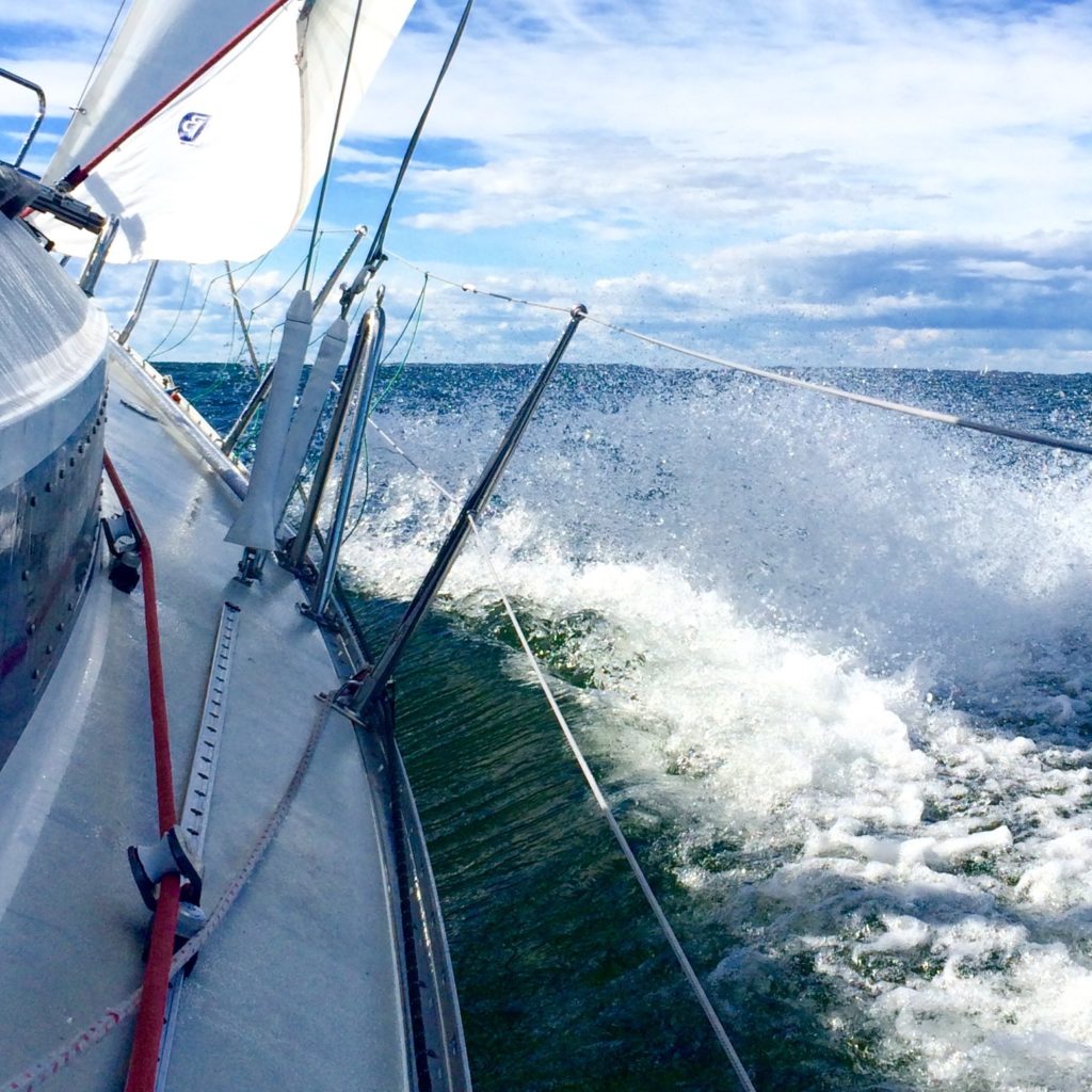
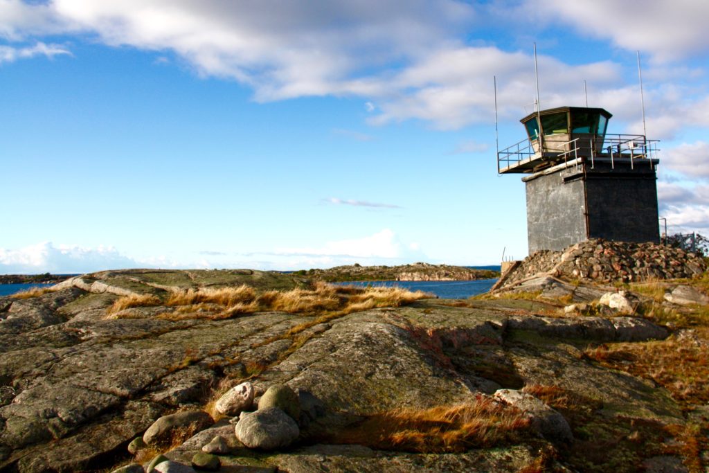
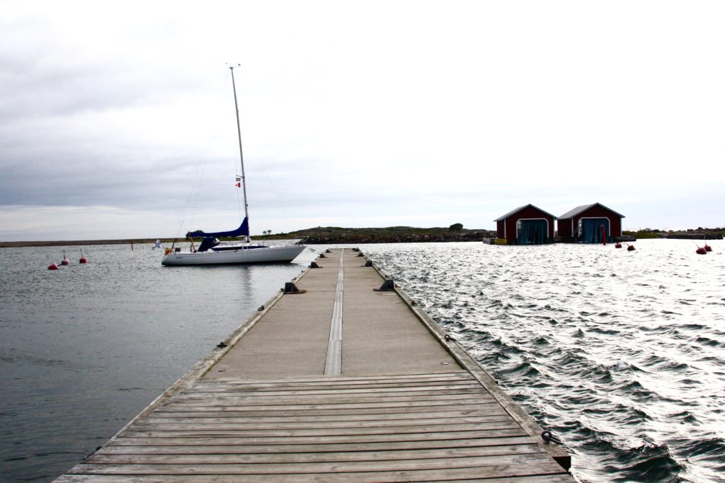
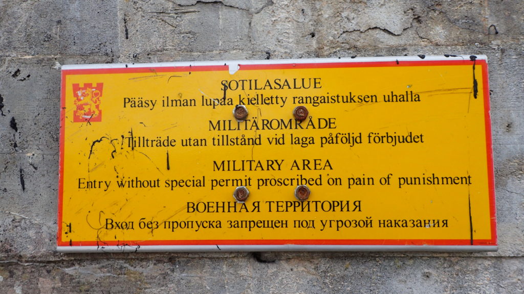
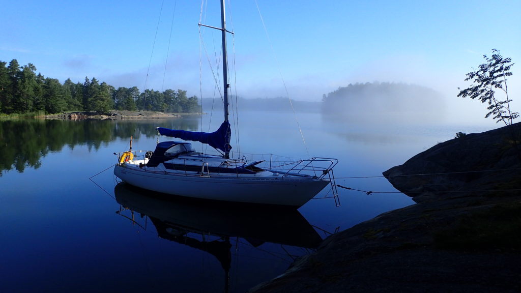
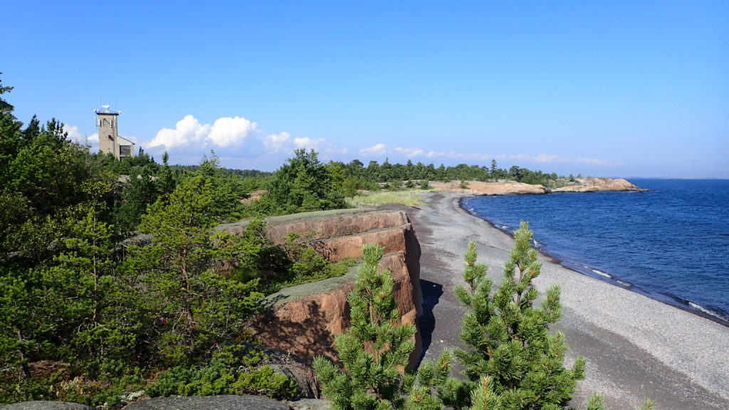
The waters approaching Örö are treacherous. Submerged rocks abound, and if you don’t pay attention to your charts you’ll end up swimming in the cold Baltic Sea. It only makes sense, as the inhabitants of this Finnish island have spent the last century with guns in hand, trying to keep visitors at bay.

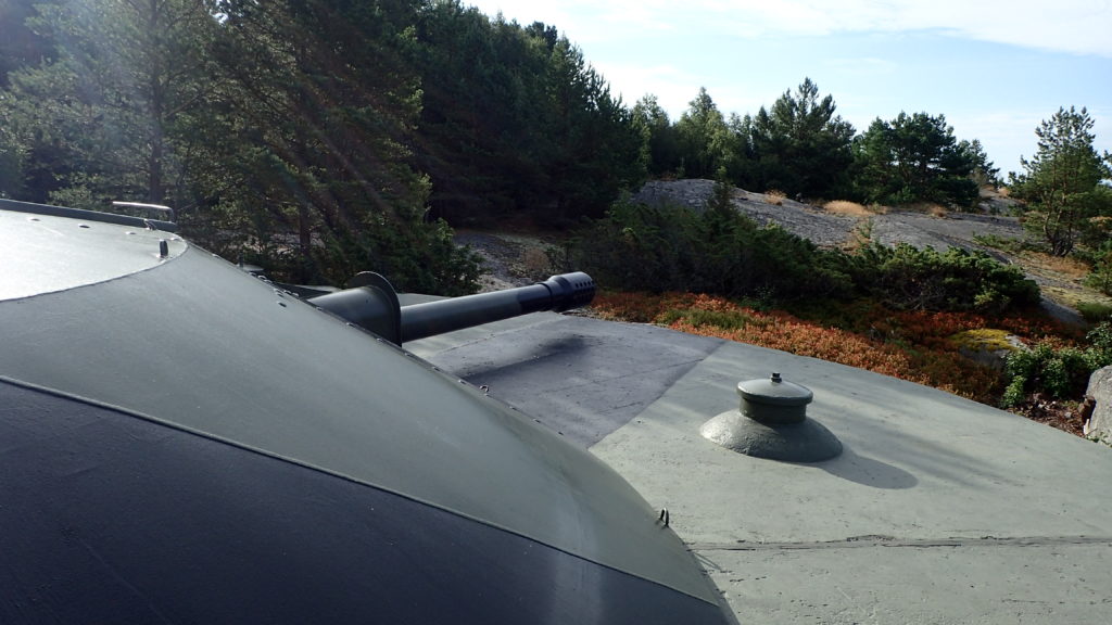
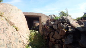
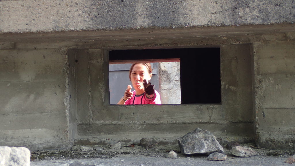
We handed our sails and motor into the marina under the gun-slit gaze of a weathered concrete bunker, knowing the gun barrels were plugged with concrete while the bunkers are now a tourist attraction.

Örö served as a grazing pasture for local farmers until the early 1900s. Then, as the First World War loomed, Tsarist Russia built a fortress on the island to keep ships away from it’s nearby capital, St Petersburg. Civilians were prohibited from visiting the island and the Russians embarked on a base-building frenzy, from artillery batteries, observation towers, barracks, jetties and cobble-stone roads to warrens of trenches.

When Finland declared independent in 1917 Örö was handed to the Finnish Defence Forces — and remained closed to the public. It was an important defence base during World War Two, and it remained an active base until 2004. Only in 2015 were Örö and all of its buildings transferred to the park system and opened to the public. Örö is only about a 25 mile sail southwest of the region’s major yachting base of Hankow.

The second ö in Örö means island in Swedish, the language of choice for many locals — which points to wars that took place even before this island was militarised. Many of the decommissioned islands have been occupied by Swedish, Russian and Finnish soldiers over the centuries, so each layer of peeling camouflage paint has a story to tell.

On Örö,, the rusting weaponry still gives off a Cold War chill. The historical preservation has been careful and unobtrusive, allowing each new visitor to feel as if they’ve stumbled upon a secret.

If your charts are a year or two out of date, like mine were, the secret can suddenly become pressingly more realistic.

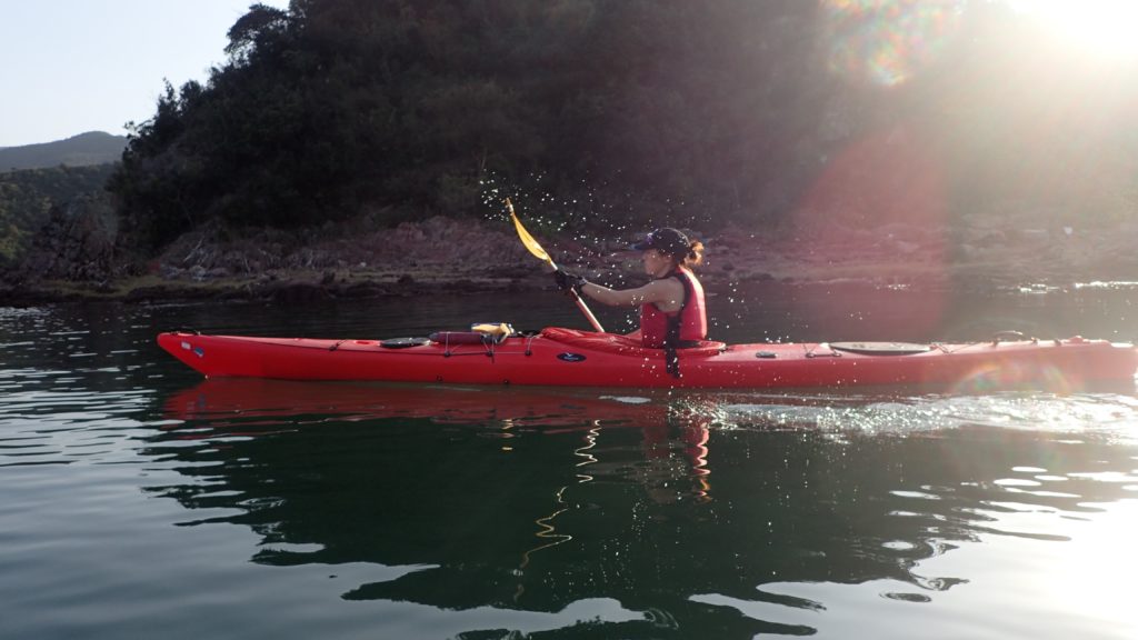
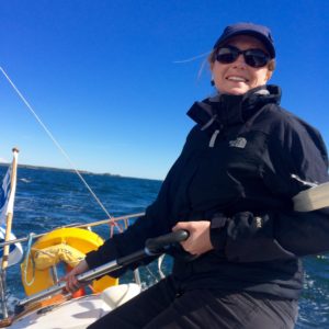
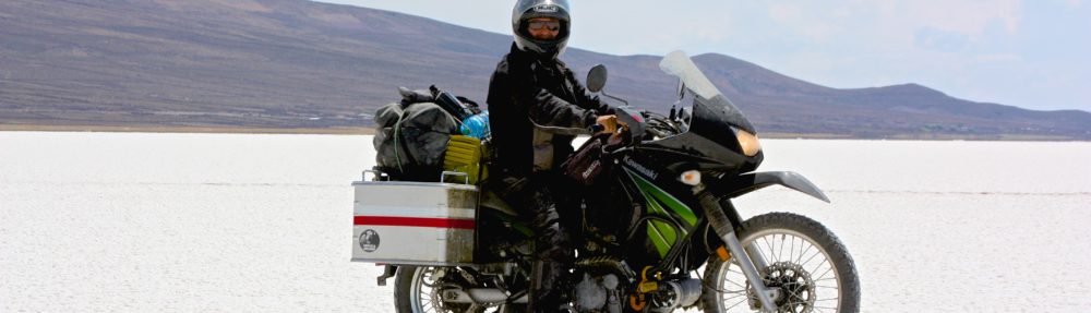
“There’s a north cardinal up ahead,” my girlfriend told me as she helmed our borrowed H323 through the skerries south of Örö. We were on a three-week cruise, with this being her first ever sailing trip. I was navigating, my nose in a book of charts.

“What? You must be seeing something else. There’s nothing on the charts,” I replied, scanning paper and screen simultaneously.


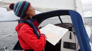
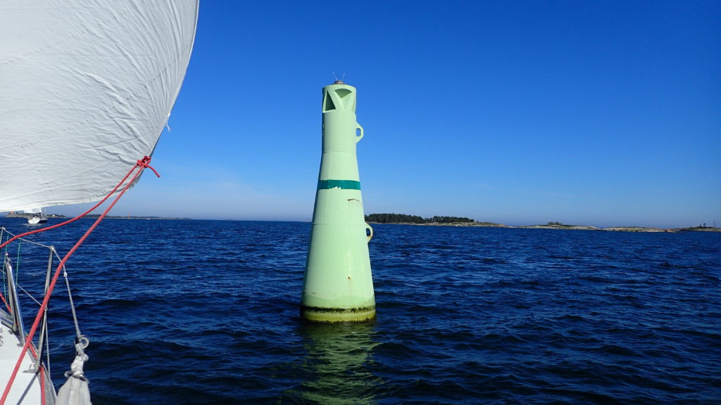
The lack of marks on my charts explained why we were sticking to a wider channel, tacking well clear of the shore and watching the depth meter with a nervous eye. Finland’s waters are notoriously rocky, but the main cruising areas are well marked, with excellently maintained and positioned cardinals, transit marks, lighthouses and cairns. It’s like sailing in a navigational classroom.

“And there’s an east cardinal…I think I can see another north over there.”

These marks for small craft had been laid, or maybe only revealed, in the past year or two, if the date on my charts were correct. I had no doubt the Finnish Defence Forces had these waters well-charted, but still, it felt like we were in remote waters.

Once we were safely moored on Örö we wandered the many hiking trails that wind through forests and over windswept rocky shores. Sprinkled across the island are barracks and mess halls painted the rusty red colour favoured by Scandinavian cottage owners. Örö felt like a summer camp, until we stumbled upon guns with barrels big enough to support a bridge. A radar whirred and spun atop a communications tower, reminding us of Örö’s less peaceful past. Each headland and windswept hill is honeycombed with bunkers and gun positions.

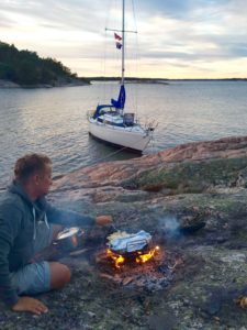
That night we sat, naked and sweating, in the marina’s new sauna, a Scandinavian chic and minimalistic building nestled among the birch trees. An expansive veranda led to a pier, from which steaming pink bodies were being launched into the frigid sea. A full moon bathed the rocky shore in light and turned the leaves of the forest silver. War seemed far away.

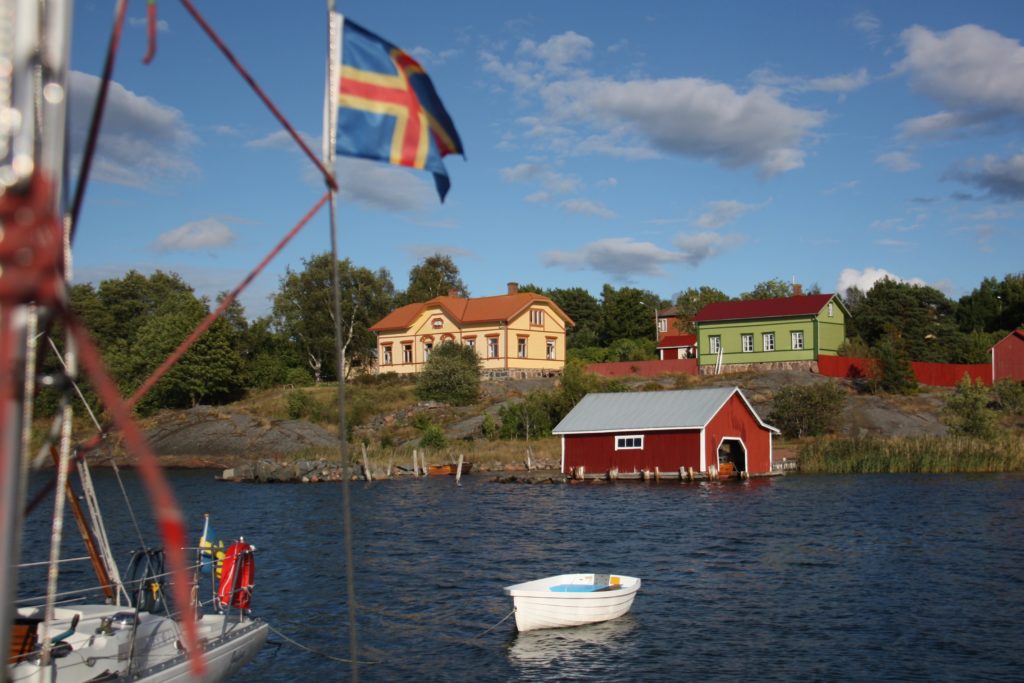
Some of the decommissioned islands are just outside Helsinki’s main harbour. Vallisaari was known for centuries as a place where sailors could take fresh water. When Sweden and Russia were at war in 1808 the Russians used Vallisaari as a base, and the island was only opened as tourism destination in 2016. The nearby islands of Isosaari and Lonna, all part of the Helsinki Archipelago, have similar stories to tell. Limited access has allowed threatened wildlife species and habitats to thrive on these islands, making them popular with scientists and eco-tourists alike.

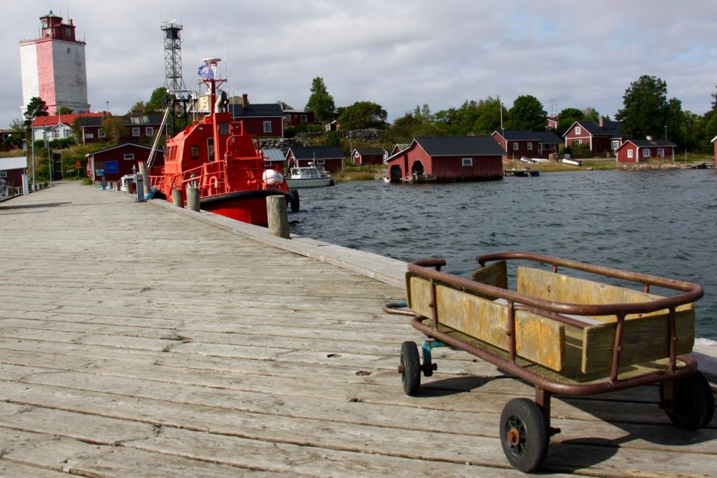
While the bucolic natural settings have made it easy to turn the islands into parks, some decommissioned islands can’t shake their rough character quite so easily. On Utö, 25 miles to the southwest of Örö, the cruising boats are outnumbered by beefy coast guard ships and working boats that have to earn their keep. Utö has had a weather station since 1881 and is the southernmost year-round inhabited island in Finland, but the island feels like a place you are sent to and where you remain out of a sense of duty. Here the bunkers carved into granite feel colder, harder, more dangerous. In reality, Utö has also been a place of refuge. The island and its sailors formed the backbone of the rescue effort when the MS Estonia ferry sank nearby in 1994.

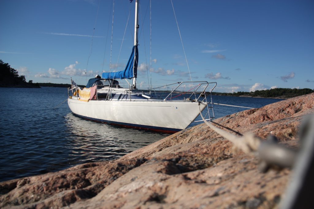
There was a cold, stiff breeze hitting Utö from the northeast when we were there, and it made me wonder about the island’s welcome. But then it came time for one of the handful of sailing boats to leave the dock, and the warm heart of these waters showed. Helping hands began to emerge from cockpits as the departing sail boat started her engine. Warps were run ashore, instructions shouted into the wind, and the boat began to back out while the sailors ashore controlled her head and made sure she got away cleanly. Here, boats moor bow to the dock, with a hook on a stern line to catch the mooring buoy. Boats run their anchor from the stern in smaller marinas without buoys. Most local boats have a strap line on a spool at the stern to make mooring easier.

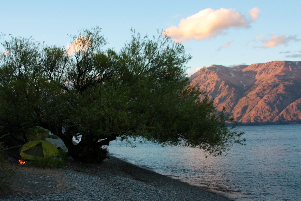
A spool of strong line on the stern also makes it easier to adapt to local customs in natural harbours. In the Finnish archipelago the land falls into the sea so steeply that in many places you can moor your boat directly to the rocks — a frightening exercise for uninitiated sailors. The anchor is dropped off the stern, and bow lines are tied to trees or pitons pounded into cracks in the rock. Then you jump ashore off the bow and explore your island.

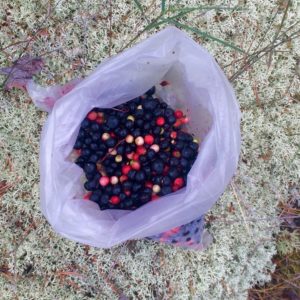
Even in the high season of June and July you can have a cozy bay all to yourself. The forests are wild and pristine, filled with wild berries — within a one-week span we picked blueberries, strawberries, raspberries and cranberries — as well as wild mushrooms, if you dare. While there are summer houses sprinkled across the archipelago, the land use customs dictate that as long as you’re not moored right in front of the property and give everyone a bit of space and privacy, you’re allowed to go ashore anywhere you want.

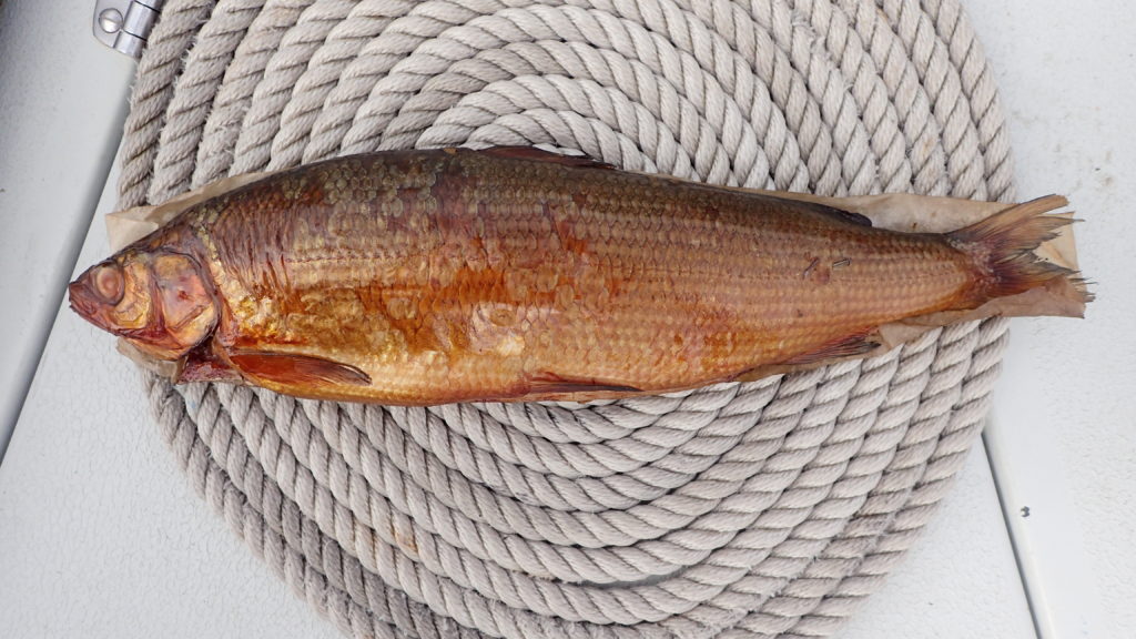
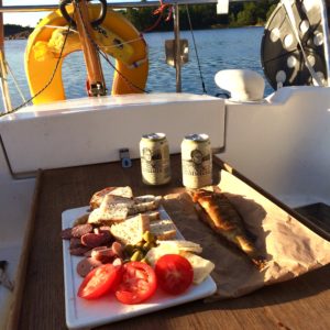
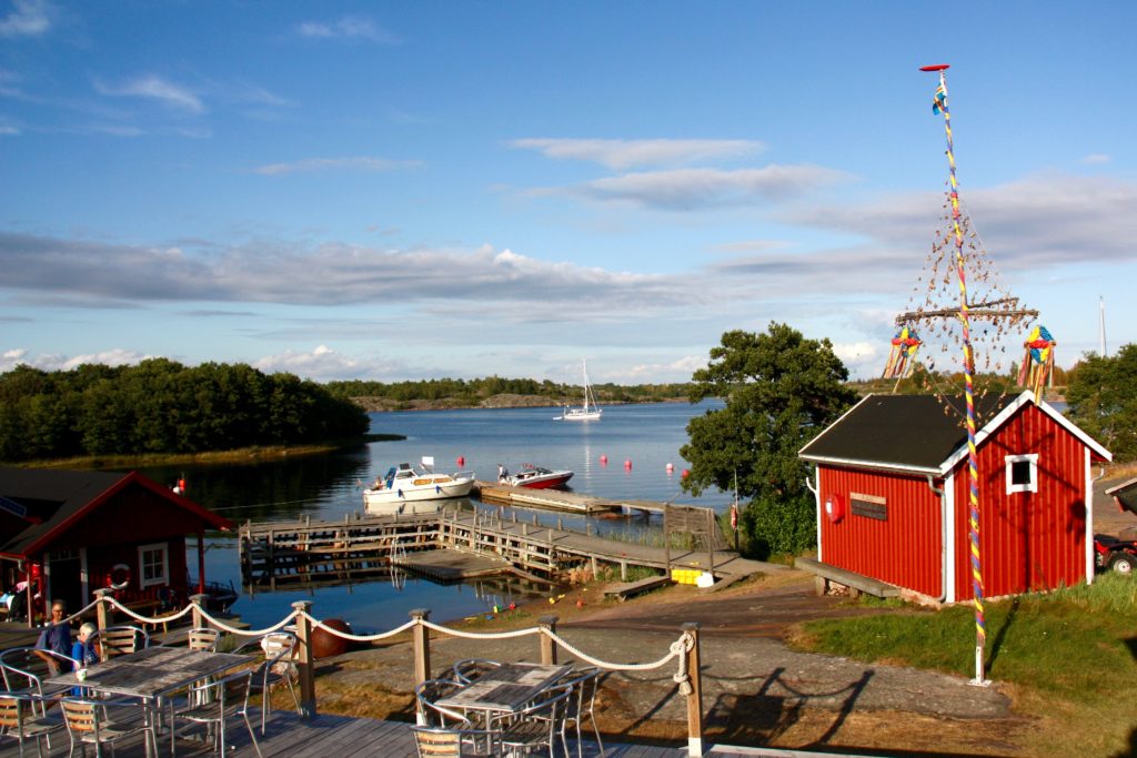
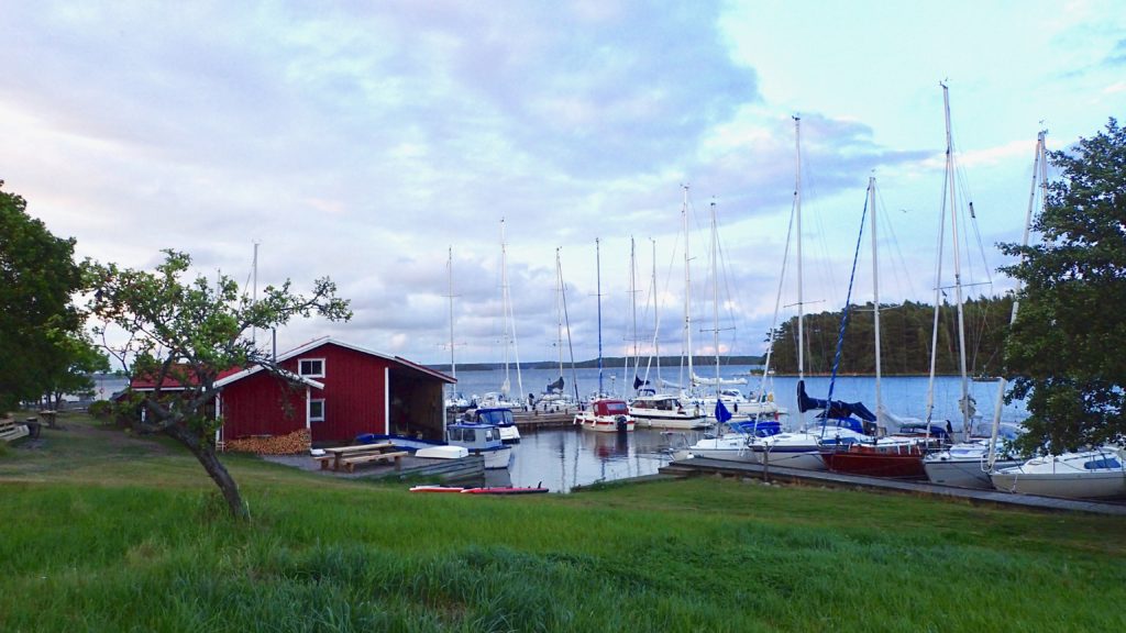
When you run out of beer and locally smoked fish, there are scores of small, affordable with basic services and friendly advice. The islands have three main mooring options: Natural harbours, whether anchored or moored to the shore; basic marinas, with a toilet and picnic table near the dock and not much more, are free; service marinas, which range from small family-run affairs that offer basic amenities to professionally-run marinas with fuel and repair support. Service marinas charges anywhere from 15 to 40 euros for a 40-foot boat, depending on their location and services.

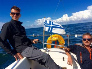
Foreign boats are rare, and locals are surprised to encounter sailors from Hong Kong in their homely little ports. We borrowed Valaska from a friend, and she flies the Finnish flag, so in every port there was an awkward explanation — we’re not Finnish, we don’t speak Finnish or Swedish, we’re not from around here, but hello all the same. We saw a handful of Germans, the odd British, Estonian or Russian flag, but the vast majority of the boats were from Sweden or Finland. It only added to the feeling that we were discovering something special.

But the discoveries are not limited to old guns and underground bunkers. A dusty patina of history also covers many of the civilian islands that have transitioned from industry and other functions to nature tourism. Most of them are within an easy day’s sail of each other.

Själö was once home to a mental hospital and leper colony — today it’s a marine research center and quiet marina. Nearby is Jussarö’s abandoned iron ore mine, which became a military training ground before even the soldiers went home. The island, now a nature reserve, advertises itself as Finland’s only ghost town.

Helsingholmen is also on that list. When I told a fellow sailor that I preferred rustic, quiet marinas to the full-service ones, he showed me the island on a map.

“There’s just one family living there, running the place, selling some fish and keeping the island alive,” he said.

We arrived in Helsingholmen after a long day of dodging squalls and running in front of a 25-knot breeze. It was nearly dead calm in the bay. Children were playing on the lawn and the smell of smoke and fish drifted through the air.

Helsingholmen has been inhabited by farmers and fishermen since the 1770s, but now it’s just the Andersson family left. I went ashore to pay our marina fee and instead of a cash register found a wooden box nailed to the wall of an old barn, on the honour system. Smoked fish and bread rolls that were still warm from the Andersson family oven were on offer.

A hike across the island took me past abandoned log cabins with leaky roofs, 18th century farm machinery that was slowly becoming part of nature, and overgrown pastures carved out of the forest. The whole island felt like a museum piece.

The sun was beginning to set — which happens late, if at all, during the Finnish summer. I found a rocky outcrop that faced mainland Finland. The sea chopped at the rocky shore, trying to tear out the reeds that grew in the shallows. My sailing voyage through Finland’s archipelago was coming to an end, and I looked out across the water we would cross the next day. We would sail east, towards the bustling port of Hankow and beyond that the capital, Helsinki, and back into the present.

Double Haven

Read this story as it originally appeared on SCMP.com.

The map showed an idyllic patch of water hemmed in by parkland islands. I could see small coves and passages, the perfect place to explore in a kayak. Its name, Double Haven, completed the tranquil image.

But we weren’t there yet. First we had to cross the lumpy, grey seas of Tolo Channel, our kayaks bobbing in the waves as we waited for a ship to pass. Then we rounded Wong Chuk Kok Tsui, where hikers scrambling along the rocky shore to get to the Devil’s Fist shouted and waved at us as we paddled by.

We landed on Tung Wan for lunch, where my paddling partner, on her first big kayaking trip, slumped down onto a rock, exhausted.

“Is the whole trip going to be like this? With wind and waves? This cold?”

I made reassuring sounds and promised better conditions ahead, but I wasn’t sure myself what to expect. After an hour of shivering on the beach and gulping hot tea from a thermos I cajoled her back into her kayak. We pointed the boats through the narrow gap between Crescent and Double Islands and entered a whole different world.

Double Haven lay spread out before us, unfurled like an old Chinese scroll painting, complete with overlapping hills that disappeared into the blue haze. The water was calm, like an inland lake. The sun came out, turning greys into greens and blues, the light catching the silver flash of a jumping fish.

Double Haven, named Yan Chau Tong in Chinese, is on the northeastern shores of Plover Cove Country Park. Eroded volcanic rock, which is sharp and brittle and often blood red with iron oxide, shelters Double Haven at all points of the compass, saving it from the storms that batter other parts of Hong Kong. At its north end Double Haven becomes Crooked Harbour, but the two protected bodies of water can be explored as one.

Very few Hong Kongers even know of Double Haven, much less visited it. There no roads into the area and ferry connections are infrequent and inconvenient, so most visitors hike in. The area is perhaps best known for Lai Chi Wo, the 300-year old walled Hakka village that is being revitalised and sits inside the Yan Chau Tong Marine Park that was created in 1996.

The historic village was our destination for the day, and it was late afternoon by the time our kayaks bumped ashore next to its pier. There was no space for a tent on the beach, and the village square was covered in concrete, so we settled on a tiny patch of grass next to the village gate. We pulled our kayaks up above the high-tide line, hung our dripping clothes from a line and pitched the tent. It was dark by the time we had our cook stove hissing. Soon a villager arrived on his bicycle and we braced ourselves, expecting him to chase us away.

“I’m just checking my nets,” the man said. “It’s okay, you can camp here.”

He waded out into the receding tide, and moments later reappeared with a small fish he had pulled from his net.

“It’s not much, but I’m just fishing to feed myself, so it’s enough,” he said.

Before leaving he warned us to secure our food bags against wild pigs. Sure enough, we saw one trotting along the darkened shore and were jolted awake during the night when a squealing pig ran by our tent, chased by baying village dogs.

The next morning we paddled north to the island of Ap Chau. In the 1960s this island became home to the Taiwan-based True Jesus Church and its followers. Today, the church remains in use but there are only a handful of the island’s 1,000 Tanka residents left.

It was on the peak of Ap Chau where the preciousness of Double Haven’s seclusion hit home. Just two kilometres to the north was Yantian, which in the past two decades has evolved from a small fishing village into one of the world’s busiest container terminals. The roar of engines and clang of metal floated across the water, the acrid smell of diesel exhaust hung in the air. To the northwest was a wall of office and residential towers, where Sha Tau Kok blends seamlessly into the far reaches of the Shenzhen metropolis. To the east, beyond the hills of Crooked Island, was the open waters of Mirs Bay, dotted with cargo ships from around the world. But to south lay a scene largely unchanged for thousands of years; the intricate maze of isolated islands and quiet bays that we’d just paddled through. A tiny refuge in a sea of people and progress.

We paddled two kilometres east to the village of Kat O on Crooked Island, one of the only villages in the area with a permanent population and signs of activity. The village itself is well maintained and interesting to explore, but its main beach, where we landed, faces the industrial eyesore of Yantien, so we ate a quick lunch and continued on our way.

We pointed our kayaks south, back into the protection and quiet of Double Haven. It was hot and still for a winter day, and we took breaks from paddling to trail our hands in the cool water. The marine park teems with life, and the jumping fish were the only thing breaking the smooth surface of the sea. Our course took us along the southern shores of Double Haven and through the narrow Hung Shek Mun gap between Double Island and the mainland. We were on our way home, but it was still a long way to go.

Because Double Haven has so few waves the vegetation grows right down to the high tide line and there are few beaches, resulting in a dearth of camping spots. The weather forecast called for a drastic change of weather, so we needed protection. I scanned the shores, looking for a flat, dry spot to pitch our tent.

As we rounded the southern tip of Double Island and exited Double Haven I spotted the Outward Bound base in Wong Wan. The camp was empty except for a grizzled caretaker, who welcomed us to pitch our tent on the lawn. By the time all our gear was hung to dry, the tent was pitched and our dinner was on the stove the wind had begun to pick up. It was hard to tell at first, as we were still in a protected cove, but across the water we could see white-caps and spumes of spray where the waves were crashing into the shore.

“There’s going to be a storm,” the caretaker warned. “Tomorrow will be worse.”

He was right. We fell asleep to the sound of our tent fly flapping in the wind, and awoke to a full gale that brought with it a 10-degree drop in temperatures. The final 10 kilometres of our 45 kilometre trip would take us through exposed, open seas, so we waited, hoping the wind would ease. In the afternoon we went as far as to load the kayaks and paddle out to sea, but we were quickly turned back by steep, breaking waves. The camp caretaker gave us a “I told you so” look as we returned to his base and set up our tent for another night.

By the next morning the wind had subsided, but the cold remained. We hurried through breakfast iin case the wind would return and then pushed off from the shore, headed for home. The waves were smaller than they’d been the day before, but they still broke over the decks of our kayaks, reminding us of the haven we’d left behind.

Åland

Read this story as it was first published in the April issue of Cruising World.

Finnish sailors are proud of their submerged rocks. They grinned as they told me about the many skerries that barely break the surface of the Baltic Sea.

“Surely most of them are well marked,” I begged.

They shrugged their shoulders in a worrying, non-committal way and gave a rueful chuckle, like someone who has learned their lesson the hard way.

Those rocks were on my mind as I helmed west through the Finnish Archipelago.
I couldn’t afford to mess this up. My Finnish friends had generously lent me their sailing boat, Valaska, for three weeks, no strings attached, and I didn’t want to betray their trust.

The island of Korpo was to starboard. I’d just dropped off the owner’s son after a two-day shakedown cruise out of Turku, during which I tried to memorise where all the switches, sea cocks and latches were, which bits to jimmy and which ones were jammed. Now the yacht was my responsibility, and nothing but the hull stood between the rocks and I.

“After this west cardinal there are three north cardinals in a row, and then a south cardinal,” my crew told me, sitting in the cockpit, paper charts on his lap, checking the veracity of the chart plotter. He looked worried.

“I see an east cardinal there…is that ours?” I stood up, straddling the rudder of the trim little H323, ready to turn either way at moment’s notice, my eyes scanning the water for the waves in the middle of nowhere that characterise skerries.

And so it would go for the next few hundred miles as we wove our way through the thousands of islands sprinkled across the Gulf of Bothnia. Our destination was Åland, a place I’d never even heard of until I’d begun planning this cruise.

When the owner first made his offer I proposed that I sail to Sweden and explore its famous archipelago. And as soon as the words were out of my mouth I sensed that this was not what he had in mind.

“Yes, you could sail to Sweden, but Finland has thousands of islands as well. You would have to pass right by Åland. Look it up, you might want to spend your time there instead.” There was raw nerve of competition between the Scandinavian neighbours, I realised.

They were right about this little-known corner of Europe, where berries grow wild, the sun stays high in the sky during summer nights and the fluttering Åland flag reminds visitors that Finland may own the land, but the hearts and spirit of the people remain free.

Åland is an archipelago of 6,500 islands and skerries. It was under Swedish rule for 700 years until the Treaty of Fredrikshamn forced Sweden to hand it, along with Finland, to Imperial Russia. In 1917 Finland declared independence from Russia and took Åland with it. Ålanders argued for their own self-determination, with a request for annexation by Sweden, but there were concerns that independence could make them vulnerable to Nazi Germany or Soviet influence.

In 1920 Finland granted wide-reaching cultural and political autonomy to Åland, including its own flag, postage stamps, police force and a seat in the Nordic Council. This demilitarised region is part of Finland’s Archipelago Sea, the largest archipelago system in the world and the spiritual home of Tove Jansson, the Finnish novelist and comic strip author of the Moomin books for children.

Dotted with natural harbours, remote islands and weatherbeaten pilot houses, Åland’s history is visible at every turn. In small ports I saw iron mooring rings pounded into granite shores by Russian sailors more than a century ago, which today are used to moor yachts. Lonely pilot houses top windswept islands and remind sailors that this was once one of the great shipbuilding sites of Europe.

It is rare to see sailors from outside Scandinavia in these waters, and most of those you do meet are German. So, when we arrived in the marina at the top of Bärö, next to the island of Kumlinge, we were surprise to find a dozen cruisers filling the tiny harbour. But there was still one spot left — arriving in a 32 foot boat with a 1.4m draft is a distinct advantage in these waters. These brackish waters have no significant tides, allowing for an extra degree of bravery when edging a yacht into shallow anchorages.

After the customary anchor drinks I changed into swimming shorts and headed for the sauna built on a floating dock, eager for the full experience of Finnish sailing. I threw open the door with a cheery “Hello!” — sometimes it’s an advantage to have everyone know you’re not local. The three women inside pulled their towels a little bit tighter around them and looked at me suspiciously.

“This is a private sauna,” one of them cooly informed me.

I stammered my apologies, backing out the way I’d come, and returned to the boat for additional anchor drinks. Soon one of them swam over with a smile on her face to explain that we had to book the sauna — but unfortunately it was already booked solid for the evening. Our first sauna experience would have to wait.

The next morning we returned to the steady southwesterly 15-18 knot breeze that had brought us here. It carried us to the remote northern shores of Fasta Åland, the main island, where the region’s most untamed forests and islands are. Saggö, nestled against its sister island Saggö ön, forms a narrow strait that provided us protection from the wind and showed promise ashore.

It was my first attempt at Finland’s unique mooring system. I motored along the shore to check depths, then picked my spot. The crew stood on the bow, mooring lines in hand, and I dropped the anchor from the stern as we approached the rocky cliffs. I edged the boat close enough for the crew to jump ashore, where they banged iron pitons into cracks in the granite. Mooring lines were looped through the pitons, while I tightened the anchor line. When we were done the bow of the boat was only two feet from the rocks, but the steep shore and taut anchor line kept the keel in deep water.

I jumped onto a boulder covered in orange lichen and scrambled up the rocks, using the scrawny fir trees to pull myself into the forest. The forest was deep and quiet, with only the sigh of wind against the tops of the fir trees to break the silence. The thick, springy silenced my steps. I reached down and pulled out a damp handful, releasing a woodsy, earthy smell — a scent I don’t normally associate with cruising holidays.

Then I spotted them…a cluster of red ones here, some deep purple ones there. Bilberries and lingonberries — in North America commonly known as blueberries and cranberries — growing wild in thick clumps.

I dropped to my knees and gorged on them. They were tart and sweet, making my tongue tingle. I picked until my fingers were blue with juice and had filled a small bag with those that somehow escaped my mouth.

That evening we sat around a campfire on the rocks, sipping coffee and eating fresh berries with scones baked in Valaska’s oven. The firelight flickered on her white hull, confusing me for a moment — was I on a camping or a sailing holiday?

We continued across the north of Fasta Åland, alone but for the Whooper swans — Finland’s national bird featured on the 1 euro coin — and even an occasional seal, but we saw few other boats. Eventually we turned south, down the western side of the island, past the Ådskär lighthouse to Mariehamn.

The southern coast is the part of Åland that most visitors see. Mariehamn, the region’s capital, was named for a Russian empress. Here huge ferries disgorge tourists from Sweden, Estonia and mainland Finland, and the streets are lined with cafes and restaurants in ornate, historic buildings. It’s home to summer music festivals and nearly half of Åland’s population.

That night the wind rose until waves broke over the marina docks and the air was filled with the screech of rigging, so in the morning we switched to bicycles, Åland’s other great mode of transport. Fasta Åland and the outlying islands have hundreds of kilometres of well maintained and signposted bicycle paths, and we followed one of them north. It took us through rolling fields of ripe barley and wheat growing between forests of fir and silver birch, past small farms with bright red outbuildings and summer cottages with stacks of firewood outside their doors. Every few kilometres the path cut back towards the coast, and I caught glimpses of the sparkling Baltic Sea.

Twenty-five kilometres later we arrived at Kastelholm, a Swedish-built medieval castle occupied by Finns, Swedes and Russians over the centuries. It was used as a prison and execution grounds in the late 1600’s when Åland was in the grip of a hysterical witch hunt. Åland’s independent postal office has just issued a stamp to commemorate the execution of seven suspected witches.

From the castle walls I looked down on the Kastelholm Yacht Harbour, nestled in the narrow inlet of Ladängsviken, making a mental note to sail rather then pedal next time.

By the next morning the winds were more manageable, and we set off through the complicated fairway leading from Mariehamn to open sea. We shared the channel with several massive international ferries, which added to the navigational challenge. Despite the apparent remoteness of the region, there are also small ferries criss-crossing the archipelago, requiring sailors to keep a constant watch.

Rödhamn, an island port I’ve heard about from numerous other sailors, is just 10 nm south of Mariehamn. Its name refers to the red (röd) colour of its rocky shores, which have provided safe haven to centuries of seafarers. The shores of the southern, sea-lashed side of the island are dotted with stone cairns left behind by passing sailors. There is no electricity or running water in the marina, making it a quiet, peaceful place. A small bakery delivers hot rolls to your boat in the morning.

But the real reason I came to Rödhamn was its famed sauna. Late that night we hiked across the island with our towels around our necks. The air had turned chilly and the sky was filled with the kind of clear light only found in a high-latitude summer night. On the far side of Rödhamn, perched at the tip of a peninsula, was a small hut facing the sea. Smoke puffed from its chimney.

We stripped and ducked into the warm darkness. It was nearly dark inside, with just a glimmer of evening light coming through a small window. The wood-burning stove hissed as I threw a scoop of water at it, producing a searing hot steam that rose to ceiling. Soon I was dripping with sweat and conversation ebbed to the occasional sigh.

When the heat became unbearable I burst out of the sauna and ran, stark naked, across the smooth granite rocks that sloped towards the sea. The indigo sky was streaked with yellow light, the sun still high above the horizon despite the late hour.

“Whoo hooo!” I shouted as I launched myself, my yell becoming a yelp as I hit the frigid Baltic Sea. Within seconds the cold became too much, and I swam for the shore to dash back into the sauna.

The summer was coming to an end, and the wind turned from westerlies to easterlies as we began our 150nm voyage to Valaska’s home port of Helsinki. The easterlies brought a cold rain that slashed at our faces as we tacked our way home, as if cajoling us to return to Åland and its sunny skies.

Canadian Shield

Read this story online as it was published in the South China Morning Post.

camerondueckrriverimg_3582

“This sure doesn’t feel like October,” my brother says, standing knee deep in lake water, squinting up at the warm afternoon sun.

Our yellow canoe is pulled up on a narrow beach, perpendicular to the deep hoof prints left by a passing moose. The birch and spruce forest leans over the beach, as if reaching for the sunlight that glitters off the water. Most of the leaves have already fallen and the trees are naked and white.

“The water’s a bit chilly, but the sun makes up for it,” I say as I wade ashore after a quick plunge in Lake Kilvert, in Ontario’s Eagle-Dogtooth Provincial Park.

camerondueckrriverimg_3500

It’s one of thousands of lakes carved out of the 4 billion year old rock. This is the Canadian Shield, the largest mass of exposed Precambrian rock on earth, the exposed continental crust of North America, where ancient mountains were flattened and lakes carved from rock during the Ice Age. Eight million square kilometers of it, igneous rock born from volcanoes that grew into tall mountains which were then worn down to rolling hills and a thin sifting of soil by monstrous slabs of ice.

camerondueckrriverimg_3473

Right now, that much ice, or even snow, is hard to imagine. We’re enjoying some late season warmth on the first day of our canoe trip. This park, only a 2.5 hour drive east of Winnipeg, has five meandering canoe routes through moraines, boggy beaver ponds and pine forest ecosystems. We gambled with a late-season trip and it paid off as we have the lakes to ourselves. Everyone else has already packed up their boats for the winter.

We hoist our canoe and trudge one and a half kilometers through the forest to Gale Lake, where we drop it with a sigh. I stretch my neck and shoulders as we walk back to retrieve our bags and a food barrel. This is just one of seven portages we’ll make on our 51.5 kilometer route, the price we pay to paddle across these remote lakes.

camerondueckrriverimg_3593

Once we’ve portaged all of our gear we set up camp in a stand of tall red pine on the western shore of Gale Lake, a small tear-drop shaped body of water that pinches off into a narrow creek in the north. There’s plenty of wood for a fire, and I mix up a batch of bannock, the unleavened Native American bread. I fry it in a pan, seasoned with wood smoke and raisins.

camerondueckrriverimg_3703

The Canadian Shield is the home of Algonquian nomadic hunters, who paddled these lakes in birchbark canoes, but the wide expanses of bare rock, poor soil and frequent marshes made it difficult for early explorers and fur traders to push westward into the continent. On the other side of this rock wall are the Prairies, Canada’s wheat land.

Eventually the European colonialists blasted a rail line through the Shield, which opened it to prospectors who found gold, silver, nickel, cobalt, zinc, copper, iron ore and, more recently, diamonds. This is also where Canada has built massive hydroelectric dams to feed cities to the south. The Shield, both past and present, looms large in Canadian history and culture, and canoeing these waters is a rite of passage for many Canadians.

Our good weather holds for exactly two days. Just long enough for us to grow smug, congratulating ourselves for setting forth while others stayed at home. Then, during the night, the temperature drops. We pull out our thermal underwear and stoke the fire as rain spits from a leaden sky. Now, suddenly, that Ice Age seems more feasible.

camerondueckrriverimg_3738

We’re watching the change of the season, when the benign summer is replaced by the unpredictability of early winter. This winter won’t wear down mountains or create a new lake like a true Ice Age, but it will put the land to sleep for the next six months or more.

Luck never changes in half-measures, and the wind that brought the cold air blows heartily from the southwest, straight on our bow. A day earlier the lakes were so still the rippled wake of a loon traveled a kilometre across the water, and now the grey water sloshes into our boat as we claw our way upwind.

“Do you still have control of the boat?” I call back to my brother, who is steering from the stern and who I’ve only heard grunts and curses from for the last few minutes. He is the more experienced canoeist, so surely he will know if we’re pushing our luck. We’re trying to round a point of land that has compressed waves and wind and I’ve just taken on a lap full of cold lake water.

“Yea, but we’re on the edge,” he shouts. “Just keep paddling, hard.”

camerondueckrriverimg_3662

We make it, but once we’re in a protected bay we rule against risking further miles in these conditions. Along a low, swampy shore on Dogtooth Lake we find a forest clearing created by gnawing beavers and set up camp to wait out the storm. Every few hours we walk to the edge of the woods to see if the white caps that race across the lake are becoming smaller. They are not.

But the view is great. Tall cliffs left behind by glacial erosion, topped by scraggly jack pine and poplar. Massive round boulders have been dropped by the retreating ice, like marbles left behind by a child. Speckled alder and red maple still sport a few blazing leaves, beacons in the grey light.

Our last morning begins before dawn. We’ve promised friends and family to reemerge from the wilderness at a certain time, and in order to do that we need to make up the distance lost to the storm. We stop once, mid-morning, to boil up some coffee, and then push on. The wind has died, leaving behind a cold mist that blankets the quiet lakes.

camerondueckrriverimg_3779

I’ve had something on my mind, but I’ve been afraid to say it. I didn’t want to jinx things. But then we round a corner and I can see our truck and the end of our canoe journey. I double check, squinting to make sure, but I can see no one on the shore.

“We haven’t seen another person in five days,” I finally blurt out. “Not a boat, no people outside their cabins, no one at all.”

“If there was anyone else out there they were warm and dry in their cabins,” my brother says. “Probably looking out of their window at us paddling past in the mist and thinking, ‘Those poor buggers’.”

camerondueckrriverimg_3535

Raja Ampat

Earlier this year I went on a kayak and dive adventure in Raja Ampat, Indonesia. Here is the story that ran in the SCMP, and a photo essay on the Canoe & Kayak website.

CD-RajaAmpat-IMG_0753

There’s the muffled rattle of floorboards as someone walks across the platform you’re living on. Parrots, hornbills and a score of other exotic birds chirp and trill overhead. There’s the hiss of waves hitting the shore and maybe the splash of fish. But other than that … silence.

Raja Ampat, an archipelago in the Indonesian state of West Papua, is less densely populated than the Western Sahara, but this undeveloped, remote corner of Asia is home to the greatest diversity of marine life and coral reef ecosystems on Earth.

Scuba divers have been exploring this marine paradise for a few years and live-aboard dive boats are a common sight, but for land-based tourists, the region’s back-to-basics homestays are the best way to immerse oneself in Papuan life.

DCIM106GOPRO

A 35-hour string of flights, ferry rides and car journeys from Hong Kong deposits us at Mando’s, a homestay built typically of bamboo and palm fronds on stilts over the sea. Home life in Papua takes place on wooden platforms, each having several rooms or huts on it, for cooking, eating and sleeping. As at most homestays, meals at Mando’s are served family style.

The dive industry here is largely operated by Indonesians from other parts of the country, but homestays are owned and operated by Papuan families. They form a bridge between the life on the sea that is so central to Papuan culture and the wild, forested islands that provide wood, food and fresh water.

Mando’s is on the main island of Waigeo and within driving distance of Waisai, the grimy little capital of Raja Ampat and the only place on the island where you can buy supplies. The views from the dining room – a table under a grass roof – make for disjointed conversations.

“So after that we caught a flight to … Oh look!” a traveller exclaims. Everyone around the table cranes their neck. “A school of dolphins.”

Or a jumping manta ray, a fish leaping from the water, a surfacing turtle, an exotic bird soaring across the sky. After a few days, dolphins are no longer newsworthy, and the challenge becomes catching sight of a leaping manta ray. All I ever see is the splash.

DCIM106GOPRO

Waigeo is home to the rare Wilson’s bird-of-paradise, a red and blue beauty that can be spotted on a morning hike in the jungle. At night, glow worms ( Odontosyllis enopla) flicker bright green in the sea as they pump out bioluminescence to attract a mate.

Many homestays are in remote locations and neighbours may be 20km down the coastline or across the open sea. Island hopping takes planning, patience and time. There is practically no scheduled inter-island transport and few of the islands have roads, making privately hired longboats the most convenient mode of travel.

Longboats also allow you to see the karst topography, and explore small islets so undercut by waves they look like mushrooms. We weave through the islands, staring down into the crystal-clear water at endless coral reefs, schools of colourful fish and small sharks.

DCIM106GOPRO

Raja Ampat’s coral reefs have shown greater resilience to the bleaching caused by rising sea temperatures than others around the world, and conservation efforts have greatly increased fish populations in the protected areas, but the flourishing marine life attracts poachers.

The Indonesian government has taken a strong stand against commercial fishing and created large protected areas, but this region is also rich in other natural resources. The largest gold mine and the third-largest copper mine in the world are nearby, and the Papua region is Indonesia’s largest source of tax revenue. That has attracted a large military presence, and many activists have disappeared, been killed or been jailed.

The Raja Ampat Research and Conservation Centre is one of the best established community development groups in the archipelago, and a key local partner of many international conservation organisations. The centre trains Papuans to build boats and then guide tourists on kayaking tours in those boats – the same development plan used for the homestays – provides research facilities and operates educational programmes.

“Our goal is to support those living in this beautiful and fragile ecosystem to have better, healthier lives and make them stewards in protecting this natural environment,” says Tertius Kammeyer, who heads the centre’s kayaking operations.

CD-RajaAmpat-IMG_1733

Tourism is growing rapidly and new homestays are popping up on every island, but outside of peak seasons, when domestic travellers come to Raja Ampat, there’s a good chance you’ll have one to yourself.

Time loses its meaning when you’re living in a grass hut. There are no clocks or timetables; meals are served when they are ready.

Circumnavigating the island of Gam makes for a pleasant three- or four-day trip by motorboat from Waisai. It is not one of the “regal” islands – Raja Ampat means “four kings” – but Gam is near the centre of the archipelago, and has plenty of small bays along its coast. On a clockwise trip around the island, a first night might be spent in Arborek Village, on a sandy spit of an island just off Gam.

CD-RajaAmpat-IMG_1557

In Arborek, there is a daily reminder of passing time; the village bell – an empty fuel canister – is rung at dawn, gently awakening the village from its slumber. After breakfast on the beach, we paddle to nearby Manta Sandy, a sandbar where mantas come to feed on plankton and allow fish to clean them of parasites. We slip on snorkel gear and drop into the water, and within moments mantas with wing spans of several metres appear out of the blue. Watching them glide effortlessly through the water makes our boat travel seem a lot less elegant.

Yet there is no other way to get to Warikef, an isolated homestay in a quiet bay near the Kaboei Passage, a narrow, winding stretch of water that separates Gam from Waigeo. Strong tidal currents in the passage offer divers and snorkellers an exhilarating underwater ride among the fish and coral fans.

CD-RajaAmpat-IMG_1323

Warikef backs onto a steep, forested cliff, just below a cave that supplies a steady stream of fresh water. The sea beneath the platform teems with life, and just because we’re not in the water, doesn’t mean we’re not considered part of a food chain. I feel a splash of water on my foot as an archerfish mistakes me for an insect and shoots a carefully aimed stream of water between the planks. A book left on the floor gets soaked as the fish make repeated attempts to capture it for lunch.

As the sun sets, the jungle surrounding Warikef falls silent and the glassy sea reflects the last light of the day. I can hear the muted voices of the host family chatting as they cook our dinner. There is the hiss of a gas stove and rattle of pots, the entire platform swaying gently as they move about.

The generator is broken, and the only light comes from a flickering oil lamp. I lay on the decking and watch the stars come out, forgetting for a moment that a less-tranquil world exists.

CD-RajaAmpat-IMG_0766

Dinosaurs in the Gobi

I’m working with the University of Hong Kong to produce an online course (a Massive Open Online Course — MOOC) about dinosaur ecosystems for the Coursera platform. I spent most of July in the Gobi Desert shooting video for this project, as well as researching a story for the SCMP’s Post Magazine.

Here’s the story, which you can also read on the SCMP website.

It is 44 degrees Celsius on the floor of the Gobi Desert; the air shimmers and dances with the heat. My eyes swim with tedium after hours of staring at the gently undulating ground, trying to spot precious fossil fragments among the countless pebbles.

To my right, within shouting distance, a scientist stoops, picks at something on the ground, then squats down for a closer look. He digs with his hammer, the chink-chink-chink of metal on stone carried away by the hot, dry wind. A small fragment comes free and he gently rubs the dirt away with his hands before putting it in a small plastic bag.

This University of Hong Kong-led expedition is not the first to come looking for remnants of the dinosaurs that lived, 80 million years ago, in the Upper Cretaceous ecosystem of the Erlian Basin, in Inner Mongolia, on China’s northern border. This ground has been searched for fossils repeatedly over the past century, but the earth keeps pushing them up, like presents. Each year, helped by rain, frost and scouring gusts of wind, the soil is eroded and more fossils are exposed.

“When you prospect an area thoroughly you pick up a large proportion of the fossils of interest, and it takes several years of erosion before more things start to come out,” says Dr Corwin Sullivan, a researcher at Beijing’s Institute of Vertebrate Paleontology and Paleoanthropology (IVPP) and one of a dozen people in our team of fossil hunters. Sullivan, whose book From Fish to Human: The March of Vertebrate Life in China was published recently, wears a wide sun hat and a large red backpack as he zig-zags across the desert. “We just need to wait for more erosion to take place here and give us another crop of fossils to harvest.”

Dr Corwin Sullivan

Dr Corwin Sullivan

Sometimes the desert gives up larger treasures; a leg bone here, a rib there. When big fossils are found, technicians take over the site, covering the specimen and the ground that holds it in plaster and burlap. Once the cast is dry, they heave it into the back of a truck and take it away for closer study.

No fossil is insignificant: these days, a small piece of bone rich with diagnostic features could be enough to confirm a new species.

China has a very rich and extensive fossil record, one that is just now being explored,” says Sullivan. “The infrastructure and funding for research have expanded so much in China. There’s a bit of a fossil rush going on. There’s probably nowhere else that offers quite the same combination of richness and freshness.”

Fossils recently found in China have greatly illuminated long-held ideas about evolution, particularly on the issue of flight and the hypothesis that birds are living dinosaurs. A small piece, the right piece, perhaps just a centimetre long, could solve questions over what these animals ate and how they walked and evolved.

“One of the most important issues for palaeontology right now is how dinosaurs turned into birds, which was a major evolutionary transition,” says Professor Xu Xing, also of the IVPP and one of China’s most prominent palaeontologists. “In the past 20 years, we’ve found a lot of feathery dinosaurs, as well as bird-like dinosaurs and preserved feathers in China. In terms of important discoveries and influential fossils, and their impact on conventional ideas, China is No1 right now. It has really changed what we think about how dinosaurs evolved.”

Prof Xu

Prof Xu

Scientists have also found in China the earliest tyrannosaurs, relatives of the mighty North American movie star Tyrannosaurus rex, and some of the best placoderm fossils ever found, allowing them to learn more about these early, giant fish.

Erlian was prospected as early as 1922, but the current rush began in the late 1990s, when dinosaur fossils began to be discovered across the country, from Shandong to Liaoning, Yunnan, Xinjiang and Tibet. In 1996, scientists found Sinosauropteryx, the first feathered dinosaur, in Liaoning, a poor and heavily industrialised province in the northeast. The rush was on and, by 2007, China had surpassed the United States in the number of dinosaur species discovered.

A lizard in the Gobi Desert

A lizard in the Gobi Desert

During the Cretaceous Period, which ended about 65 million years ago, Liaoning was filled with lakes and marshes, which, together with volcanic eruptions, created the ideal conditions to preserve fossils. Many that have come from that area display exceptional detail. The limestone layers of the province earlier this year revealed a winged ancestor of the velociraptor that scientists named Zhenyuanlong. The 125-million-year-old animal is one of the closest relatives to modern birds ever found, further closing an important evolutionary knowledge gap.

“Without those discoveries we wouldn’t be able to restructure the transition as well as we have so far,” says Xu.

Sorting through fossils in the IVPP's warehouse in Beijing.

Sorting through fossils in the IVPP’s warehouse in Beijing.

IN SOME CASES, the flood of new species has been too good to be true. Forgery and misleading restoration have become rampant. This is a particularly troublesome problem among specimens that supposedly came from Liaoning, which has produced thousands of genuine pieces from various time periods.

Most museums have become adept at spotting forgeries. While many of the institutions’ specimens may be partially, and badly, restored, there’s little doubt about which parts of them are real and worthy of study. The greater danger is being duped by an apparently hot, fresh fossil being offered on the private market.

Museums have long used X-rays to look for density abnormalities that would point to forgery, and chemical-element mapping also helps prove, or disprove, a fossil’s origins. But a new technique is literally shedding light on the problem.

“I’m involved in developing a method that shines laser light onto specimens, causing certain minerals in them to fluoresce,” says HKU palaeontologist Dr Michael Pittman, leader of the Erlian expedition. “The pattern created by the fluorescent minerals is a chemical fingerprint that is unique to every fossil, so potentially forged portions of a specimen can be spotted when part of the fluorescence pattern looks out of place. Excitingly, this method can also reveal fossil details that are invisible under normal light, including skin and feather details.”

Dr Michael Pittman and Dr Jason Ali of HKU

Dr Michael Pittman and Dr Jason Ali of HKU

Part of the problem is that many of China’s fossils are dug from the ground by farmers and then sold to museums, other institutes and private dealers. Liaoning’s farmers can often earn more by selling fossils than they can by tilling the soil. Although China has strict laws against private fossil sales, the black market thrives.

“Scientists, universities and institutes face a real dilemma, because if they buy the fossil they are supporting this industry. But if they are offering you a fossil that is new to science, and it possesses anatomical features that fill in big holes in our knowledge, it’s also kind of unethical … to not buy it,” says Pittman.

Even if scientists can prove a specimen is real and unaltered, buying it from an amateur hunter usually means they can’t study the geological layers of rock that hid the fossil – the stratigraphy – and which contain important age and environmental evidence.

Another part of the problem is the speed at which the fossil industry has appeared. Museums and institutes are still developing the expertise and research capacity to deal with the flood of new specimens coming from the field.

A technician prepares a dinosaur fossil at the IVPP.

A technician prepares a dinosaur fossil at the IVPP.

“It’s just like the Chinese economy, which has grown large very quickly,” says Xu. “There are still many spaces left to be developed. In sciences we have some strengths but, in general, the research level is not that high, in terms of training and methods.”

Professor Tan Lin has watched this evolution from its earliest stages. One of the most accomplished fossil hunters in the Gobi Desert, Tan created the Long Hao Geologic and Paleontological Research Centre, in Hohhot, capital of Inner Mongolia, to house his finds. He is close partners with Xu and a sage adviser to the wave of scientists coming to his corner of China.

Poised but moving slowly due to age, Tan is still drawn to the field. He visits the HKU site in Erlian and, arms pointing to the horizon, discusses with the other scientists where fossils may be found.

Dr Pittman and Prof Tan

Dr Pittman and Prof Tan

“China is a superpower in terms of fossils, both vertebrate and invertebrate, and its fossils span the whole geological time scale,” says Tan. “Not only are the fossils spread over large areas of China, their diversity is also very high.”

Tan has worked in other provinces but he has a soft spot for the Gobi sands, where we spend a week searching for fragments. Erlian’s is an unusual ecosystem with an interesting combination of dinosaurs. For example, scientists have found therizinosaurs from the same family as the T-rex – the theropods – that evolved from carnivores into herbivores. Another of the Gobi’s treasures is the gigantoraptor, a large, beaked theropod that was also secondarily herbivorous or may have been omnivorous.

“In 2007, I was working with Xu in the Erlian area,” says Tan. “We were working together with a Japanese television documentary team. They asked us to dig for something; they needed footage of us digging. We started uncovering bones, larger ones than we had expected, and we became excited. Once the shooting had wrapped up, Xu and I went back to dig some more and we uncovered a gigantoraptor, which we brought back to Hohhot.”

Xu described the specimen in Nature, the prestigious scientific journal.

“That’s why Erlian remains one of my favourite places to hunt for fossils, because of the stories that I’ve lived in that place,” Tan says.

His institute is based on the outskirts of Hohhot, down a rutted road, among small factories and cheap housing. Tan’s finds fill row upon row of rolling shelves. The specimens are numbered and grouped into dusty boxes. A box of claws, fearsomely curved. Leg bones stacked like cordwood. A skull, in the shadows at the back of the shelf, its eyes wide open. All from different animals, places and times.

Searches for specific fossils in the warehouse can take hours. The concrete floors are littered with specimens still wrapped in the plaster that was applied in the field, yet to be opened, cleaned and studied. Photography in the collection rooms is forbidden as they contain many fossils yet to be seen by the outside world.

P1250664

Sorting through fossils in the IVPP's warehouse

Sorting through fossils in the IVPP’s warehouse

“There are still more discoveries to be made in our collection. We’re just a small institute and we don’t have many researchers, so we still have a lot of work to do,” Tan says.

The backlog in Tan’s collection is not uncommon, with most of China’s major institutes and museums holding large collections of unstudied specimens. They are predicted to yield discoveries regarding the environment these animals lived in, how they aged and grew, and the evolutionary relationships between them.

“Every time you move along the shelves you see something that could be a new species or a better example of something that has already been found,” Pittman says, after spending three days in Tan’s treasure trove.

Our expedition adds to the pile of fossils that need further study, even though they are only small fragments. Some pieces reveal the presence of animals that were not known to be in the Erlian Basin, such as alvarezsaur theropods.

ON ONE OF OUR LAST DAYS in the desert, team members present Pittman with their latest finds. Two small, elongated fossils put a sparkle in his eye and cause his voice to rise an octave in excitement.

“We’ve found two jaw elements from theropod dinosaurs. They’re very different, which is interesting because it implies that they used to feed in slightly different ways and do slightly different things within the ecosystem,” Pittman says. “It’s an exciting discovery.”

The fossils are wrapped up and tucked away for further study, joining thousands of others pulled from Chinese soil. After millions of years buried in the ground these animals will have to wait a little bit longer to divulge their secrets.

Here be monsters

China has many museums and parks dedicated to dinosaurs. Some of them are filled with gaudy displays of dubious origin; others contain authentic and important specimens presented according to international standards. Here are a few of the best.

Paleozoological Museum of China This museum is located in western Beijing (Xizhimen), next to the Institute of Vertebrate Paleontology and Paleoanthropology, which is home to many of China’s top palaeontologists. Its galleries present a wide range of dinosaur specimens accompanied by solid scientific information. The museum also shows a popular 3D film about dinosaurs. (www.paleozoo.cn).

Shandong Tianyu Museum of Natural History Excavations have been conducted in Shandong province since the late 1950s. Professor Zheng Xiaoting, who amassed his wealth from gold mining, has built the largest collection of complete dinosaur fossils in the world. The museum collection includes fossils of feathered dinosaurs, early birds and the Tsintaosaurus, a crested duck-billed dinosaur. (www.tynhm.com).

Zigong Dinosaur Museum
The museum sits over a large dinosaur-bone bed in Sichuan province’s Dashanpu Formation, which has helped fill a gap in Jurassic history. The site was discovered by a gas company that was building a plant outside the city of Zigong in 1972, and now attracts up to seven million visitors a year. (www.zdm.cn).

Palaeontological Museum of Liaoning

China’s largest palaeontological museum is located on the campus of Shenyang Normal University. Its collections include feathered dinosaurs, the earliest mammal with hair, the oldest known gliding lizard and eight giant dinosaurs from Liaoning, including the 15-metre-long Liaoningotitan. (www.pmol.org.cn).

Beijing Museum of Natural History
The collections at China’s leading natural history museum include palaeontology, ornithology, mammals and invertebrates, and a major collection of dinosaur fossils and mounted skeletons. It’s also fun for children, with a Dinosaur Park populated by models of the beasts, many of which move.

P1250035

Palawan Kayak

This story originally appeared in the SCMP’s Post Magazine on May 10 as “Blazing Paddles”.

A wave of vertigo washes over me as I look down. It’s not far to the bottom – a few metres at most – but I feel as though I am floating in the air. The water is so clear, it is invisible, the sunlight brightening the colours of the starfish and coral on the sea bed.

Palawan is one of the most pristine and remote corners of the Philippines, and the country’s largest province by territory. Three of us are on a week-long kayaking tour, slowly winding our way through the karst islets and immaculate beaches surrounding Busuanga Island, in the northernmost part of the province.

Every paddle stroke brings into view another coral reef and another school of colourful fish flashing through the water beneath our hulls. The sky stretches achingly clear and blue overhead.

DCIM105GOPRO

From the cockpit of a kayak, Palawan is all rocky coves, distant rounded mountains and jagged cliffs with sugary beaches at their base.

It’s the end of the dry season, when the seas are relatively calm and the islands look parched. Other than a few fishing bankas – canoes with outriggers that come in a wide range of sizes – the only signs of human life are the occasional village and a few exclusive resorts huddled underneath palm trees on distant islands.

The sun has set by the time we arrive at our first campsite. We coast onto the beach, hulls scraping noisily against the sand, disrupting the evening silence. A nearly full moon casts the beach in a white glow, the curving trunks of palm trees standing out in stark relief.

From the kayak hatches come tents, cooking stoves, sleeping mats, bags of food and jugs of water. Many of the islands have no fresh water, so maintaining supplies is a constant concern. Tents are pitched and paddling gear hung up to dry. We cook an easy two-pot meal of pasta and vegetables, the air still so warm that working over the camp stove is uncomfortable. The fire we light on the beach is for cheer, and we sit well back from it in search of a cool breeze.

DCIM106GOPRO

Having awoken with the sun and after a quick breakfast, we’re back on the water, hoping to make the most of the cool morning air. We’re paddling north and, as we pass Lusong Island, one of our number lets out a shout.

“Hey, there’s something down there under the water!”

He is frantically back-paddling his kayak as he peers over the side. This region is littered with the wrecks of Japanese ships from the second world war, and we’ve just stumbled upon one. We tie our kayaks to a float bobbing on the surface, pull on masks and fins – stowed on the decks of our kayaks to explore reefs as we find them – and roll over the sides with a splash.

The wreck is in shallow water and filled with colourful fish that swarm around us, flitting away when we make sudden movements. The ship lies on its side, an entry wound of torn and twisted metal still evident despite heavy coral growth.

DCIM105GOPRO

For lunch, we land on a shady beach on Marily Island. It’s a pattern we’ll repeat in the days to come – an early start, followed by several hours of hiding from the blazing sun before we paddle on into the early evening.

Many of the beaches and islands are inhabited only by caretakers, some with their families, who hold possession of the land for faraway owners. Some of them charge a few hundred pesos for camping privileges; others don’t even bother us to say hello.

“Isn’t it dangerous?” asks the caretaker of Marily Island of our trip, in English. “Where is your guide?”

We’re paddling sea-worthy kayaks, wearing personal floatation vests and special clothes to protect us from the sun. Our boats are filled with emergency satellite beacons, water filters and first-aid kits. We’re navigating by GPS and monitoring the weather on smartphones. The caretaker and his wife sleep in a house made of palm fronds and bamboo, and live a subsistence life. The assessment of risk is very subjective.

I have badgered every passing fisherman to sell me some of their catch, hoping for a beach barbecue, and I tell the caretaker about my fruitless search. He grins, jumps into his banka and paddles 100 metres off the beach. He dives into the water – once, twice – and returns with four fish.

“Here, these are for you. Now you can eat fish.”

I pressure him to take a few pesos and he finally relents, tucking the money into his waistband without looking at it. Then he climbs a tree, drops us three fresh, young coconuts filled with sweet, cool water, and goes off to fetch a bottle of wild honey that he has harvested in the hills behind his home. We offer him a bar of chocolate in exchange, thanking him for the food as well as the lesson in generosity.

DCIM106GOPRO

Several days into the journey the clear blue sky begins to show puffy white clouds and an ominous darkening far in the north. Super Typhoon Maysak has been slowly spinning its way towards the Philippines. We paddle to one of the larger villages, which has a mobile signal, to call our outfitter, Tribal Adventures. We are assured the typhoon has ebbed to a tropical storm and that it’s safe to continue our voyage.

I have become used to the fine layer of sea salt that covers my body and the reek of sweat, pungent in a sweltering kayak. Sand and salt have turned my hair into a wild forest, and my stubbled chin holds globs of day-old sunscreen.

DCIM105GOPRO

Each night we bathe in the sea, lolling in the warm water, bright moonlight making modesty impossible. Voices, singing indistinguishable songs, float across the water from villages that turn dark soon after sunset.

The inhabitants have no electricity; a few fires and torches shine and then wink out one by one while we still sit on the sand, eating our dinner.

Roosters announce the return of the villages each morning, as the sun slowly creeps above the edge of the sea, rousing us from our tents to pack up and resume our journey through this remote natural wonderland.

DCIM106GOPRO

Calauit Island

Calauit Island Game Preserve and Wildlife Sanctuary (calauitisland.com) is a surreal but delightful experience in one of the most remote corners of the Philippines. Giraffes and zebras that are thousands of miles from their natural home are free to roam the island, yet tame enough to pet and feed by hand.

The 3,700-hectare reserve, off the far northwestern coast of Busuanga Island, was created in 1976 by then Philippine president Ferdinand Marcos as a private playground. Closed to everyone but the Marcos family and visiting dignitaries until the 1980s, the park is now badly in need of funding and professional zoological staff. There is no veterinarian on staff to look after the animals and birds while the cages of some of the more dangerous creatures, such as crocodiles and snakes, are rusting. Many of the park’s outbuildings remain in ruins following Super Typhoon Haiyan, in 2013.

Still, that doesn’t take away from the magic of having a giraffe bend its elegant neck and reach out with its long tongue to pull leaves out of your hand, or waking up in the park campsite to see zebras grazing metres from where you lay.

Give your head a shake, you’re still in the Philippines.

DCIM106GOPRO

Penghu

This story originally appeared in the SCMP’s Post Magazine as “The wind and the waves” on November 16, 2014.

The temple is filled with the fug of incense, the air musty with 400 years worth of prayers that have been offered up towards its wooden beams. I’m not a religious man, and certainly not one who prays to Chinese gods, but these are special circumstances. If it worked for pirates, it might work for me.

Outside, the tangy brine fills my nostrils and the unrelenting wind tugs at my hair. I stand at the threshold, the darkness of the temple behind me, the sea just a few blocks away, knowing that thousands of sailors have stood in this spot, like me, wishing the winds would back off a little.

CD-PenghuTaiwan 273

From the Penghu Mazu Temple, the goddess of the sea, known as Tin Hau in Cantonese, has watched over this Taiwanese archipelago’s seafarers for four centuries, offering her protection from countless typhoons like the one that is now darkening the skies.

I came to notoriously windy Penghu, an archipelago of 90 islands, to experience its maritime culture and soak in the folklore of pirates and conquering navies. Now I’m experiencing the uncertainty of being a Taiwan Strait sailor. Penghu’s mariners learned long ago that the winds are out of their control, hence the 183 temples scattered across the islands, some large and grand, others so small and nondescript they’re hard to find.

Severe Tropical Storm Fung-wong is churning her way north, aimed squarely at Taiwan. As soon as my flight touched down in Magong, the islands’ main town, my skipper called to warn me that our sailing trip would be delayed.

Like any restless shore-bound sailor, I seek ways to kill time.

Magong is a maze of criss-crossing streets, the heart of the old town lying low and grey behind ancient walls, huddled against the elements. New, garish hotels and empty boulevards sit exposed to the steady rush of wind. The town’s bars have been shut down for the season, and I haven’t spotted any bordellos around the port, so I rent a scooter and ride the island’s winding roads.

CD-PenghuTaiwan 288

The reliance of the Penghu Islands, also known as the Pescadores, on the ocean is evident at every turn; from ancient houses and garden walls built of greying coral to the waft of drying fish.

Settlement of these islands began some 700 years ago, 400 years before the Chinese arrived on the Taiwanese mainland, and they served as a way station for people migrating from Fujian province to Taiwan, leaving the chain scattered with historical sites.

Numerous navies have anchored off the Penghu shores, their colonial forces engulfing the islands and then receding again, like the storms that sweep over the low-lying land. The Dutch came to Taiwan in 1624, were challenged by the Spanish and were eventually dislodged by Ming-dynasty loyalist Zheng Chenggong, whose Latinised name was Koxinga.

He was a privateer with a vast fleet and control over large swathes of China’s coastline, and the Penghu Islands were a frequent hideout. Koxinga used Taiwan as a base in his failed fight to overthrow the Qing dynasty and restore the Ming.

Eventually, the French came and built a fort overlooking Magong, but their stay was short, and they were long gone by the time the Japanese moved in for a 50-year stay, only to be replaced by the Chinese Nationalists.

CD-PenghuTaiwan 296

Now it is the Republic of China’s armed forces who are stationed on a far-flung promontory, their base built around the stately Yuwengdao Lighthouse, which was designed by a British engineer for the Chinese imperial government in 1828. Soldiers peer from behind rusted gates and banks of sagging sand bags, the camouflage paint on the buildings peeling in the sun. They slouch with boredom, staring across the strait at an ideological enemy that batters the island with tourists instead of artillery shells.

The islands have long been viewed as a frontline in tensions with mainland China, and martial law was only lifted in 1979, allowing people from Taiwan proper unfettered access for the first time. Penghu has since tried to grow a tourism industry, to prop up its tepid economy, offering as enticement its long, pristine beaches and azure water.

On July 23, Magong hit the front pages of newspapers when TransAsia Airways Flight 222, from Kaohsiung, crashed when landing in heavy winds and careened into nearby homes, killing all but 10 of its 58 passengers and crew.

“They were almost all from here, from Penghu, so it was very bad. Everyone knew someone affected,” says my host, Tom Chen, proprietor of the oddly named 1,2,3 V-Stone B&B, which is located a short walk from the main harbour and a five-minute drive from the centre of Magong, in a rapidly developing part of town.

“Now everyone is scared, so with this storm there will be no flights or ferries until it is gone.”

CD-PenghuTaiwan 312

The snaking road that connects the islands via bridges and causeways leads to Wai-an, in Siyu township, a small village perched in front of a hill that threatens to push it into the sea. The village is centred on its port, the main street tracing a line of bollards on the wharf and each side street leading to and from the water.

The harbour is jammed with fishing boats, with more arriving every hour, seeking shelter from the impending storm. The boats appear first as dots on the horizon, riding a white wake as they draw near. They rumble into the port and tie up three deep along the wharf, where fishermen sleep in hammocks or squat on their haunches, cigarettes smouldering between their lips as they repair their nets.

CD-PenghuTaiwan 306

“Looks bad, doesn’t it,” I ask a group of fishermen sitting on the wharf, surrounded by billowing heaps of net. They squint, looking up at the sky, where the sun still shines despite the dark bruise on the southern horizon.

“It will be over tomorrow,” they assure me. “The storm comes one day and then it is gone.”

The wind may prove inconvenient at times, but it does draw tourists to Penghu, whether for windsurfing, kite boarding or, more recently, sailing; the Penghu Regatta Week is held every June.

The fishermen were wrong, being out by two days, but finally the weather breaks, the wind dies and the skies clear.

We slip the lines on our 40-foot catamaran and motor to the harbour master’s station, to officially clear port before heading out to sea. A stream of fishing boats floods out of the harbour alongside us, crews eager to lower their nets.

Soon we’re making our way down the coast, where the ornate, curved roofs of the temples stand high above village houses. From the sea I can’t be sure which of the temples venerate Mazu, so instead I mouth a prayer of thanks into the breeze, sure that it will eventually reach the goddess of the sea.

DCIM103GOPRO

Thank-you

I’m at the airport in Santiago, Chile, about to fly to Winnipeg. Bike is sold, gear either tossed, given away, or jammed into my bags. I’m done and heading home! I set off for home with a rather empty bank account (budget? Oh, that! It’s busted, in a ditch somewhere in Colombia!) but I feel like the richest man alive with all I’ve seen and learned. Once again, I’ve been changed by a challenge, a journey, a goal achieved. I am incredibly lucky to be living the life I dreamt of as a child, and even luckier that you want to read about it.

Thank you for reading this blog over the past seven months. It’s been a pretty special journey. Not only have I see a good chunk of the world (19 countries!), but I have learned so much about my heritage and who we are as Mennonites. Now to fit that into a book!

Thank you to all those I’ve met along the way. The long-lost cousins, the Mennonites in far flung corners of the Americas, the bikers, the new friends made on ferries, dusty roads, in dodgy hostels, in splendid campgrounds. You, more than anything, made this journey worth the effort.

Many people have sent me notes in the past months. Encouragement, contacts, questions, challenges and advice. I’m sorry if I have not responded, but they were all deeply appreciated. Thank you!

Next up, seeing my first film, The New Northwest Passage, up on the silver screen at the Winnipeg Real to Reel Film Festival. It plays on Feb 16 and 17, I hope to see some of you there. Then, it’s back home to Hong Kong, where the real work begins…

Keep checking in for updates on the book, film, and my next adventure.

Slow down for curves,
pullover to help those in need.
But never stop,
because there’s even greater things ahead.

Cameron

20130127-205531.jpg