Seattle Screening on Feb 12

I’m very pleased that my documentary “The New Northwest Passage” will be screening at the Nordic Heritage Museum in Seattle, WA as part of their “Imaging the Arctic” exhibition.

Date: Thursday, February 12, 2015
Time: 7:00 pm
Location: Nordic Heritage Museum, 3014 NW 67th Street
Tickets are $5

RSVP at documentary-newnorthwestpassage.eventbrite.com

FjordLobbysmall

Penghu

This story originally appeared in the SCMP’s Post Magazine as “The wind and the waves” on November 16, 2014.

The temple is filled with the fug of incense, the air musty with 400 years worth of prayers that have been offered up towards its wooden beams. I’m not a religious man, and certainly not one who prays to Chinese gods, but these are special circumstances. If it worked for pirates, it might work for me.

Outside, the tangy brine fills my nostrils and the unrelenting wind tugs at my hair. I stand at the threshold, the darkness of the temple behind me, the sea just a few blocks away, knowing that thousands of sailors have stood in this spot, like me, wishing the winds would back off a little.

CD-PenghuTaiwan 273

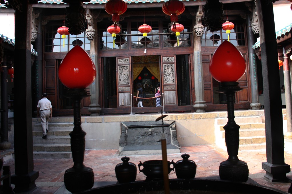
From the Penghu Mazu Temple, the goddess of the sea, known as Tin Hau in Cantonese, has watched over this Taiwanese archipelago’s seafarers for four centuries, offering her protection from countless typhoons like the one that is now darkening the skies.

I came to notoriously windy Penghu, an archipelago of 90 islands, to experience its maritime culture and soak in the folklore of pirates and conquering navies. Now I’m experiencing the uncertainty of being a Taiwan Strait sailor. Penghu’s mariners learned long ago that the winds are out of their control, hence the 183 temples scattered across the islands, some large and grand, others so small and nondescript they’re hard to find.

Severe Tropical Storm Fung-wong is churning her way north, aimed squarely at Taiwan. As soon as my flight touched down in Magong, the islands’ main town, my skipper called to warn me that our sailing trip would be delayed.

Like any restless shore-bound sailor, I seek ways to kill time.

Magong is a maze of criss-crossing streets, the heart of the old town lying low and grey behind ancient walls, huddled against the elements. New, garish hotels and empty boulevards sit exposed to the steady rush of wind. The town’s bars have been shut down for the season, and I haven’t spotted any bordellos around the port, so I rent a scooter and ride the island’s winding roads.

CD-PenghuTaiwan 288

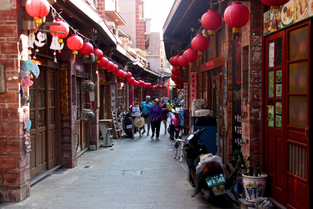
The reliance of the Penghu Islands, also known as the Pescadores, on the ocean is evident at every turn; from ancient houses and garden walls built of greying coral to the waft of drying fish.

Settlement of these islands began some 700 years ago, 400 years before the Chinese arrived on the Taiwanese mainland, and they served as a way station for people migrating from Fujian province to Taiwan, leaving the chain scattered with historical sites.

Numerous navies have anchored off the Penghu shores, their colonial forces engulfing the islands and then receding again, like the storms that sweep over the low-lying land. The Dutch came to Taiwan in 1624, were challenged by the Spanish and were eventually dislodged by Ming-dynasty loyalist Zheng Chenggong, whose Latinised name was Koxinga.

He was a privateer with a vast fleet and control over large swathes of China’s coastline, and the Penghu Islands were a frequent hideout. Koxinga used Taiwan as a base in his failed fight to overthrow the Qing dynasty and restore the Ming.

Eventually, the French came and built a fort overlooking Magong, but their stay was short, and they were long gone by the time the Japanese moved in for a 50-year stay, only to be replaced by the Chinese Nationalists.

CD-PenghuTaiwan 296

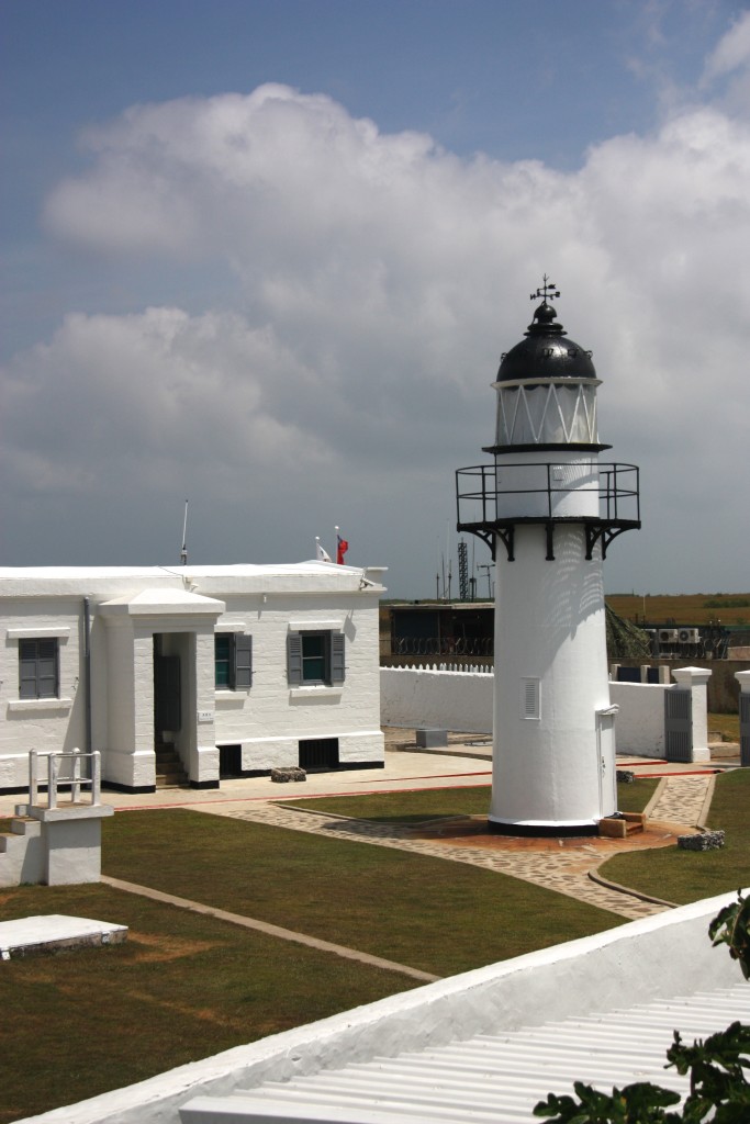
Now it is the Republic of China’s armed forces who are stationed on a far-flung promontory, their base built around the stately Yuwengdao Lighthouse, which was designed by a British engineer for the Chinese imperial government in 1828. Soldiers peer from behind rusted gates and banks of sagging sand bags, the camouflage paint on the buildings peeling in the sun. They slouch with boredom, staring across the strait at an ideological enemy that batters the island with tourists instead of artillery shells.

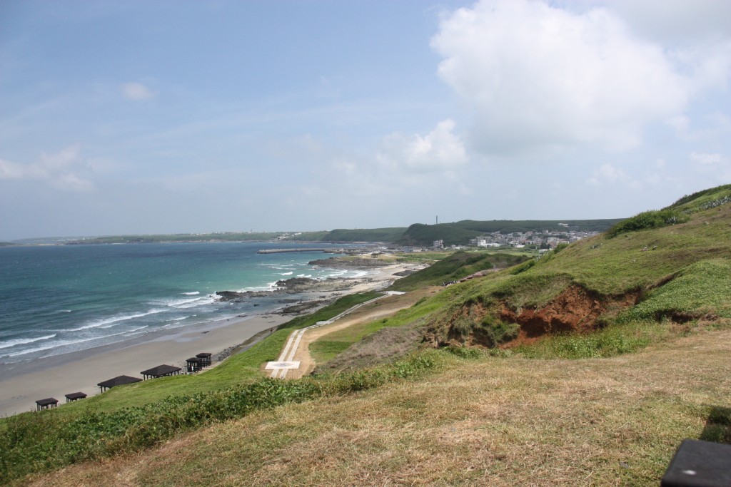
The islands have long been viewed as a frontline in tensions with mainland China, and martial law was only lifted in 1979, allowing people from Taiwan proper unfettered access for the first time. Penghu has since tried to grow a tourism industry, to prop up its tepid economy, offering as enticement its long, pristine beaches and azure water.

On July 23, Magong hit the front pages of newspapers when TransAsia Airways Flight 222, from Kaohsiung, crashed when landing in heavy winds and careened into nearby homes, killing all but 10 of its 58 passengers and crew.

“They were almost all from here, from Penghu, so it was very bad. Everyone knew someone affected,” says my host, Tom Chen, proprietor of the oddly named 1,2,3 V-Stone B&B, which is located a short walk from the main harbour and a five-minute drive from the centre of Magong, in a rapidly developing part of town.

“Now everyone is scared, so with this storm there will be no flights or ferries until it is gone.”

CD-PenghuTaiwan 312

The snaking road that connects the islands via bridges and causeways leads to Wai-an, in Siyu township, a small village perched in front of a hill that threatens to push it into the sea. The village is centred on its port, the main street tracing a line of bollards on the wharf and each side street leading to and from the water.

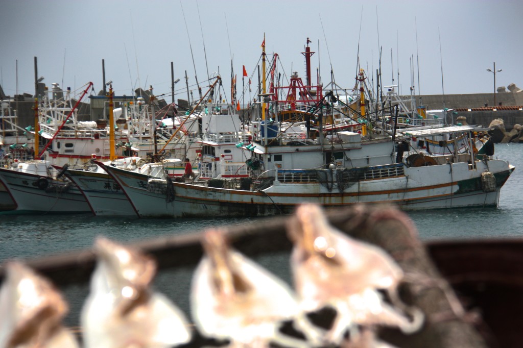
The harbour is jammed with fishing boats, with more arriving every hour, seeking shelter from the impending storm. The boats appear first as dots on the horizon, riding a white wake as they draw near. They rumble into the port and tie up three deep along the wharf, where fishermen sleep in hammocks or squat on their haunches, cigarettes smouldering between their lips as they repair their nets.

CD-PenghuTaiwan 306

“Looks bad, doesn’t it,” I ask a group of fishermen sitting on the wharf, surrounded by billowing heaps of net. They squint, looking up at the sky, where the sun still shines despite the dark bruise on the southern horizon.

“It will be over tomorrow,” they assure me. “The storm comes one day and then it is gone.”

The wind may prove inconvenient at times, but it does draw tourists to Penghu, whether for windsurfing, kite boarding or, more recently, sailing; the Penghu Regatta Week is held every June.

The fishermen were wrong, being out by two days, but finally the weather breaks, the wind dies and the skies clear.

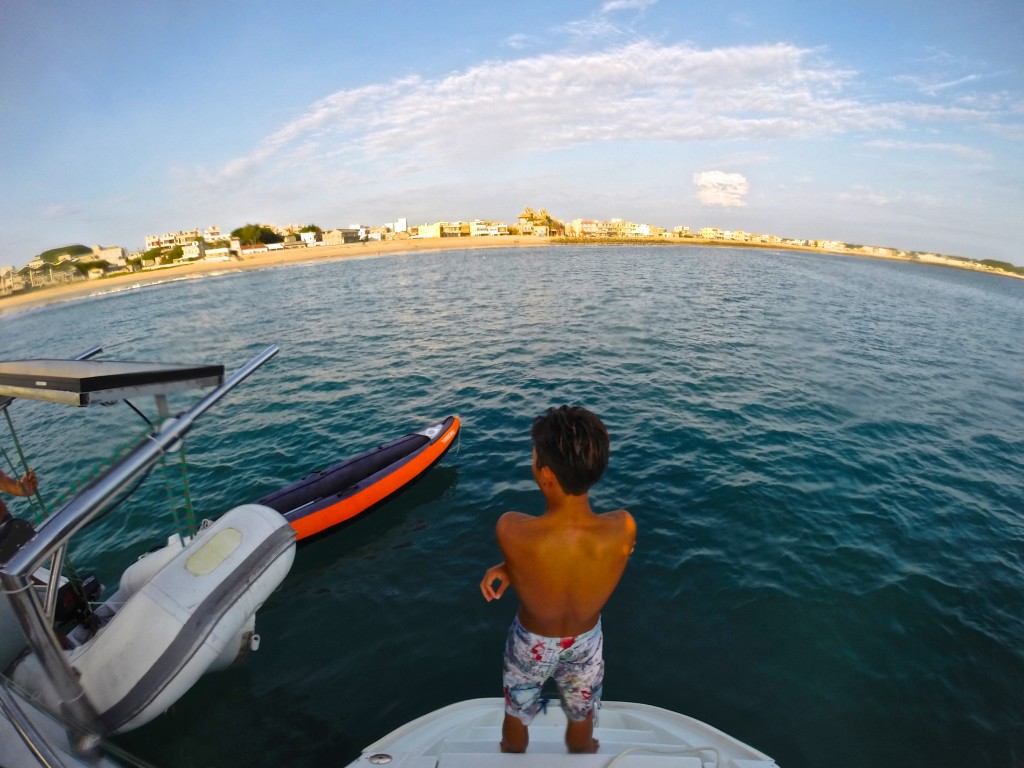
We slip the lines on our 40-foot catamaran and motor to the harbour master’s station, to officially clear port before heading out to sea. A stream of fishing boats floods out of the harbour alongside us, crews eager to lower their nets.

Soon we’re making our way down the coast, where the ornate, curved roofs of the temples stand high above village houses. From the sea I can’t be sure which of the temples venerate Mazu, so instead I mouth a prayer of thanks into the breeze, sure that it will eventually reach the goddess of the sea.

DCIM103GOPRO

Manigotagan

This story originally appeared in SCMP’s Post Magazine as “Canoeing along Canada’s Manigotagan River” on Feb 1, 2015.

I am still trying to get comfortable in my seat and come to terms with steering the canoe when my brother points to the sky. A bald eagle with a two-metre wingspan soars overhead, its brilliant white head twisting back and forth in search of prey.

The eagle circles us in a lazy loop and then, with two smooth strokes of its wings, disappears over the treetops. When I come back down to earth, I find that our canoe is drifting down the Manigotagan River sideways – which is bad news, because it’s getting dark and we have yet to find a campsite.

The Manigotagan is only a few hours north of Winnipeg, the capital of Manitoba province. But we could just as well be a thousand miles from civilisation as the river carries us through the Canadian Shield, the massive rock craton that forms the core of the North American continent. This is rolling land with rock outcrops that were rounded off by the last ice age, leaving room for boreal forests and marshes. Maps show long, narrow lakes, all running in the same direction, torn into the earth by the slow claw of ice.

DCIM104GOPRO

Atop each rocky outcrop, at every roaring waterfall or quiet bend where the river slows, history invites us to imagine. To envision humans on this river thousands of years ago, proud natives traversing their land; the first European fur traders and voyageurs, men who came searching for their fortunes in Canada’s wilderness, toiling their way up and down this watery highway.

A nearby archaeological site proves that human habitation of the Manigotagan area began at least 2,000 years ago and use intensified when aboriginal people underwent a cultural shift from relying on grassland hunting to life in the forest, where they survived on fish, small mammals, waterfowl and wild rice.

When white men discovered the forests’ bounty, they set up the Bad Throat fur-trading post at the mouth of the river, on the eastern shores of Lake Winnipeg. The river became an important trade route for trappers and their canoes, and they were soon followed by loggers and miners. Rusting iron machinery, empty trappers’ cabins, shards of pottery and tent circles all mark chapters in this river’s history.

That trading post has become the town of Manigotagan, which continues to rely on nature, with forestry, commercial fishing, wild rice harvesting and tourism being the economic mainstays. The river is now travelled by weekend canoeists looking to connect with nature. The longest canoe trips stretch to 102km – five to seven days of paddling – and the last 70km of the downriver journey has no exits. After 32km, you’re committed to a week-long journey.

We start at the mouth and work our way upstream. Just as daylight begins to fade, we come to a thundering set of waterfalls. There are dozens of falls and rapids along the river, most of which must be skirted. This requires us to unload both two-man canoes and carry everything on forest paths that pass the dangerous water: a process called portaging.

At Old Woman’s Falls, the river appears to be trying to dislodge a small island. The water sweeps around the rocky obstruction before roaring into narrow chutes on either side.

DCIM103GOPRO

We gingerly land our canoes in eddies only metres from the maelstrom and drag them up to safety before scouting out a campsite. The island is one of the most popular campsites on the river but it is late in the year and no one else is braving the chilly weather. Or perhaps the ghost of the old woman whose death here gave the falls their name has scared them away.

Firewood collected and tent erected, we are soon sitting around a crackling campfire with dinner simmering in a pot. A few streaks of light remain in the sky and the falls are now just a flash of white in the dusk, a steady clamour of water bashing itself against the rocks.

The topography along the Manigotagan ranges from sheer rock faces topped with craggy Jack pine and a thin skin of rock-tripe lichen to thick green stands of balsam poplar, green ash and elderberry. Our small island is covered in towering pines, the reflection of the river glinting through gaps between the trunks.

And there is wildlife; the entire river lies within protected parkland filled with, among other creatures, moose, black bear, wolf and woodland caribou. Beavers can be seen working along the banks.

We sit, passing a rum bottle in circles, until we have depleted our wood pile and the fire fades. We give the dishes a hurried scrub in the frigid water, the clattering of pots echoing across the river. We crawl into our tent, hoping that whatever the large brown furry thing we saw earlier was, it won’t be brave enough to swim across Old Woman’s Falls.

DCIM103GOPRO

The next day, we continue upriver, leaving the campsite set for our return. We spend the morning paddling over gentle rapids. At midday we find a rock outcrop overlooking Big Skunk Rapids. The others gather wood while I mix up a batch of bannock, the simple flat-bread that is the traditional mainstay of native American cooking. We crouch around the fire, watching the dough turn a golden brown flecked with ash.

After lunch, we turn back, now riding with the current. My other brother, in the second canoe with his son, eyes up a low set of rapids that we portaged around earlier.

“I think we can run those, eh?” he says, as much a challenge as a question.

His canoe slips into the current, dips, bobs, is caught in a spray of water, as we hold our position in an eddy. I can see only heads.

A few moments later, a drenched duo are treading water, one at each end of the swamped canoe, gasping with shock at the cold.

“Get your canoe around the rapids and get us out of the water! Hurry!”

DCIM104GOPRO

We do as we’re told, less careful about the canoe’s paint than we were on earlier portages. The pair roll into our canoe, sodden and shivering, rocking the craft until I worry that we will all be swimming soon.

Back at Old Woman’s Falls, a fire leaping through the grating and clothing strung from the trees, the story is retold with added flourishes, a gentle nip of warning from nature.

The next day we break camp and turn for home, letting the current slowly pull us towards Lake Winnipeg. The sun breaks through the clouds and remains free, bringing out the blue reflection of the sky on the water, the emerald green of trees and moss.

As we approach our landing spot, where pick-up truck, mobile phones and cluttered life await, what looks like the same bald eagle takes flight out of a poplar tree along the banks.

Once again it circles and eyes us, as if tallying to check whether those who ventured into his hunting grounds have returned alive.