Canadian Shield

Read this story online as it was published in the South China Morning Post.

camerondueckrriverimg_3582

“This sure doesn’t feel like October,” my brother says, standing knee deep in lake water, squinting up at the warm afternoon sun.

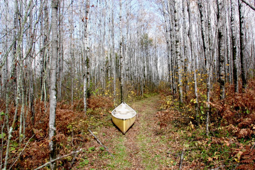
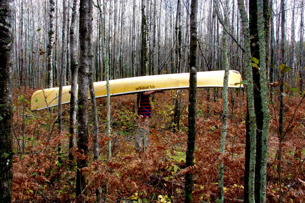
Our yellow canoe is pulled up on a narrow beach, perpendicular to the deep hoof prints left by a passing moose. The birch and spruce forest leans over the beach, as if reaching for the sunlight that glitters off the water. Most of the leaves have already fallen and the trees are naked and white.

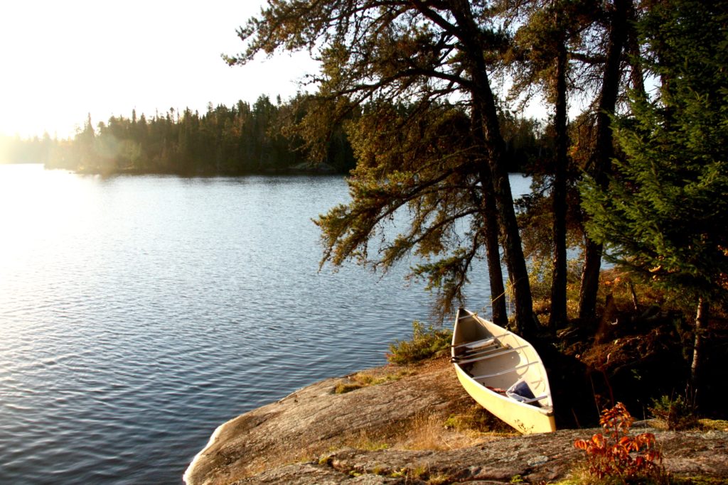
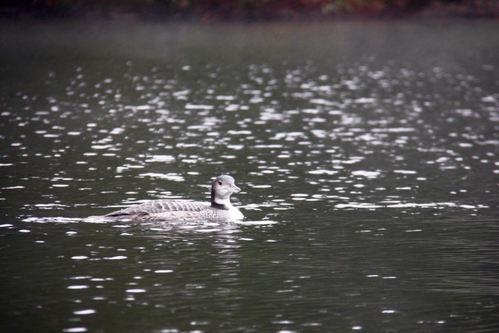
“The water’s a bit chilly, but the sun makes up for it,” I say as I wade ashore after a quick plunge in Lake Kilvert, in Ontario’s Eagle-Dogtooth Provincial Park.

camerondueckrriverimg_3500

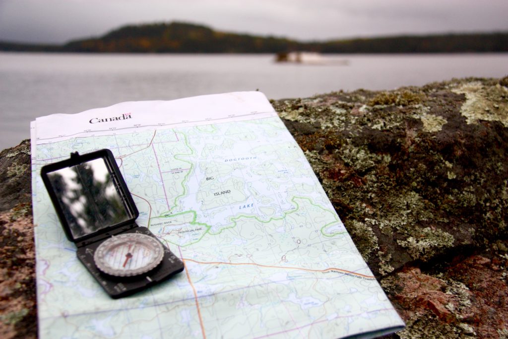
It’s one of thousands of lakes carved out of the 4 billion year old rock. This is the Canadian Shield, the largest mass of exposed Precambrian rock on earth, the exposed continental crust of North America, where ancient mountains were flattened and lakes carved from rock during the Ice Age. Eight million square kilometers of it, igneous rock born from volcanoes that grew into tall mountains which were then worn down to rolling hills and a thin sifting of soil by monstrous slabs of ice.

camerondueckrriverimg_3473

Right now, that much ice, or even snow, is hard to imagine. We’re enjoying some late season warmth on the first day of our canoe trip. This park, only a 2.5 hour drive east of Winnipeg, has five meandering canoe routes through moraines, boggy beaver ponds and pine forest ecosystems. We gambled with a late-season trip and it paid off as we have the lakes to ourselves. Everyone else has already packed up their boats for the winter.

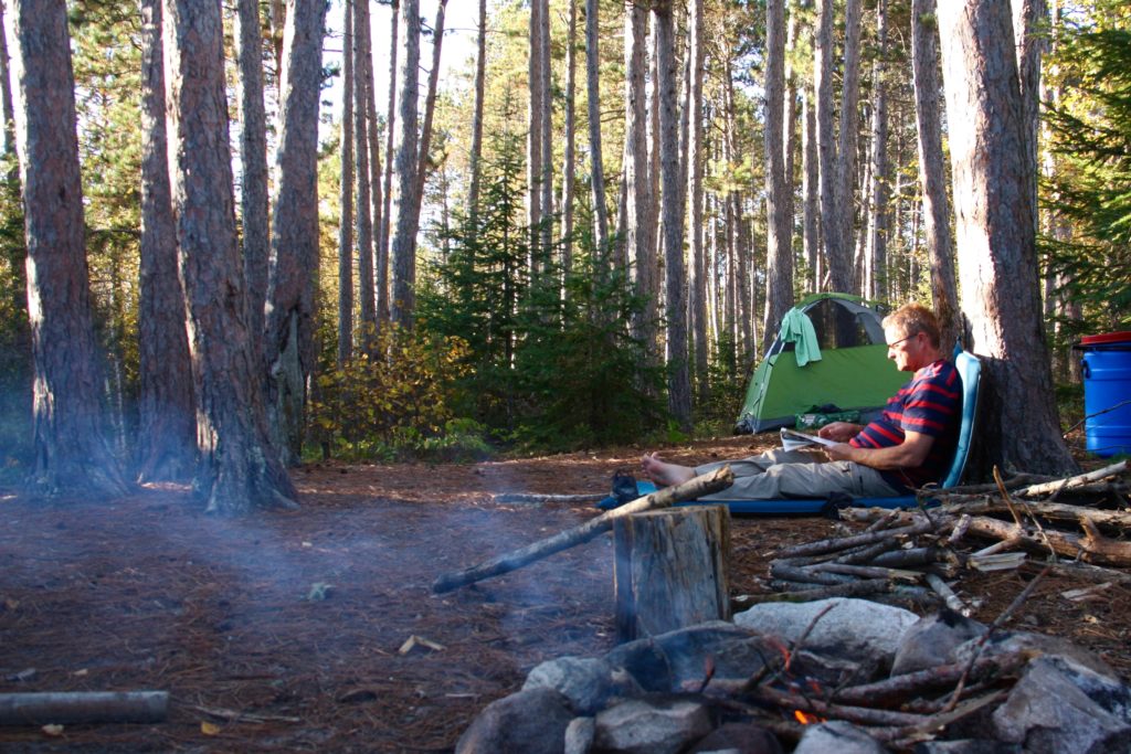
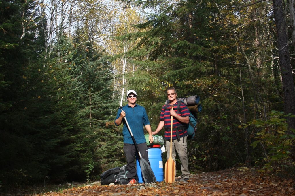
We hoist our canoe and trudge one and a half kilometers through the forest to Gale Lake, where we drop it with a sigh. I stretch my neck and shoulders as we walk back to retrieve our bags and a food barrel. This is just one of seven portages we’ll make on our 51.5 kilometer route, the price we pay to paddle across these remote lakes.

camerondueckrriverimg_3593

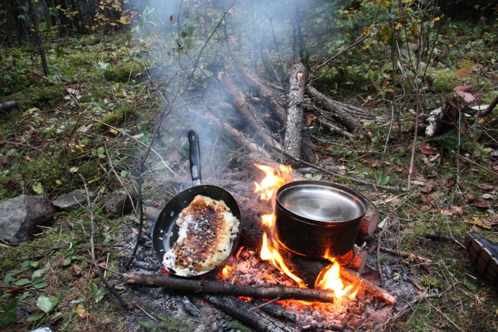
Once we’ve portaged all of our gear we set up camp in a stand of tall red pine on the western shore of Gale Lake, a small tear-drop shaped body of water that pinches off into a narrow creek in the north. There’s plenty of wood for a fire, and I mix up a batch of bannock, the unleavened Native American bread. I fry it in a pan, seasoned with wood smoke and raisins.

camerondueckrriverimg_3703

The Canadian Shield is the home of Algonquian nomadic hunters, who paddled these lakes in birchbark canoes, but the wide expanses of bare rock, poor soil and frequent marshes made it difficult for early explorers and fur traders to push westward into the continent. On the other side of this rock wall are the Prairies, Canada’s wheat land.

Eventually the European colonialists blasted a rail line through the Shield, which opened it to prospectors who found gold, silver, nickel, cobalt, zinc, copper, iron ore and, more recently, diamonds. This is also where Canada has built massive hydroelectric dams to feed cities to the south. The Shield, both past and present, looms large in Canadian history and culture, and canoeing these waters is a rite of passage for many Canadians.

Our good weather holds for exactly two days. Just long enough for us to grow smug, congratulating ourselves for setting forth while others stayed at home. Then, during the night, the temperature drops. We pull out our thermal underwear and stoke the fire as rain spits from a leaden sky. Now, suddenly, that Ice Age seems more feasible.

camerondueckrriverimg_3738

We’re watching the change of the season, when the benign summer is replaced by the unpredictability of early winter. This winter won’t wear down mountains or create a new lake like a true Ice Age, but it will put the land to sleep for the next six months or more.

Luck never changes in half-measures, and the wind that brought the cold air blows heartily from the southwest, straight on our bow. A day earlier the lakes were so still the rippled wake of a loon traveled a kilometre across the water, and now the grey water sloshes into our boat as we claw our way upwind.

“Do you still have control of the boat?” I call back to my brother, who is steering from the stern and who I’ve only heard grunts and curses from for the last few minutes. He is the more experienced canoeist, so surely he will know if we’re pushing our luck. We’re trying to round a point of land that has compressed waves and wind and I’ve just taken on a lap full of cold lake water.

“Yea, but we’re on the edge,” he shouts. “Just keep paddling, hard.”

camerondueckrriverimg_3662

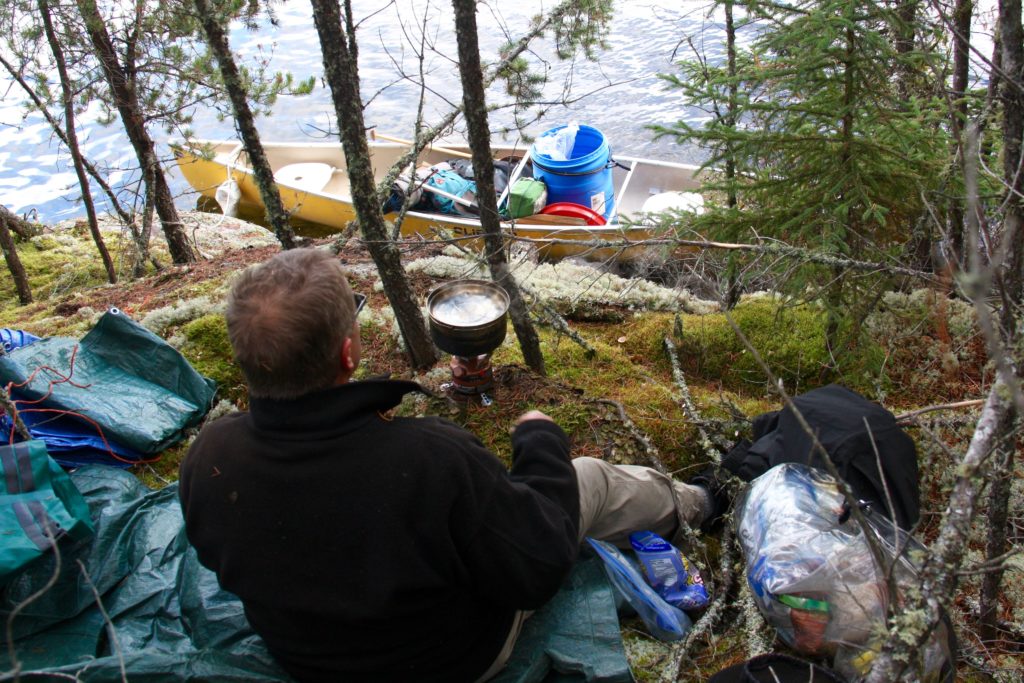
We make it, but once we’re in a protected bay we rule against risking further miles in these conditions. Along a low, swampy shore on Dogtooth Lake we find a forest clearing created by gnawing beavers and set up camp to wait out the storm. Every few hours we walk to the edge of the woods to see if the white caps that race across the lake are becoming smaller. They are not.

But the view is great. Tall cliffs left behind by glacial erosion, topped by scraggly jack pine and poplar. Massive round boulders have been dropped by the retreating ice, like marbles left behind by a child. Speckled alder and red maple still sport a few blazing leaves, beacons in the grey light.

Our last morning begins before dawn. We’ve promised friends and family to reemerge from the wilderness at a certain time, and in order to do that we need to make up the distance lost to the storm. We stop once, mid-morning, to boil up some coffee, and then push on. The wind has died, leaving behind a cold mist that blankets the quiet lakes.

camerondueckrriverimg_3779

I’ve had something on my mind, but I’ve been afraid to say it. I didn’t want to jinx things. But then we round a corner and I can see our truck and the end of our canoe journey. I double check, squinting to make sure, but I can see no one on the shore.

“We haven’t seen another person in five days,” I finally blurt out. “Not a boat, no people outside their cabins, no one at all.”

“If there was anyone else out there they were warm and dry in their cabins,” my brother says. “Probably looking out of their window at us paddling past in the mist and thinking, ‘Those poor buggers’.”

camerondueckrriverimg_3535

Palawan Kayak

This story originally appeared in the SCMP’s Post Magazine on May 10 as “Blazing Paddles”.

A wave of vertigo washes over me as I look down. It’s not far to the bottom – a few metres at most – but I feel as though I am floating in the air. The water is so clear, it is invisible, the sunlight brightening the colours of the starfish and coral on the sea bed.

Palawan is one of the most pristine and remote corners of the Philippines, and the country’s largest province by territory. Three of us are on a week-long kayaking tour, slowly winding our way through the karst islets and immaculate beaches surrounding Busuanga Island, in the northernmost part of the province.

Every paddle stroke brings into view another coral reef and another school of colourful fish flashing through the water beneath our hulls. The sky stretches achingly clear and blue overhead.

DCIM105GOPRO

From the cockpit of a kayak, Palawan is all rocky coves, distant rounded mountains and jagged cliffs with sugary beaches at their base.

It’s the end of the dry season, when the seas are relatively calm and the islands look parched. Other than a few fishing bankas – canoes with outriggers that come in a wide range of sizes – the only signs of human life are the occasional village and a few exclusive resorts huddled underneath palm trees on distant islands.

The sun has set by the time we arrive at our first campsite. We coast onto the beach, hulls scraping noisily against the sand, disrupting the evening silence. A nearly full moon casts the beach in a white glow, the curving trunks of palm trees standing out in stark relief.

From the kayak hatches come tents, cooking stoves, sleeping mats, bags of food and jugs of water. Many of the islands have no fresh water, so maintaining supplies is a constant concern. Tents are pitched and paddling gear hung up to dry. We cook an easy two-pot meal of pasta and vegetables, the air still so warm that working over the camp stove is uncomfortable. The fire we light on the beach is for cheer, and we sit well back from it in search of a cool breeze.

DCIM106GOPRO

Having awoken with the sun and after a quick breakfast, we’re back on the water, hoping to make the most of the cool morning air. We’re paddling north and, as we pass Lusong Island, one of our number lets out a shout.

“Hey, there’s something down there under the water!”

He is frantically back-paddling his kayak as he peers over the side. This region is littered with the wrecks of Japanese ships from the second world war, and we’ve just stumbled upon one. We tie our kayaks to a float bobbing on the surface, pull on masks and fins – stowed on the decks of our kayaks to explore reefs as we find them – and roll over the sides with a splash.

The wreck is in shallow water and filled with colourful fish that swarm around us, flitting away when we make sudden movements. The ship lies on its side, an entry wound of torn and twisted metal still evident despite heavy coral growth.

DCIM105GOPRO

For lunch, we land on a shady beach on Marily Island. It’s a pattern we’ll repeat in the days to come – an early start, followed by several hours of hiding from the blazing sun before we paddle on into the early evening.

Many of the beaches and islands are inhabited only by caretakers, some with their families, who hold possession of the land for faraway owners. Some of them charge a few hundred pesos for camping privileges; others don’t even bother us to say hello.

“Isn’t it dangerous?” asks the caretaker of Marily Island of our trip, in English. “Where is your guide?”

We’re paddling sea-worthy kayaks, wearing personal floatation vests and special clothes to protect us from the sun. Our boats are filled with emergency satellite beacons, water filters and first-aid kits. We’re navigating by GPS and monitoring the weather on smartphones. The caretaker and his wife sleep in a house made of palm fronds and bamboo, and live a subsistence life. The assessment of risk is very subjective.

I have badgered every passing fisherman to sell me some of their catch, hoping for a beach barbecue, and I tell the caretaker about my fruitless search. He grins, jumps into his banka and paddles 100 metres off the beach. He dives into the water – once, twice – and returns with four fish.

“Here, these are for you. Now you can eat fish.”

I pressure him to take a few pesos and he finally relents, tucking the money into his waistband without looking at it. Then he climbs a tree, drops us three fresh, young coconuts filled with sweet, cool water, and goes off to fetch a bottle of wild honey that he has harvested in the hills behind his home. We offer him a bar of chocolate in exchange, thanking him for the food as well as the lesson in generosity.

DCIM106GOPRO

Several days into the journey the clear blue sky begins to show puffy white clouds and an ominous darkening far in the north. Super Typhoon Maysak has been slowly spinning its way towards the Philippines. We paddle to one of the larger villages, which has a mobile signal, to call our outfitter, Tribal Adventures. We are assured the typhoon has ebbed to a tropical storm and that it’s safe to continue our voyage.

I have become used to the fine layer of sea salt that covers my body and the reek of sweat, pungent in a sweltering kayak. Sand and salt have turned my hair into a wild forest, and my stubbled chin holds globs of day-old sunscreen.

DCIM105GOPRO

Each night we bathe in the sea, lolling in the warm water, bright moonlight making modesty impossible. Voices, singing indistinguishable songs, float across the water from villages that turn dark soon after sunset.

The inhabitants have no electricity; a few fires and torches shine and then wink out one by one while we still sit on the sand, eating our dinner.

Roosters announce the return of the villages each morning, as the sun slowly creeps above the edge of the sea, rousing us from our tents to pack up and resume our journey through this remote natural wonderland.

DCIM106GOPRO

Calauit Island

Calauit Island Game Preserve and Wildlife Sanctuary (calauitisland.com) is a surreal but delightful experience in one of the most remote corners of the Philippines. Giraffes and zebras that are thousands of miles from their natural home are free to roam the island, yet tame enough to pet and feed by hand.

The 3,700-hectare reserve, off the far northwestern coast of Busuanga Island, was created in 1976 by then Philippine president Ferdinand Marcos as a private playground. Closed to everyone but the Marcos family and visiting dignitaries until the 1980s, the park is now badly in need of funding and professional zoological staff. There is no veterinarian on staff to look after the animals and birds while the cages of some of the more dangerous creatures, such as crocodiles and snakes, are rusting. Many of the park’s outbuildings remain in ruins following Super Typhoon Haiyan, in 2013.

Still, that doesn’t take away from the magic of having a giraffe bend its elegant neck and reach out with its long tongue to pull leaves out of your hand, or waking up in the park campsite to see zebras grazing metres from where you lay.

Give your head a shake, you’re still in the Philippines.

DCIM106GOPRO