I went trekking in the Indian Himalaya in June. Here’s the long version of the story that ran in the SCMP Post Magazine this Sunday, on the web, and the pdf file.
The camp is stirring to life. I’ve opened my eyes, once, briefly, to confirm that it is daylight. Now I nestle down into my sleeping bag, savouring its warmth as I wait for that magical moment that reminds me that this isn’t just another camping trip.
“Sir…Sir, good morning,” a soft voice says outside my tent. “Your chai is ready.”
The tent opens with a zzzzip and rustle of nylon, and there stand Gaurav and Saurav, two teenage brothers working as the cook’s assistants. They hand me a cup of steaming hot chai, which I take into my tent before zipping the door closed.
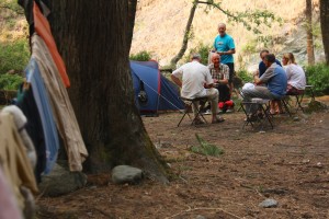
We are high in the Indian Himalayas, in the state of Uttarakhand, about 50 kilometres shy of the Tibetan border, amongst the headwaters of the Ganges. I’ve done my fair share of camping and rough, backcountry travel, but never with a full posse of cooks, porters and guides; a 1-to-1 ratio of staff for 10 trekkers. The time and energy this leaves for savouring and reflecting on this phenomenal corner of India takes me back to an earlier time of exploration.
 As I sit cross legged in my tent, carefully setting my tin cup aside to cool, I open the books that have become my guides. Not trail guides that tell me to turn left at the big tree or cross the river near the bend, but guides for the mind and the eye as I follow in the footsteps of mountaineering icons.
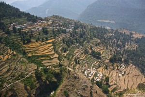
“Mountaineering in the Garhwal and Kumaon Himalayas more nearly resembles mountaineering in Switzerland, the country is unspoiled by commercialism,” Frank S. Smythe wrote in his 1949 book The Valley of Flowers, which describes his expedition through this region. “There are no railways, power lines, roads and hotels to offend the eye and distract from the primitive beauty and grandeur of the vistas, and there are peaks innumerable, unnamed and unclimbed, of all shades of difficulty and valleys that have never seen a European, where a simply kindly peasant folk graze their flocks in the summer months.”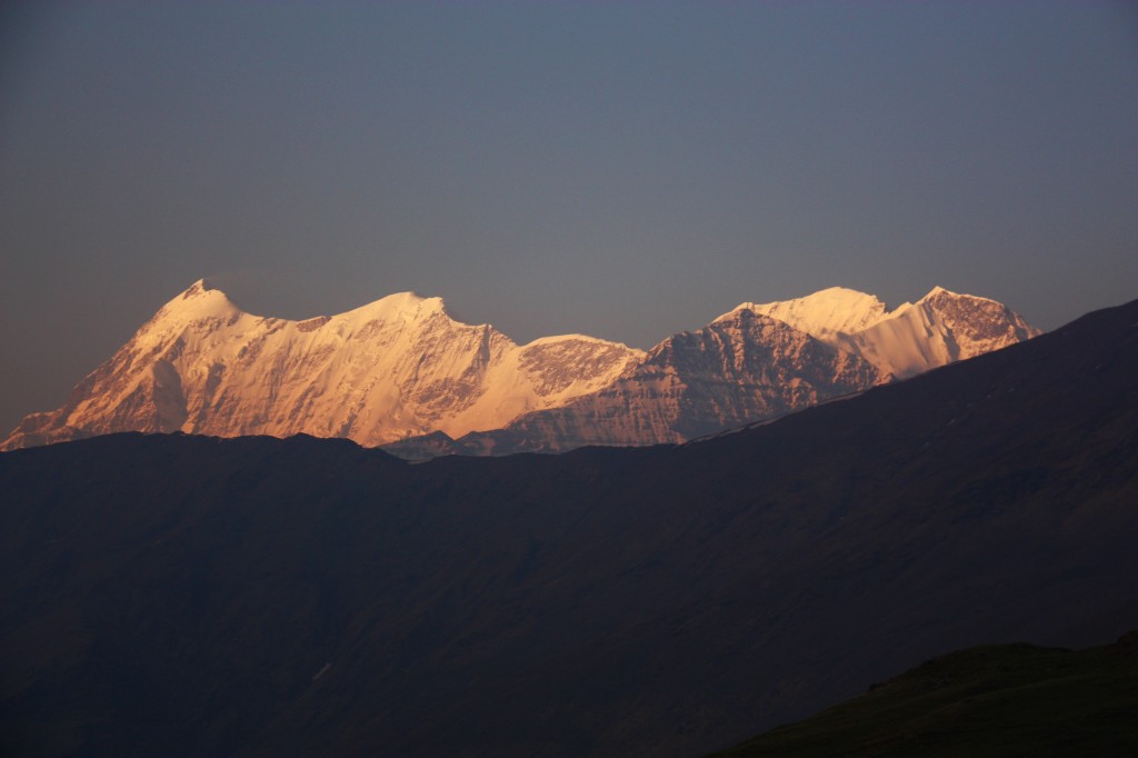 Smythe’s book, along with The Ascent of Nanda Devi by H.W. Tilman and Nanda Devi by Eric Shipton, are landmark accounts of early Himalayan mountaineering. All of them describe these very mountains and trails in Northern India as they were eight decades ago. Greener than the northern side of the range in Tibet and Nepal, India’s Garhwal region is filled with quiet valley villages and high meadows rich in grass, with each ripple of the landscape pointing the way deeper and higher into the world’s greatest mountain range.
They were all drawn to the region by Nanda Devi, at 7816 meters the highest mountain in India, and at the time, the biggest in the British Empire. It stands in the middle of a basin ringed by 7,000 meter peaks, creating the famous Nanda Devi Sanctuary. We’re only trekking the approaches to the famed mountain, but these historic accounts spend many pages describing the same valleys and mountains we are traversing.
Times have changed since Smythe’s description, but Uttarakhand is still raw and undeveloped, the disadvantages of which became evident in June, 2013 when heavy rains caused devastating floods and landslides in the country’s worst natural disaster since the 2004 tsunami. More than 5,700 people were killed, and the army had to evacuate more than 110,000 people from the steep valleys in this mountainous state. The mountains stills how raw scars from landslides and the roads are still buried in rubble.
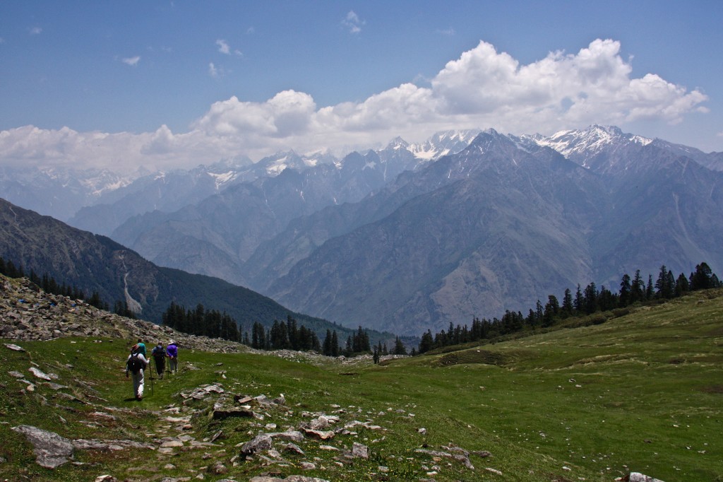
Today, there are roads and electricity, in places, but visitors are still few and far between. In ten days of trekking we do not see one other European trekker, and only a handful of local groups. We are trekking in high season, crossing and joining famous routes such as the Curzon Trail and Roop Kund Trail as we weave our way through the mountains towards the Kuari Pass, but still, we have the mountains to ourselves.
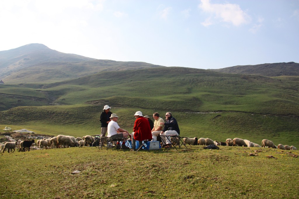
 Actually, we weren’t totally alone, as the high meadows were dotted with sheep chased up from the valleys for summer grazing. One morning we ate our breakfast under a cloudless sky, the rarefied Himalayan air sharpening every colour, ridge line and glint of sunshine that struck the rolling meadow. Our table, made from the tin chests used by the porters, was moved out of the dining tent to offer us an uninterrupted view of the string of snow-capped peaks on the horizon.
As we ate, hundreds of sheep made their way through our camp, bleating as they daintily picked their way between tents in search of fresh grass, the shepherd exchanging greetings with the porters as he slowly walked behind his flock. The flock opened and engulfed our breakfast table like a river around a rock. We sat, our tin cups of chai paused in mid air, watching them. Some of us scrambled for cameras, other broke into laughter at the absurdity of the scene.
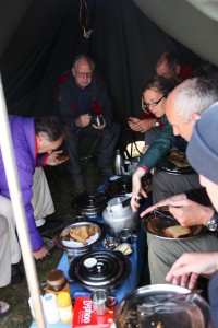
 Our days fell into a comfortable rhythm. We awoke early and ate a hot breakfast that catered to Western tastes while the porters began breaking camp. Each day, as the tents came down, the porters built a pyramid of shiny tiffin boxes, lunches that were stuffed into rucksacks as we exited the camp and began the day’s hike.
We often began with a steep climb, as our camps were made in valleys, near water sources. Then, by noon, we’d be on a ridge, breathless from the work and thin air, our eyes roving across the spectacular skyline of peaks.
“As the drew is dried up by the morning sun, so are the sins of mankind by the sight of the Himachal,” reads the Skanda Puranam, an ancient Hindu holy text.
We would feast our eyes on the spectacle while devouring our lunches, resting for the afternoon push. By mid afternoon we’d amble into the next camp, having walked between 10 and 15 kilometres, and often climbed well over 1,000 meters during the day. The mules and porters, taking shortcuts and relying on legs stronger than ours, usually had the cook tent up by the time we arrived. Chai and snacks were quickly served. The platter of channa masala, a snack of chick peas with chopped tomatoes, onions and coriander, was passed around as we reflected upon what we’d seen on the trail that day.
It was then, aglow with the effort of the day’s hike and satiated by the tea, that we had our best opportunities to soak in the grandeur of the mountains. Some camps offered unobstructed views of the peaks, others were set beside rushing rivers or overlooking broad valleys. The light would soften, the air would cool until jackets were needed, and the camp became domesticated with strings of laundry and the smell of dinner underway.
Dinner, we quickly learned, was not to be missed, as it consisted of at least four hot dishes, plus bread and rice. Suman, our cook, rarely repeated a dish on our 10 day journey. Rajma, dals, various paneer preparations, stuffed bitter gourd, chole battura and tibetan style dumplings were all prepared on two kerosene burners, with all supplies hauled on mules. When we were all sighing and setting our plates aside the waiters arrived at the dining tent with banana fritters in chocolate sauce, rice puddings and freshly baked cakes. We had to keep walking, or we’d grow fat.
 Smythe’s book kept me scanning the high meadow passes and valley trails shaded by pine and chestnut trees, searching for the myriad of flowers he identified on his trek. The ground was carpeted in millions of tiny primula blooms, purple, red, blue and yellow, close to the ground to hide from the constant wind, unfaded by the baking Himalayan sun. There was the bright blue Eritrichium Strictum, which looked like a forget-me-not, the rare dwarf Iris Decora, and the Arum, or Arisema Wallichianum, a cobra headed plant that looked vaguely evil.
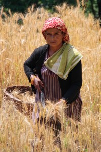
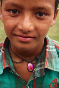
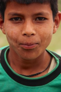
The meadows were also a source of riches for the isolated villages we came across. The Parahi herders were moderate Hindus, as influenced by the Buddhists to the north as their compatriots to the south, and we encountered them nearly every day on the trail, bodies hardened by their mountain life but smiles filled with warmth.
“The natives are short and sturdy, and fairer in colour than the inhabitants of the plains. Blue eyes and cheeks tinged with red are not uncommon and some of the women are very beautiful,” Shipton wrote of the locals eight decades ago, and his words still rung true.
 They ranged the mountains tending their sheep, and, for a few short weeks each summer, in search of kira jhar, a fungus sold to Chinese medicine men as a treatment for lungs, kidneys and erectile dysfunction. It was the latter property that the village boys wandering through our camp told us about, giggling as they tried to explain. They knew it for that, and for its interruption to their play.
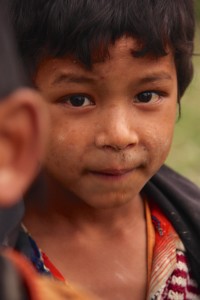
“We want to play cricket, but there’s not enough boys to make a game. Everyone is up in the hills, picking kira jhar” a barefooted boy said with a pout when asked why they were mopping about the camp.
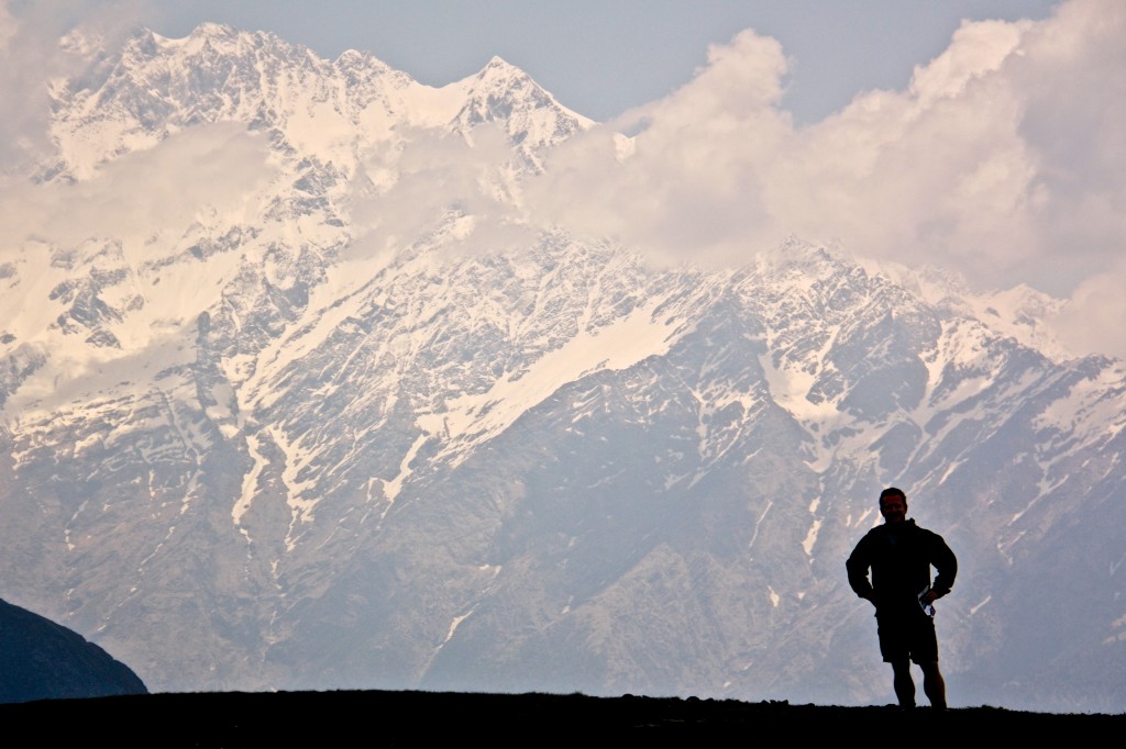
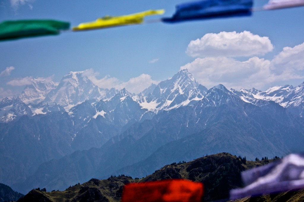
 It was on the high passes where I felt a little bit drunk. Not only because the altitude — we trekked as high as 4,100 meters — had me panting and dizzy with a dull ache behind my eyes, but because I could see forever. The mountain peaks, strung like jewels across the horizon, were intoxicating. Nanda Kot,Trisuli, Nanda Gunti and Mrithuni, a series of 6000 and 7,000 meter peaks, appeared repeatedly, like old friends on the far side of a river. Catching the gleam of the first morning sun here, shrouded in fog there, bathed in a golden sunset as seen from our campsite. There was still plenty for me, as an inexperienced trekker, to aspire to.
“In Britain the atmosphere subtly deceives our estimation of height and distance, but in the moisture-free atmosphere of the Himalayas the peaks look high because they are high. At midday they gleam like polished steel under a nearly vertical sun and the eye sinks with relief to the green valley floor,” Smythe wrote.
Tilman, infamous for his tetchy nature, was far more perfunctory in his descriptions of the region than Smythe and Shipton were, but even he expressed admiration for the “peculiar nature” of the landscape, where valleys at 1000 meters are filled with lush green vegetation, while snowy 7000 meter peaks are visible only 20 or 30 kilometres away. That lushness, and its few visitors, is what sets the Indian Himalayas apart from visiting the same mountain range in Tibet and Nepal. The Indian, or southern, side of the range enjoys summer monsoons, while the northern flank is much drier.
“The whole country is an intricate tangle of valleys and ridges with their attendant ravines and spurs, which, even in the foothills, are all on a scale undreamt of in this country,” Tilman wrote.
We’d set out on this trek to reach the Kuari Pass. It’s name, meaning virgin, was given by Lord Curzon, the Viceroy of India, in 1905, when he became the first to cross it. Or, at least it was the first time it was crossed by a man who had the means to report his success back to London.
 We approached the pass on the penultimate day, and pitched our tents next to the sheep herders on the Dhakwani meadow, just as Shipton did.
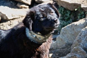
“The tinkle of sheep bells and the plaintive notes of a shepherd’s pipe drew us towards as shepherd encampment, and here we spend the night, a thousand feet below the pass,” I read in his book as a shepherd chases his flock of sheep through our camp, the beasts bleating and tripping over our tent guy wires. Sheep dogs nipped at their heels, their neck kept stiff by the tin collars they wore to protect them against marauding snow leopards.
 Tents were set up in a race against the clouds that were sinking ever lower, and which finally doused us in a cold, driving rain just as camp was made. That night, huddled together for warmth in the dining tent, taking extra servings of chai to stave off the cold, we speculated over what the next day would bring.
“It won’t take long to climb up to the pass in the morning,” Archit, our guide said. “This rain will end tonight, and it should clear the atmosphere and make the visibility really good.”
I crawled into my sleeping bag that night listening to the ping of raindrops on nylon, thinking of the sacredness of these mountains. We’d been on the trail for more than a week, and I felt a changed person for it, whether it was the gods or the fresh air. If the sights of the Himachal had not completely dried up my sins, they had at very least created a thirst to return.
The next morning we cross the pass, which gave us views of Kedarnath, Badrinath, Kamet and Hathi Parbat, the hewn rock and glittering snow that Shipton described as “one of the grandest mountain views in the world.”
He found it “difficult to refrain from gasping at the vastness of the scene,” and I realised nothing much had changed since the first explorers passed this way.

 Follow