I’m working with the University of Hong Kong to produce an online course (a Massive Open Online Course — MOOC) about dinosaur ecosystems for the Coursera platform. I spent most of July in the Gobi Desert shooting video for this project, as well as researching a story for the SCMP’s Post Magazine.
Here’s the story, which you can also read on the SCMP website.
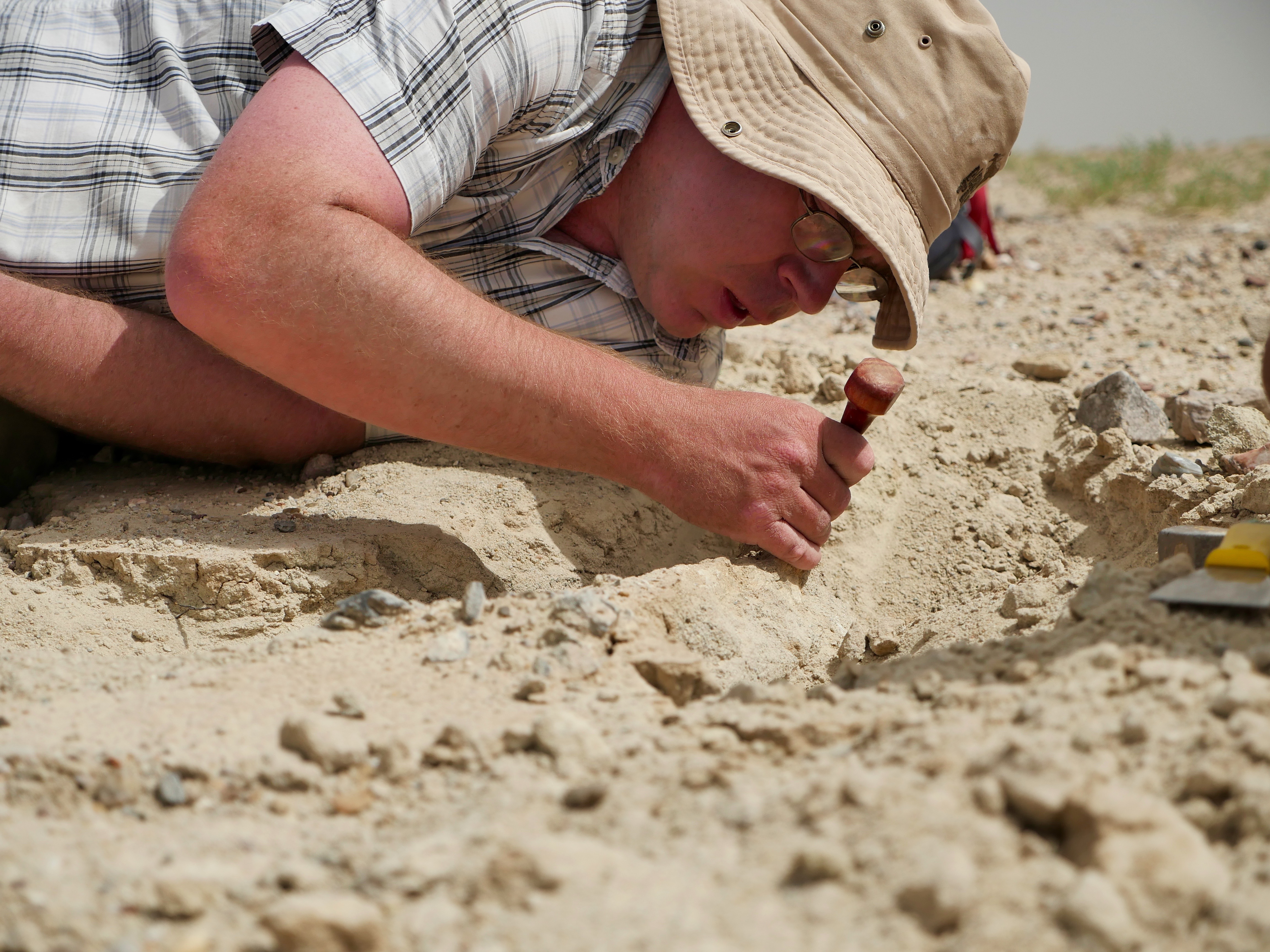
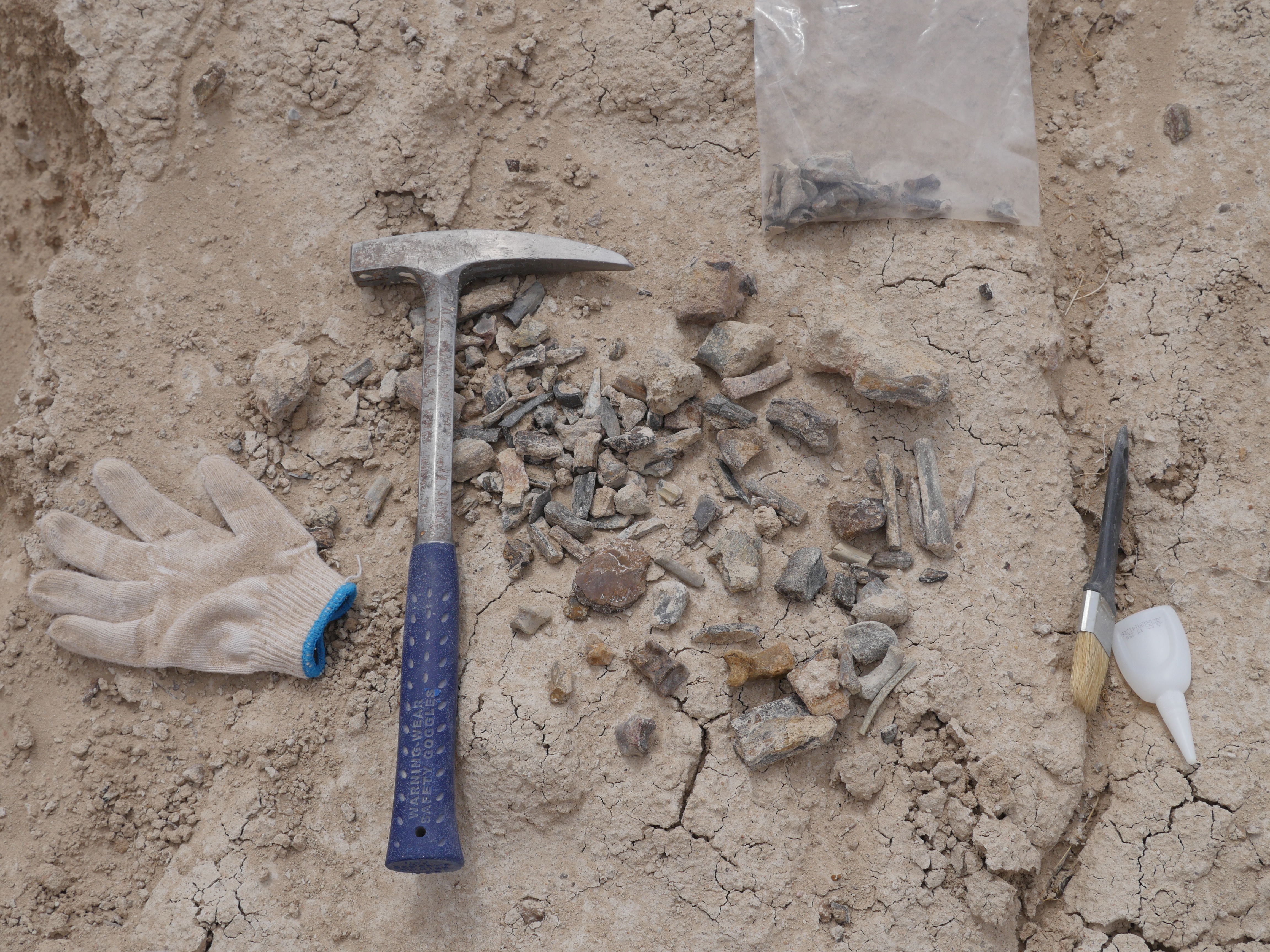
It is 44 degrees Celsius on the floor of the Gobi Desert; the air shimmers and dances with the heat. My eyes swim with tedium after hours of staring at the gently undulating ground, trying to spot precious fossil fragments among the countless pebbles.
To my right, within shouting distance, a scientist stoops, picks at something on the ground, then squats down for a closer look. He digs with his hammer, the chink-chink-chink of metal on stone carried away by the hot, dry wind. A small fragment comes free and he gently rubs the dirt away with his hands before putting it in a small plastic bag.
This University of Hong Kong-led expedition is not the first to come looking for remnants of the dinosaurs that lived, 80 million years ago, in the Upper Cretaceous ecosystem of the Erlian Basin, in Inner Mongolia, on China’s northern border. This ground has been searched for fossils repeatedly over the past century, but the earth keeps pushing them up, like presents. Each year, helped by rain, frost and scouring gusts of wind, the soil is eroded and more fossils are exposed.
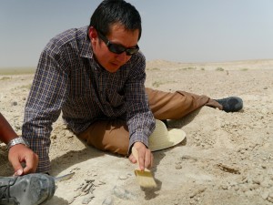
“When you prospect an area thoroughly you pick up a large proportion of the fossils of interest, and it takes several years of erosion before more things start to come out,” says Dr Corwin Sullivan, a researcher at Beijing’s Institute of Vertebrate Paleontology and Paleoanthropology (IVPP) and one of a dozen people in our team of fossil hunters. Sullivan, whose book From Fish to Human: The March of Vertebrate Life in China was published recently, wears a wide sun hat and a large red backpack as he zig-zags across the desert. “We just need to wait for more erosion to take place here and give us another crop of fossils to harvest.”
Dr Corwin Sullivan
Sometimes the desert gives up larger treasures; a leg bone here, a rib there. When big fossils are found, technicians take over the site, covering the specimen and the ground that holds it in plaster and burlap. Once the cast is dry, they heave it into the back of a truck and take it away for closer study.
No fossil is insignificant: these days, a small piece of bone rich with diagnostic features could be enough to confirm a new species.
China has a very rich and extensive fossil record, one that is just now being explored,” says Sullivan. “The infrastructure and funding for research have expanded so much in China. There’s a bit of a fossil rush going on. There’s probably nowhere else that offers quite the same combination of richness and freshness.”
Fossils recently found in China have greatly illuminated long-held ideas about evolution, particularly on the issue of flight and the hypothesis that birds are living dinosaurs. A small piece, the right piece, perhaps just a centimetre long, could solve questions over what these animals ate and how they walked and evolved.
“One of the most important issues for palaeontology right now is how dinosaurs turned into birds, which was a major evolutionary transition,” says Professor Xu Xing, also of the IVPP and one of China’s most prominent palaeontologists. “In the past 20 years, we’ve found a lot of feathery dinosaurs, as well as bird-like dinosaurs and preserved feathers in China. In terms of important discoveries and influential fossils, and their impact on conventional ideas, China is No1 right now. It has really changed what we think about how dinosaurs evolved.”
Prof Xu
Scientists have also found in China the earliest tyrannosaurs, relatives of the mighty North American movie star Tyrannosaurus rex, and some of the best placoderm fossils ever found, allowing them to learn more about these early, giant fish.
Erlian was prospected as early as 1922, but the current rush began in the late 1990s, when dinosaur fossils began to be discovered across the country, from Shandong to Liaoning, Yunnan, Xinjiang and Tibet. In 1996, scientists found Sinosauropteryx, the first feathered dinosaur, in Liaoning, a poor and heavily industrialised province in the northeast. The rush was on and, by 2007, China had surpassed the United States in the number of dinosaur species discovered.
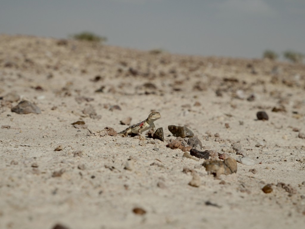
A lizard in the Gobi Desert
During the Cretaceous Period, which ended about 65 million years ago, Liaoning was filled with lakes and marshes, which, together with volcanic eruptions, created the ideal conditions to preserve fossils. Many that have come from that area display exceptional detail. The limestone layers of the province earlier this year revealed a winged ancestor of the velociraptor that scientists named Zhenyuanlong. The 125-million-year-old animal is one of the closest relatives to modern birds ever found, further closing an important evolutionary knowledge gap.
“Without those discoveries we wouldn’t be able to restructure the transition as well as we have so far,” says Xu.
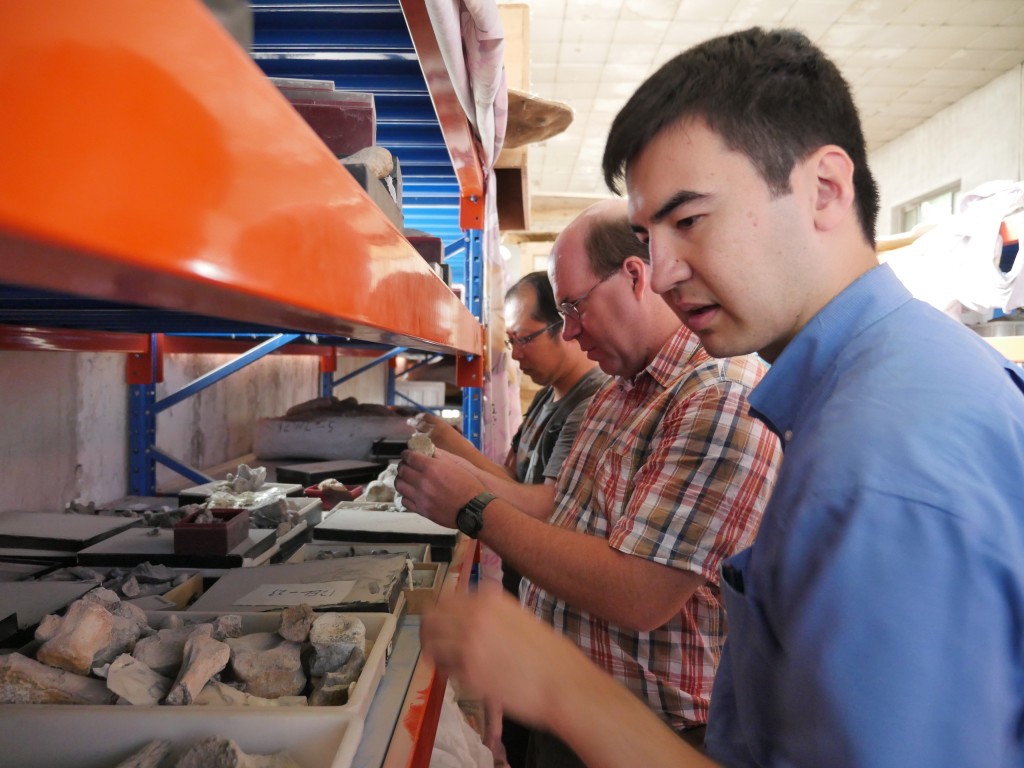
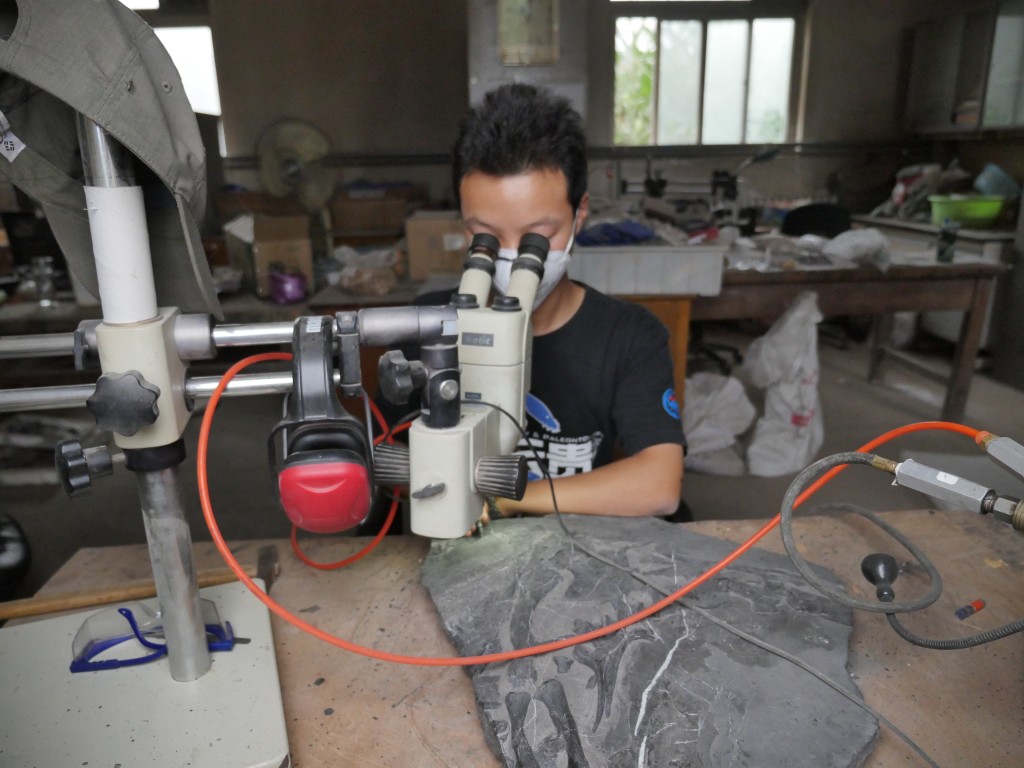
Sorting through fossils in the IVPP’s warehouse in Beijing.
IN SOME CASES, the flood of new species has been too good to be true. Forgery and misleading restoration have become rampant. This is a particularly troublesome problem among specimens that supposedly came from Liaoning, which has produced thousands of genuine pieces from various time periods.
Most museums have become adept at spotting forgeries. While many of the institutions’ specimens may be partially, and badly, restored, there’s little doubt about which parts of them are real and worthy of study. The greater danger is being duped by an apparently hot, fresh fossil being offered on the private market.
Museums have long used X-rays to look for density abnormalities that would point to forgery, and chemical-element mapping also helps prove, or disprove, a fossil’s origins. But a new technique is literally shedding light on the problem.
“I’m involved in developing a method that shines laser light onto specimens, causing certain minerals in them to fluoresce,” says HKU palaeontologist Dr Michael Pittman, leader of the Erlian expedition. “The pattern created by the fluorescent minerals is a chemical fingerprint that is unique to every fossil, so potentially forged portions of a specimen can be spotted when part of the fluorescence pattern looks out of place. Excitingly, this method can also reveal fossil details that are invisible under normal light, including skin and feather details.”
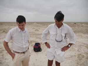
Dr Michael Pittman and Dr Jason Ali of HKU
Part of the problem is that many of China’s fossils are dug from the ground by farmers and then sold to museums, other institutes and private dealers. Liaoning’s farmers can often earn more by selling fossils than they can by tilling the soil. Although China has strict laws against private fossil sales, the black market thrives.
“Scientists, universities and institutes face a real dilemma, because if they buy the fossil they are supporting this industry. But if they are offering you a fossil that is new to science, and it possesses anatomical features that fill in big holes in our knowledge, it’s also kind of unethical … to not buy it,” says Pittman.
Even if scientists can prove a specimen is real and unaltered, buying it from an amateur hunter usually means they can’t study the geological layers of rock that hid the fossil – the stratigraphy – and which contain important age and environmental evidence.
Another part of the problem is the speed at which the fossil industry has appeared. Museums and institutes are still developing the expertise and research capacity to deal with the flood of new specimens coming from the field.
A technician prepares a dinosaur fossil at the IVPP.
“It’s just like the Chinese economy, which has grown large very quickly,” says Xu. “There are still many spaces left to be developed. In sciences we have some strengths but, in general, the research level is not that high, in terms of training and methods.”
Professor Tan Lin has watched this evolution from its earliest stages. One of the most accomplished fossil hunters in the Gobi Desert, Tan created the Long Hao Geologic and Paleontological Research Centre, in Hohhot, capital of Inner Mongolia, to house his finds. He is close partners with Xu and a sage adviser to the wave of scientists coming to his corner of China.
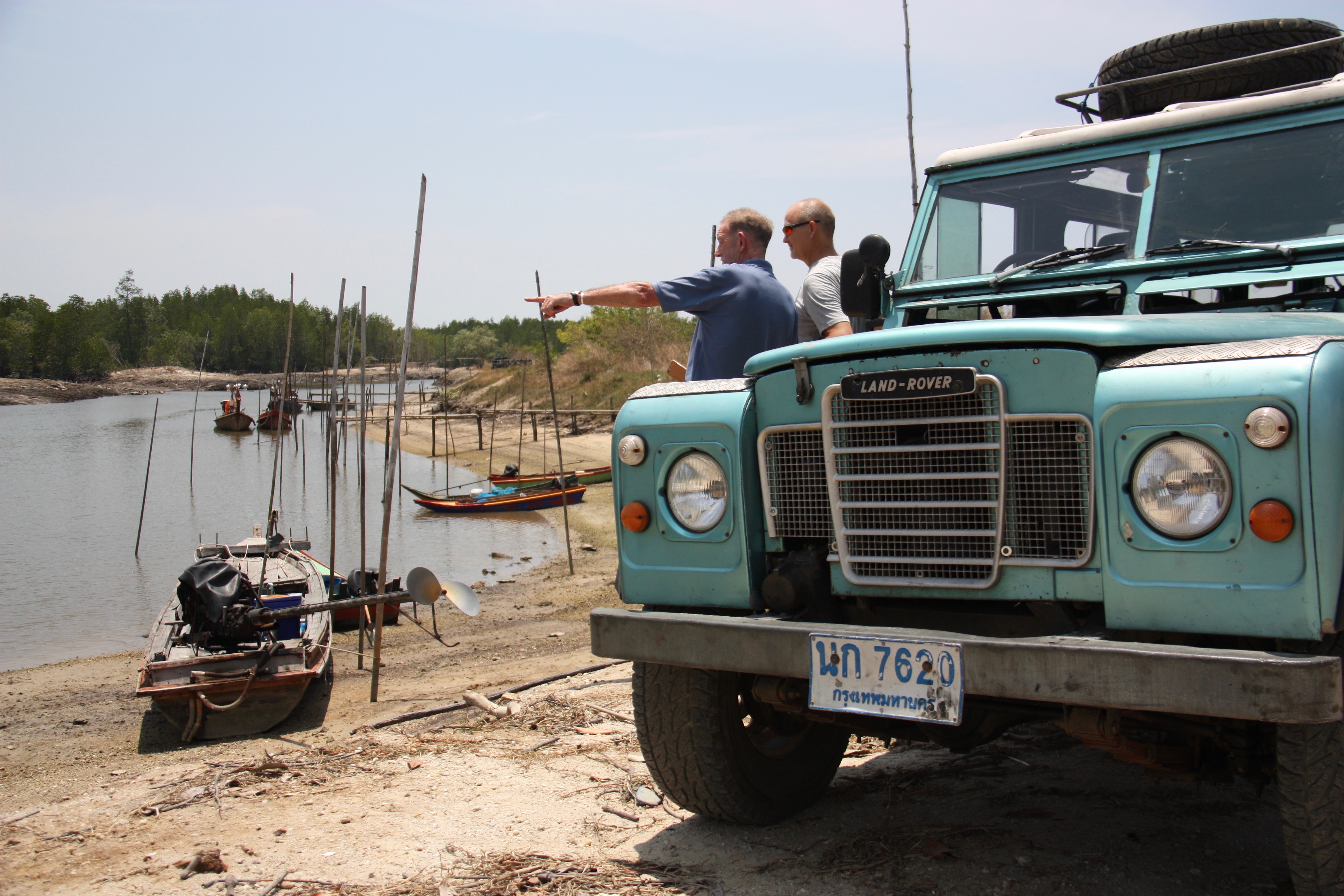
Poised but moving slowly due to age, Tan is still drawn to the field. He visits the HKU site in Erlian and, arms pointing to the horizon, discusses with the other scientists where fossils may be found.
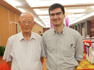
Dr Pittman and Prof Tan
“China is a superpower in terms of fossils, both vertebrate and invertebrate, and its fossils span the whole geological time scale,” says Tan. “Not only are the fossils spread over large areas of China, their diversity is also very high.”
Tan has worked in other provinces but he has a soft spot for the Gobi sands, where we spend a week searching for fragments. Erlian’s is an unusual ecosystem with an interesting combination of dinosaurs. For example, scientists have found therizinosaurs from the same family as the T-rex – the theropods – that evolved from carnivores into herbivores. Another of the Gobi’s treasures is the gigantoraptor, a large, beaked theropod that was also secondarily herbivorous or may have been omnivorous.
“In 2007, I was working with Xu in the Erlian area,” says Tan. “We were working together with a Japanese television documentary team. They asked us to dig for something; they needed footage of us digging. We started uncovering bones, larger ones than we had expected, and we became excited. Once the shooting had wrapped up, Xu and I went back to dig some more and we uncovered a gigantoraptor, which we brought back to Hohhot.”
Xu described the specimen in Nature, the prestigious scientific journal.
“That’s why Erlian remains one of my favourite places to hunt for fossils, because of the stories that I’ve lived in that place,” Tan says.
His institute is based on the outskirts of Hohhot, down a rutted road, among small factories and cheap housing. Tan’s finds fill row upon row of rolling shelves. The specimens are numbered and grouped into dusty boxes. A box of claws, fearsomely curved. Leg bones stacked like cordwood. A skull, in the shadows at the back of the shelf, its eyes wide open. All from different animals, places and times.
Searches for specific fossils in the warehouse can take hours. The concrete floors are littered with specimens still wrapped in the plaster that was applied in the field, yet to be opened, cleaned and studied. Photography in the collection rooms is forbidden as they contain many fossils yet to be seen by the outside world.
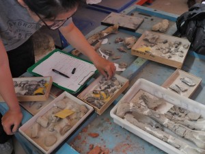
Sorting through fossils in the IVPP’s warehouse
“There are still more discoveries to be made in our collection. We’re just a small institute and we don’t have many researchers, so we still have a lot of work to do,” Tan says.
The backlog in Tan’s collection is not uncommon, with most of China’s major institutes and museums holding large collections of unstudied specimens. They are predicted to yield discoveries regarding the environment these animals lived in, how they aged and grew, and the evolutionary relationships between them.
“Every time you move along the shelves you see something that could be a new species or a better example of something that has already been found,” Pittman says, after spending three days in Tan’s treasure trove.
Our expedition adds to the pile of fossils that need further study, even though they are only small fragments. Some pieces reveal the presence of animals that were not known to be in the Erlian Basin, such as alvarezsaur theropods.
ON ONE OF OUR LAST DAYS in the desert, team members present Pittman with their latest finds. Two small, elongated fossils put a sparkle in his eye and cause his voice to rise an octave in excitement.
“We’ve found two jaw elements from theropod dinosaurs. They’re very different, which is interesting because it implies that they used to feed in slightly different ways and do slightly different things within the ecosystem,” Pittman says. “It’s an exciting discovery.”
The fossils are wrapped up and tucked away for further study, joining thousands of others pulled from Chinese soil. After millions of years buried in the ground these animals will have to wait a little bit longer to divulge their secrets.
Here be monsters
China has many museums and parks dedicated to dinosaurs. Some of them are filled with gaudy displays of dubious origin; others contain authentic and important specimens presented according to international standards. Here are a few of the best.
Paleozoological Museum of China This museum is located in western Beijing (Xizhimen), next to the Institute of Vertebrate Paleontology and Paleoanthropology, which is home to many of China’s top palaeontologists. Its galleries present a wide range of dinosaur specimens accompanied by solid scientific information. The museum also shows a popular 3D film about dinosaurs. (www.paleozoo.cn).
Shandong Tianyu Museum of Natural History Excavations have been conducted in Shandong province since the late 1950s. Professor Zheng Xiaoting, who amassed his wealth from gold mining, has built the largest collection of complete dinosaur fossils in the world. The museum collection includes fossils of feathered dinosaurs, early birds and the Tsintaosaurus, a crested duck-billed dinosaur. (www.tynhm.com).
Zigong Dinosaur Museum
The museum sits over a large dinosaur-bone bed in Sichuan province’s Dashanpu Formation, which has helped fill a gap in Jurassic history. The site was discovered by a gas company that was building a plant outside the city of Zigong in 1972, and now attracts up to seven million visitors a year. (www.zdm.cn).
Palaeontological Museum of Liaoning
China’s largest palaeontological museum is located on the campus of Shenyang Normal University. Its collections include feathered dinosaurs, the earliest mammal with hair, the oldest known gliding lizard and eight giant dinosaurs from Liaoning, including the 15-metre-long Liaoningotitan. (www.pmol.org.cn).
Beijing Museum of Natural History
The collections at China’s leading natural history museum include palaeontology, ornithology, mammals and invertebrates, and a major collection of dinosaur fossils and mounted skeletons. It’s also fun for children, with a Dinosaur Park populated by models of the beasts, many of which move.


 Follow